Gier: Durèze + Bozançon
Roman aqueducts: Lyon - Gier aqueduct (France)
Lyon-Gier aqueduct - LUGDUNUM
The Gier was the youngest, longest and highest of the four aqueducts of Lugdunum and had been built
in Opus Reticulatum in its whole line. In order to cross the many valleys in its 86 km course, four
siphons and 25 bridges ware built. An overview:
| Valley / River
| Constructions
| Siphon
|
| Durèze
| Detour plus siphon
| Header tank plus venter bridge
|
| Bozançon
| Few bridges, also over side branches
| -
|
| Mornantet
| Bridge
| -
|
| Garon
| Siphon
| Header tank 'La Gerle' plus venter bridge
|
| Yzeron
| Plat de l'Air-arcade, siphon
| Header tank plus venter bridge Beaunant
|
| Trion
| Siphon
| abutment of a header tank Fort Saint-Irénée
|
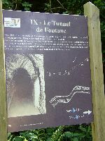
Over 50% of the aqueduct was subterranean, with 9 (perhaps 11) tunnels of different length. The
deepest was built under the village Mornant just after the river-crossing with the Mornantet. During
the construction of the tunnel of Saint-Martin-la-Plaine a miscalculation was made as can be
seen on the photographs below.
Because of the total length of the aqueduct, the distance between and the diversity of the
manholes could be studied in detail. Out of more than the estimated 1000 manholes, some 85 are known.
Where the distance between two adjacent manholes could be measured, the result was between
76 and 78 m, whereas Vitruvius and Plinius indicated 240 Roman feet or 71 m.
Jean Claude Litaudon hypothesizes that there were two kinds of manholes in the Gier aqueduct
which alternated: the broader ones (3 Roman feet, 92 * 92 cm) with lowered bottom and the smaller
ones (2,5 * 2,5 Roman feet, 77 * 77 cm) without. The first ones - a little bit broader than the
aqueduct channel - served also as cleaning basins)*.
The Gier was the only aqueduct which also could serve the upper parts of Lugdunum on the Fourvière hill.
Although its starting point was on 400 m above sea level, because of its constant and modest gradient
the Gier delivered its water on 300 m above sea level, thus 20 - 40 m higher than the other
three aqueducts.
W.D. Schram
For the pictures, see below.
)* J.-A. Hamm and J.-C. Litaudon: L'Aqueduc romain du Gier ou du Pilat (2004)
Lyon-Gier aqueduct - LUGDUNUM
| Item
| Info
|
| Length |
86 km |
| Cross-section |
0,55 m x 1,30 m |
| Volume |
15.000 m3/day |
| Fall |
0,11 % |
| Period |
50 - 125 AD |
| Features |
- 4 siphons
- 80 known manholes
-
-
|
| Recommended literature :
| M. Jean Burdy: Préinventaire des monuments et richesses artistiques IV Gier (1996)
|
| Recommended website :
| Archeo Lyon
|
| How to visit :
| See M. Jean Burdy: Guide des Aqueducs Romains de Lyon (1999) and the Recommended literature
|
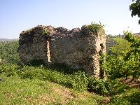
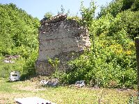
Génilac, Header tank
|
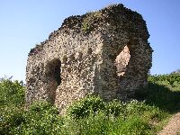
Génical, Header tank
|
Génilac, Header tank
|
Génilac, Header tank
|
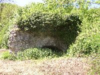
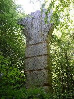
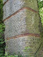
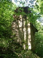
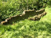
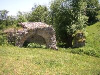
Chagnon, Pierre de Chagnon
|
Chagnon, Pierre de Chagnon
|
Pierre de Chagnon
|
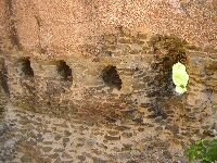
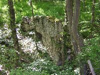
Chagnon, Cave de Curé
|
Chagnon, Cave de Curé
|
Chagnon, Cave de Curé
|
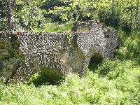
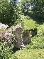
Durèze valley, venter bridge
|
Durèze valley, venter bridge
|
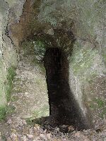
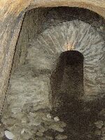
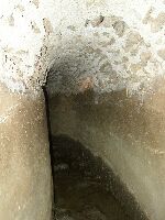
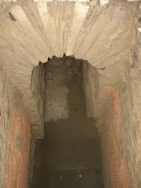
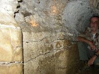
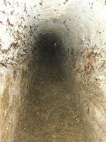
Saint-Martin-la-Plaine, Fontane tunnel
|
Saint-Martin-la-Plaine, Fontane tunnel
|
Saint-Joseph-le-Rieu, manhole
|
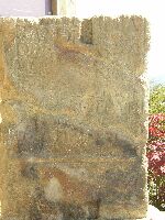
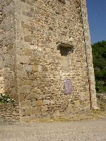
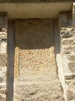
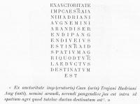
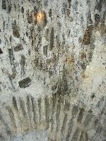
Saint-Joseph-le-Rieu, carved stone
|
Saint-Didier-sous-Riverie, bridge
|
Bridge over the Petit Bozançon
|
Saint-Didier-sous-Riverie, bridge
|
Saint Joseph / Saint-Didier
|
Saint Joseph / Saint-Didier
|
Saint-Maurice-sur-Dargoire, manhole
|
Saint-Maurice-sur-Dargoire, manhole
|
Saint-Maurice-sur-Dargoire, tunnel
|
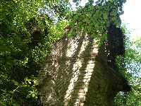
Saint-Maurice-sur-Dargoire, bridge
|
Saint-Maurice-sur-Dargoire, bridge
|
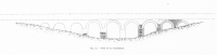
Saint-Maurice, the 'Pont des Granges' I
|
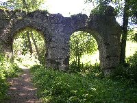
Saint-Maurice, the 'Pont des Granges' II
|
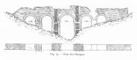
Saint-Maurice, the 'Pont des Granges'
|
Saint-Maurice, the 'Pont des Granges'
|
Saint-Maurice, the 'Pont des Granges'
|
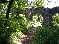
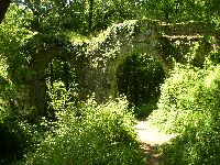
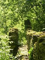
Mornant, Pont de la Condamine
|
Mornant, Pont de la Condamine
|
Mornant, Pont de la Condamine
|