Publication
The database and map data will be made available in two manners:
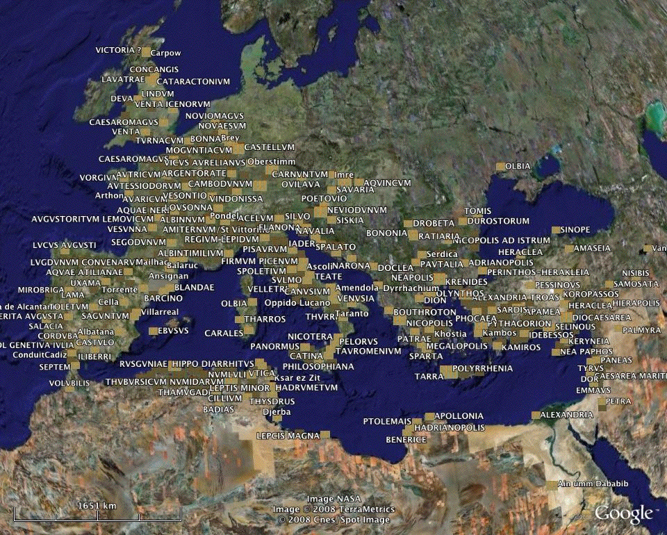
- in the form of a printed atlas, which will contain maps of the aqueducts and preserved remains, and basic information, with some photographs of the most important remains. Because of the volume of material, we will restrict entries to the most basic information, but with a full reference list and index
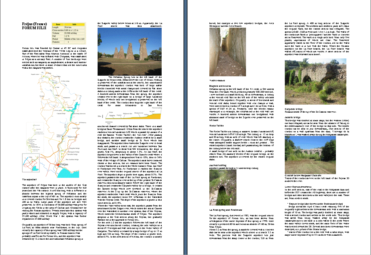
For the proposed format of pages from the Atlas of roman aqueducts, see below.
- in the form of a website, where more details and more photographs will be made available which cannot be placed in the Atlas. This website will be an expansion of the present Aquasite pages. The website will be expanded with a search function where the basic information from our database will be made available to the public.
|