| For the photo's, see below |
| For the complete website |
|
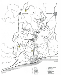
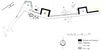
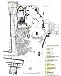
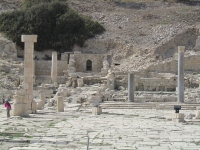
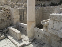
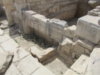
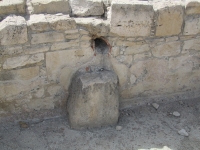
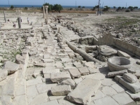
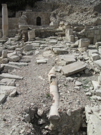
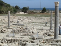
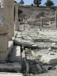
| The nymphaeum north of the agora of Amathus with in front the terracotta water supply of the agora fountain and the Roman bath complex |
| Mean fall | Start | Level (m) | End | Level (m) | Distance (km) | Calculated gradient (%) |
|---|---|---|---|---|---|---|
| North aqueduct branch | Armenokhori | 250 | Basin nr 72 | 60 | 4,9 | 3,8 |
| Northwest aqueduct branch | Dhoxamenes | 174 | Basin nr 72 | 60 | 1,2 | 9,5 |
| Common course Basin nr 72 - Wall | Basin nr 72 | 60 | North wall | 52 | 0,3 | 2,7 |
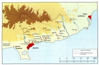
Cyprus and the Tabula Peutingeriana |
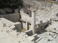
| Unfortunately the publications about Amathus were not focused on the technicalities of the water supply system. | ||
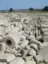
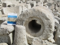
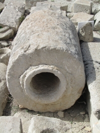
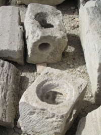
| Description / diameter | Externally | Internally |
|---|---|---|
| Large stone pipe | 0,70 m | 0,24 m |
| Small stone pipe | 0,20 m | 0,09 m |
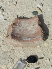
| Terracotta pipe )* | Diameter 0,20 m; "large diameter" | |
| Recommended literature : |
|
| Recommended websites : | |
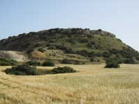
| How to visit : | Follow the Old Road along the shore, a few kilometers east of Limassol / Lemesos. Entry to the agora only € 3,- |
| HOME | More literature on more aqueducts | Last modified: August, 2011 - (webmaster) |