| For the photo's, see below |
| For the complete website |
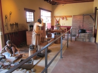
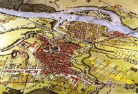
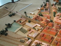
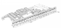
Augusta Raurica, present Augst (15 km east of Basel, Switzerland) was located at the intersection of important transport routes: the south-north links from Italy to the Rhineland and the west-east route from Gaul to the Danube region and Rhaetia converged on the River Rhine at this spot. The river itself was one of the most important transport routes in the Roman Empire.
|
|
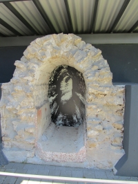
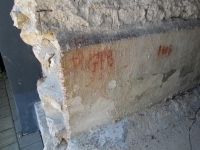
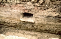
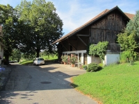
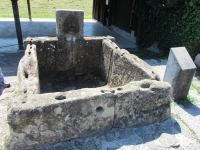
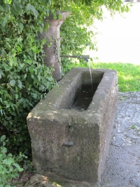
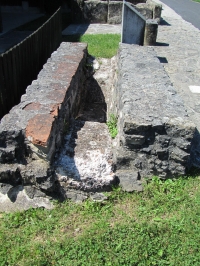
| For the exhibition "2000 year Basel "in 1957, a 1,5 m long piece of the aqueduct was excavated in Liestal, Heidenlochstrasse. After the exhibition it was placed near the bakery, almost opposite the Augusta Raurica Museum, including some 'recent' (17th and 18th century) graffiti. |
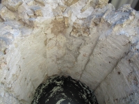
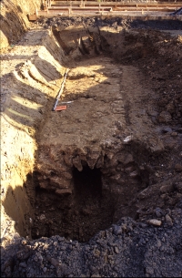
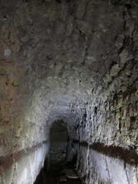
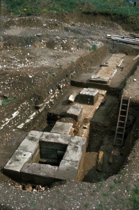
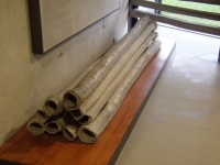
| For the opus signinum (plaster to make the 7 km long aqueduct channel watertight) at least 6.000 m3 bricks were needed, together with 1200 m3 lime. To produce the lime 10.000 m3 firewood was used (Rentzel in Ewald 1997a). |
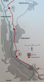
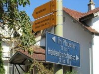
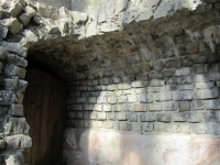
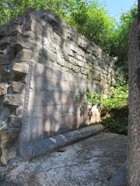
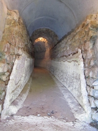
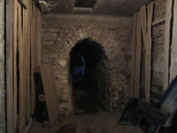
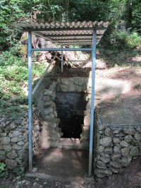
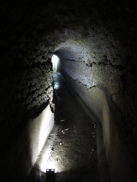
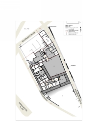
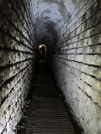
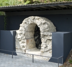
Sites to visit or see the aqueductNumbers based on the catalogue in Ewald 1997aV4 Near the bakeryopposite the museum of Augusta Raurica, Giebenacherstrasse 17 in Augst (Switzerland)For the exhibition "2000 year Basel "in 1957, a 1,5 m long piece of the aqueduct was excavated in Liestal, Heidenlochstrasse. After the exhibition it was placed near the bakery, almost opposite the Augusta Raurica Museum, including some 'recent' (17th and 18th century) graffiti. V11 Liestal: Zirkelirain / Heidenlochstrasse623.001-259.390 N 47°29.092′ E 7°44.627′ N 47.48487° E 7.74379°Display and access to the channel. The key of the gate can be obtained from Heidenlochstrasse 36. V25 Liestal: Weideliweg / Oberer Burghaldenweg south side622.011-260.213 N 47°29.538′ E 7°43.842′ N 47.49230° E 7.73070°A small, restored part of the channel, is open to the public. Here an opening of a small inlet from a side channel must have been present. V27 Liestal: Weideliweg / Oberer Burghaldenweg north side621.991-260.225 N 47°29.544′ E 7°43.826′ N 47.49241° E 7.73043°Beautiful view into the channel unfortunately behind bars. With extra lightning. V52 Füllinsdorf: Friedhofweg, Moosmatthof621.826-262.040 N 47°30.524′ E 7°43.700′ N 47.50874° E 7.72833°Accessible part of the aqueduct channel, at the inner backside of the stables. Private Property! V57 Augst / Augsterfeld: Wölferhölzli621.521-263.400 N 47°31.259′ E 7°43.461′ N 47.52098° E 7.72435°Well signposted public location in the wood south of Augusta Raurica, with two entrances plus an information panel. The text of the info panel is also available on the web. |
| Item | Info |
|---|---|
| Length | 7,3 km |
| Cross-section | 0,90 m x 1,80 m |
| Volume | 25.000 m3/day |
| Fall | 0,15 % |
| Period | First half 1c AD |
| Features |
|
| Recommended literature : |
|
| Recommended websites : | |
| How to visit : | see separate text box |
| HOME | More literature on more aqueducts | Last modified: January, 2013 - (webmaster) |