Chersonisos (Greece / Crete)
Roman aqueducts: Chersonissos (Greece)
Chesonissos - CHERSONASOS
In ancient times Chersonisos was located close to the present harbor - now called Limani Chersonisos - but because of raids by pirates
the town moved to the present location of (old) Chersonisos, 3 km inland. (Limani) Chersonisos is now a modern, noisy and busy seaside resort.
In Minoan times Chersonisos was subordinate to the main capitals of the island such as (Knossos and) Lyttos. Later on the inhabitants
were even described as the 'Lyttians by the sea'.
In Roman times Chersonisos had a water supply system which included wells, springs and an aqueduct. However the source of this aqudect has
not always been clear. Initially a connection was supposed between this aqueduct and the one of Lyttos which in this way could have exercised
power over Chersonisos and its water supply. Researchers also hint on sources at Pygi, Bitzariano and/or Agios Panteleimon.
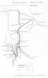
Oikonimakis - who made the most elaborate description of both aqueducts - makes clear in his maps that the source of the Chersonisos
aqueduct was E of Kalo (C)Horio without any link to the Lyttos aqueduct. Its total length was about 14 km.
Unfortunately the Roman caput aquae has not been found yet; it could have been buried under the present road from Xerokamares
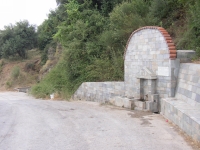
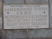
to Kalo Chorio. The present spring is called Pègè Koutsounaras, it is now embellished with a fountainhead and was upgraded in 1992.
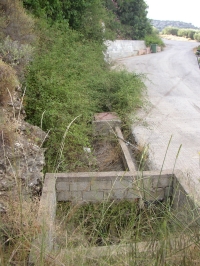
The overflow water is guided into a pit which is part of the present local water network.
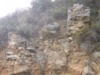
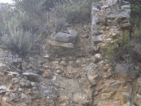
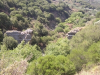
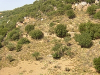
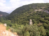
The water from Kalo Chorio first heads to the S and had to cross two steep gorges at locations called Xerokamares 2 and 1
(see drawing by Oikonomakis). Of both aqueduct bridges quite a few remains can be seen from the main roads
from Chersonisos to Kastelli / Pygi (X2) and to Potamies (X1). Because of the steepness and the overgrowth they are both difficult
to approach. Sanders describes them as follows (Sanders 1982):
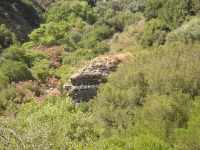
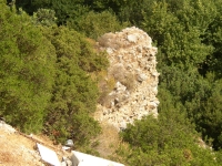
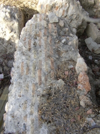
(X2 direction Kastelli): Two arches 3 m wide, constructed of stone-faced concrete with leveling courses of large masonry dividing the arch
into 5 blocks. The central part of the 4 upper blocks, from which the actual arch sprang, are not stone but tile-faced.
The present-day gap between the surviving sides is about 15 m. The height of the arch as surviving is about 12 m and is about a further
7 m below the level of the caput aquae [= headertank wds] supporting the idea of a siphon bridge. The arches are very typical for the Trajanic period.
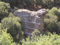
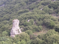
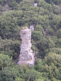
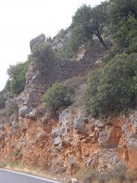
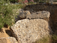
(X1 direction Potamies): here the gorge is about 60 m deep. The number of arches needed to cross this gap can no longer be definitely
ascertained but there were at least six. The major piers are about 8 m wide at their base, narrowing down to a mere 1 m where
the aqueduct rejoins the hillside. The tallest pier still stands about 25 m high.
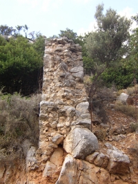
On both locations the abutments on one side of the bridges are still present which may guide the discussion on the heights of the bridges
with or without siphon(s). To my knowledge there are no indications for lead or stone pipes for a siphon system (they are available
at the Lyttos aqueduct).
After crossing both gorges the water was guided N into the valley between Xerokamares and the present (Old) Chersonisos. Here Oikonomakis
describes a tunnel which had its course nowadays on the military camp of SEAP and, unfortunately, is inaccessible.
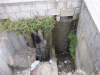
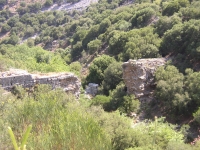
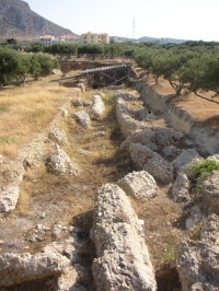
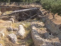
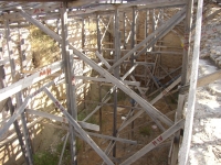
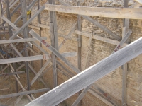
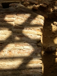
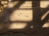
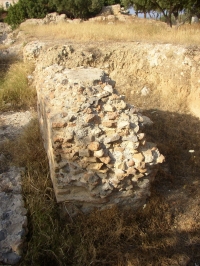
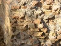
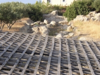
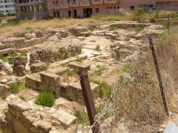
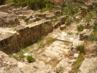
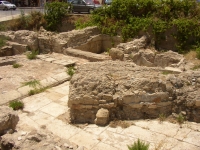
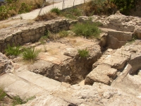
The aqueduct has its terminus in a reservoir in Palatia village in between (Old) Chersonisos en Limani (harbor) Chersonisos,
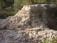
just opposite the Palatia Village hotel. The reservoir was excavated almost 10 year ago and is now well fenced. Its dimensions could have
been 52 * 5,60 * 5 m so its volume could have been about 1.500 m3.
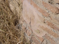
At the N end a major part of the long side wall was fallen down (because of an earthquake?). At the other end a more than 5 m deep
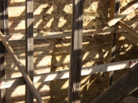
excavation pit shows three major gates in the long side (to sub-reservoirs annex?) and some patches of opus signinum (plaster). The walls of
this part of the excavations are supported by a wooden structure and includes a roof frame (the roof tiles are absent).
Visible supply channels are not present. Drawings of the complex have been requested.
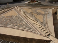
In Roman times, although under foreign rule, Chersonisos was not a minor place. It had at least a forum, a theater,
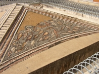
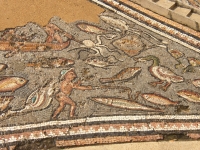
one or more fountains (one can be seen at the Boulevard in Chersonisos) and a bath house. It is generally supposed that at least
the last two items were fed by the aqueduct, via the Palatia reservoir.
W.D. Schram
Chersonisos - CHERSONASOS
| Item
| Info
|
| Length |
14 km |
| Cross-section |
m x m |
| Volume |
m3/day |
| Fall |
% |
| Period |
Trajanic |
| Features |
- reservoir / castellum divisorium
- siphon(s)?
|
| Recommended literature :
|
- Oikonomakes (1986): The aqueduct of Chersonisos (in: Lyktos, scientific periodical edition vol 2 (1986-87) pag 50 (in Greek))
- Kelly (2018): A Roman aqueduct through the Cretan highlands � securing the water supply for elevated Lyttos (in: G.A. Aristodemou: Great waterworks in Roman Greece (2018) pag 147 - 172)
|
| Recommended website :
| not available
|
| How to visit :
| See detailed desciption above and the waypoints below
|
| Waypoint |
Location |
Latitude |
Longitude |
| Ch1-009 |
Present spring (Koutsounaras) |
35 16 19.5 |
25 21 26.1 |
| Ch2-003 |
Xerokamares 2 (Crete) |
35 15 20.1 |
25 21 47.4 |
| Ch3-007 |
Xerokamares 1 |
35 16 23.9 |
25 21 54.7 |
| Ch4-043 |
N of SEAP-trainings area |
35 17 41.8 |
25 21 52.6 |
| Ch5-037 |
Palatia reservoir |
35 18 54.5 |
25 23 05.6 |
| Ch6-042 |
Roman bathhouse in L. Chersonisos |
35 19 12.6 |
25 23 27.7 |