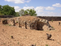
Consuegra (Spain)
Roman aqueduct of Consuegra - CONSABURA
Consuegra - CONSABURA
In the last 25 years the attention for ancient dams has grown dramatically. During a long period there is a group of civil engineers in Spain with a long-standing interest
in ancient water works; their articles are published in the magazine 'Revista de Obras Publicas'
which can be consulted on the web. Quite a few of them support the nice Traianus-website with
interesting articles on Roman dams, aqueducts, roads, and bridges in Spain. Unfortunately most of these are written in Spanish without adequate summaries in English.
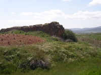
Apart from the Alcantarilla dam of the aqueduct of Toledo and the Proserpina and Cornalvo dams near Merida, the ancient dam of Consabura - present Consuegra,
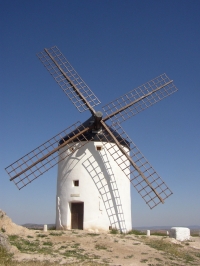
60 km southeast of Toledo - got much attention in these publications. Although Consabura is well known because of its famous windmills on the Cerro (hill) Calderico,
which can be seen from a great distance, its ancient dam - possibly less spectacular - deserves the same attention. In 1982 the dam was designated as a cultural and
historical monument.
Aqueduct
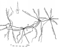
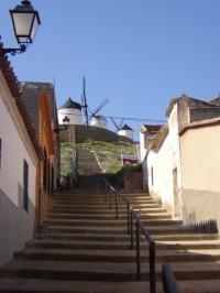 |
| From Consuegra to the windmills |
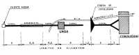
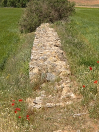
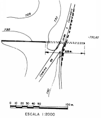
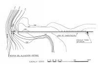
The Consabura dam in the valley of the Rio (river) Amarguillo, was part of an aqueduct system which was about 23 km long but only some 7 arches and 1/10th of a
dam remained. The aqueduct had its source in or near the Fuente Aceda (Aceda spring), also called Fuente del Moro (Moorish spring) in the spurs of the Montes de Toledo.
On its way of about 13 km to Urda, 6 km before the dam of Consabura, the water lost 7m of its height (gradient 0,05%).
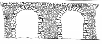
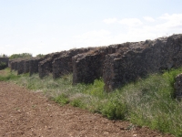
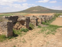
Most of the aqueduct was subterranean. In 1981 only seven of the original 40 arches were still standing and partly integrated in the concrete of the farmstead 'Los Peleches'.
Some arches were filled up with masonry.
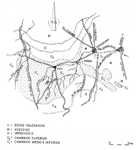
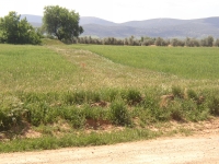
Some 6km east of Urda, 4 km west of Consabura a dam was built, the principal element of a reservoir to store aqueduct water, from which a second part of the aqueduct
started heading for the city of Consabura. Nothing is known of the water distribution inside Consabura with its 5.000 - 15.000 inhabitants in ancient times.
South of the city the remains of a bath building was found (private communications) possibly fed by aqueduct water.
In the eighteenth century Domingo de Aguirre, who found in this area a lot of roman remains that are now in the Consuegra Museum, first documented the dam.
Dam
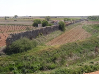
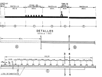
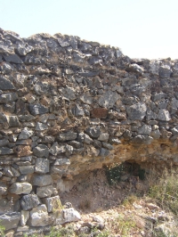
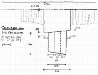
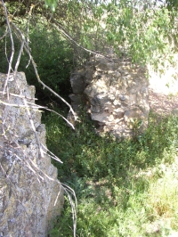
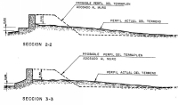
The original dam was composed of a wall with a concrete core and a rubble facing (opus incertum), 1,25 - 1,35m thick, 4,8 m in height and over 630 m long. It was
0,40 m recessed in the quaternary rocks. At that time this reservoir could contain up to 360.000 m3 water. The river Amarguillo, a tributary of the Guadiana, had washed
away the first 50 m at the northern end of the dam.
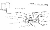
Almost in the middle 14 + 1 buttresses, 1,2 m x 1,7 m at the bottom, supported the dam at the air face: 14 on more or less equal distances from each other, the last one
on a double distance (see drawing). The whole structure was possibly reinforced with an earth embankment of which no remains are left.
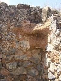
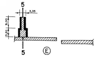
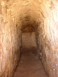
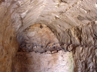
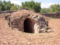
Behind this part there was an outlet. The outlet-chamber was about 3.2 m square and 3 m high, and built against the downstream side of the wall. Here the aqueduct
started it way in the direction of Consabura; it was 0,96 m wide and 2,3 m high internally. It was arched with concrete using 5 longitudinal boards, which patterns shows
clearly in the soffit.
Less that 40 m from the outlet is a gap, over 1 m wide, in the wall which seems to be caused by disagreement of the builders about the exact cause. More convincing is
the idea of a landslide.
Flood
After almost 2000 years since its construction, on September 11, 1891 and after a series of cloud-bursts, the dam could not longer resist the water pressure. A sudden
crack in the dam caused high flood waves, also in the village of Consuegra were houses on both sides of the river were washed away. Only the church of San Juan
was strong enough. In that fatal night some 400 inhabitants were killed. Since the dam crack the area around the dam is covered with mud.
Wilke Schram
Consuegra - CONSABURA
| Item
| Info
|
| Length |
23 km |
| Cross-section |
m x m |
| Volume |
m3/day |
| Fall |
0,05 % |
| Period |
1rst c ? |
| Features |
|
| Recommended literature :
|
- J.A. Garcia-Diego (1980): Nuevo estudio sobre la presa romana de Consuegra (RdOP vol 3181 pag 487 - 550)
- J.A. Garcia-Diego (1983): Estudio conjunto sobre la presa romana de Consuegra parts I, II and III (RdOP vols 3215, 6, and 7)
- M. Diaz Marta (1984): Comentarios el estudio conjuncto sobre la presa romana de Consuegra (RdOP vol 3223 pag 191 - 205)
RdOP = Revista de Obras Publicas"
|
| Recommended websites :
|
|
| How to visit :
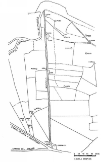
| In Consuegra take the CM 4116 direction Urda. After a few kilometers the road makes an S-curve over the Rio Amarguillo. You will find the dam a kilometer further at your left. Be careful crossing the Amarguillo.
|