Gadara (Jordan)
Roman aqueducts: Gadara (Jordan)
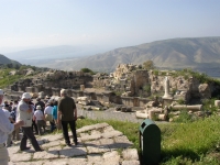
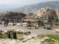
Umm Qais - GADARA
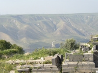
Umm Qais, situated 110 km N of Amman on a broad promontory 380 meters above sea level with a magnificent view over the Yarmouk River and the Golan Heights
both to the N, Lake Tiberias / Sea of Galilee (NW) and the Jordan-valley to the W, was known as Gadara, one of the brilliant ancient Greek-Roman cities of the Decapolis,
the league of ten cities but the actual number of cities varied over the centuries; sometimes more than 10, sometimes less.
According to the Bible, Gadara was the place where Jesus cast out several demons out of two mad men into a herd of pigs (Mathew 8:28-34).
In ancient times, Gadara was strategically situated, connected to Syria and Palestine by a number of key trading routes. It was blessed with fertile soil and abundant rainwater.
This town also flourished intellectually in the reign of Augustus and became distinguished for its cosmopolitan atmosphere, its own 'university' with scholars, attracting
writers, artists, philosophers and poets, the likes of satirist Menippos (2nd half of the 3rd century BC), the epigrammist Meleagros, and the rhetorician Theodoros (14-37 AD).
Gadara was also the resort of choice for Romans vacationing in the nearby Hammet Gader Springs with a Roman Baths.
Archaeological surveys indicate that Gadara was occupied as early as the 7th century BC. The Greek historian, Polybius, described the region as being under Ptolemaic control
at the time. The Seleucid ruler Antiochus III conquered it in 218 BC, naming the city Antiochia and Seleucia. In 63 BC, Pompey liberated Gadara and joined it to the Decapolis.
The city prospered particularly in the late 2nd and early 3rd c AD.
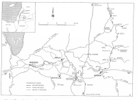
Over-regional water system
Gadara was well supplied with water from cisterns and the Ain Qais spring. Because of its strategic location with excellent roads to the north (Syria), the west (harbors of
Caesarea and Ptolemais / Akko) and to south (Petra) the town became more prosperous based on trading and agricultural opportunities. In Roman times Gadara could boast
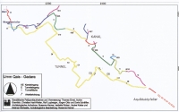
of two theaters, a nymphaeum and a hippodrome under construction. An aqueduct was built, executed as two parallel systems with a total length of over 95 km -
called the lower and the upper tunnels - also supplied some other towns in between its supposed source in the Dille swamp-area in present Syria and its final destination Gadara:
Adra(h)a (present Dar'a) and Abila Dekapoleos (Tell Abil). It is quite possible that on a later date local aqueduct arrangements of the last named towns became connected
to each other in one system (see map).
Twin aqueducts outside Gadara
 |
|
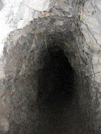
The upper aqueduct under the acropolis of Gadara was 427 m long with cross-sections between 1,60 and 2.30 m high and 1.20 wide and with a theoretical capacity of
about 19.000 m3/day which is almost the double of the lower one. Its general slope was 0,43%. Here also the distance between the building / inspection shafts was
about 35 m varying between 10 and 40 meters.
|
Until now only a few parts of the whole system of over 95 km are researched in detail. Prof. M. Doring reports about excavations under the Hirbet er-Zraqon 30 km ESE
of Gadara including a double gallery system - cross-section 2,5 m x 1,6 m - a Roman-type aqueduct bridge to cross the Wadi es-Sellale, and inspection shafts up 60 m deep.
The last part before the twin-aqueduct enters Gadara was well research by dr. S. Kerner. She reports about the two main lines from the Ain Trab spring 12 E of Gadara
with a total length of about 22 km following the contour lines of the hills without bridges or other structures. About 650 m from this spring both the lower and higher tunnel
came to light, the former carefully cut and the latter more irregular hewn with demonstratable corrective measures like lowered floors. On its way to Gadara extra water intake
took place by means of tapping additional springs and small surface channels to collect rainwater run-off from sheer rock surfaces. Because of the terrain conditions
not all manholes / inspection shafts could be traced, but where that was possible the distance between them was between 30 and 40 meters, roughly in line with Vitruvius'
suggestions: 1 actus apart (35,5 m). They were all built as sloping shafts with stairs or horizontally.
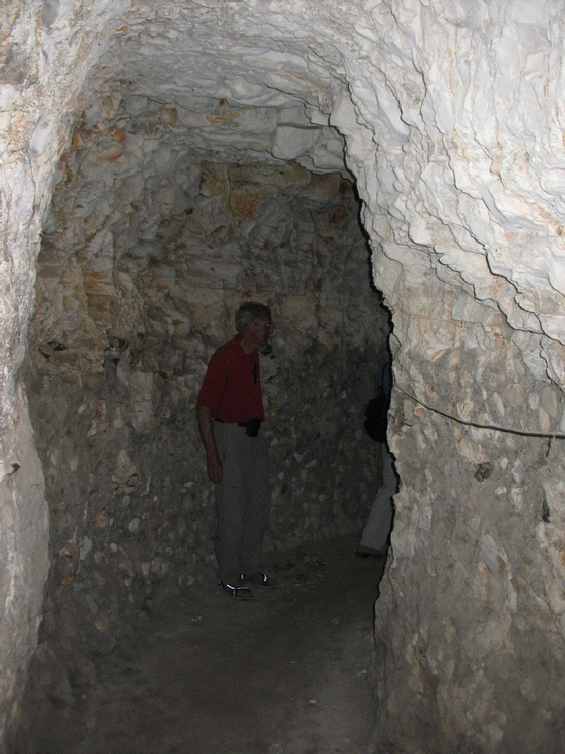
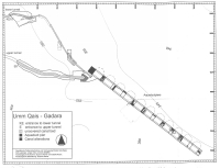
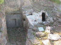
Within Gadara
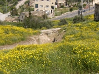
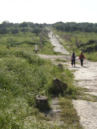
As the twin aqueduct reaches Gadara a small depression has to be crossed. Because of the present densely inhabitation only a few remains of the ancient bridge
which crossed the wadi between the modern town of Umm Qais and the acropolis of Gadara are still present. Although only the last westernmost arch is all that is left,
the pillar bases of ten more arches are discernible on the ground. Because both aqueducts were transporting water on different levels, special measures were taken
to cross the wadi: one channel on top and the other on a parallel construction along the side of the aqueduct bridge. For a proper connection with the tunnel on the
Gadara-side of the wadi, the higher aqueduct needed some substruction to keep its level and continued in one of the tunnels under the acropolis.
As the map shows, the lay-out of both tunnels is far from a straight line due to different circumstances including measuring mistakes, geological conditions and different
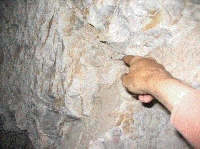
destinations of the water. Both tunnels were built in qanat-technique: several shafts were hewn and at the required depth connected horizontally to each other.
This made it possible to work simultaneously with different work forces. In the Gadara tunnels the execution of the work is of very different quality, which leads to
the assumption that quite different teams were involved in the construction.
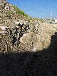
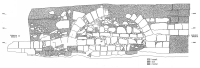
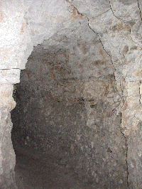
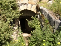
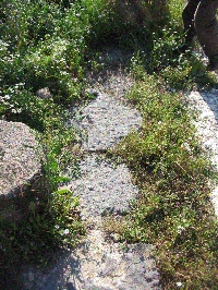
The lower and elder tunnel is 400 m long and began with a well-cut opening into the rock surface 1,92 m high and 0,82 m in width at the base. It had 12 entrances and
a capacity of about 10.700 m3/day and a mean gradient of 0,08%. One of the interested features is a water division chamber - a castellum divisorium - where the water
was distributed into three different directions by means of two additional side channels on different levels with each own set of pipes but there are no means to identify
the final destination of two of the extra outlets.
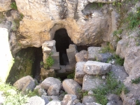
The upper aqueduct under the acropolis of Gadara was 427 m long with cross-sections between 1,60 and 2.30 m high and 1.20 wide and with a theoretical capacity
of about 19.000 m3/day which is almost the double of the lower one. Its general slope was 0,43%. Here also the distance between the building / inspection shafts
was about 35 m varying between 10 and 40 meters.
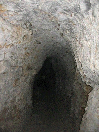
The exit was near the Byzantine church of Gadara, but after that no continuation of the channel, no pipes, the floor had not been finished, there were no traces that
the floor had been leveled, no waterproof finish on the walls, no constructions inside, no distribution mechanism. These features underline the unfinished state of the upper tunnel
which construction might be stopped by money shortage, like is supposed by the interrupted construction work on the hippodrome.
One last interesting feature of the water system of Gadara: on several places the exits of the twin-aqueducts could be linked to specific structures like bath houses,
private houses and the nymphaeum although physical remains like pipes are often missing. Along the main road of Gadara that linked the acropolis with the area around
the unfinished hippodrome - the ancient decumanus - basalt pressure pipes were found which suggested a siphon structure to overcome the depression W of the acropolis
in order to supply the western outskirts of Gadara with fresh water, supposedly from sources 100 km away.
Wilke D. Schram
Umm Qais - GADARA
| Item
| Info
|
| Length |
km |
| Cross-section |
m x m |
| Volume |
m3/day |
| Fall |
% |
| Period |
Augustan |
| Features |
- 100 km long double water system
- access-schafts
- local siphons
|
| Recommended literature :
|
- S. Kernen (2004): The waters systems in Gadara and other Decapolis cities of Northern Jordan (in: Bienert2004)
- M. Döring (2006): Römische Wasserversorgungstunnel im Norden Jordaniens (in: Wiplinger2006)
- M. Doring (2016): Wasser fur die Dekapolis, Romische Fernwasserleitung in Syrien und Jordanien
- P. Keilholz (2016): Die innerstadtische Wasserversorgung von Gadara (in: doring2016)
- P. Keilholz (2017): Water supply and distribution in the ancient Decapolis city of Gadara (in: Water History febr 2017)
|
| Recommended website :
| Qanat Firaun
|
| How to visit :
| Gadara is about 28 km N of Irbid and can be reached by car and bus.
|