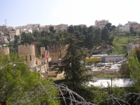
In the early phases of present Jerash there must have been a certain balance between the water needs of ancient Gerasa (present Jerash,
in Hellenistic times also called Antiochia on the Chrysorhoas) and the available water sources. The town was situated along the banks of the
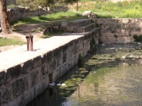
Wadi Jerash (the ancient Chrysorhoas - gold river) a tributary of the Wadi Zarqa. Within the future town walls there was a spring present
with a total capacity irregularly between 1500 and 15.000 m3/day which supplied the local houses, the gardens in the area and from
the second century AD onwards the eastern baths. Until now 'Ain Karawan supplies water to its surroundings. Unfortunately the level
of the source was too low to feed the ancient city on the W side of the present Wadi Jerash.
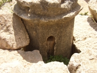
Apart from that, there were many cisterns fed by rainwater.
As the town became more and more prosperous and flourishing as agricultural and trade center, the standard of living rose and so did
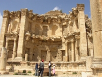
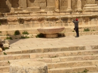
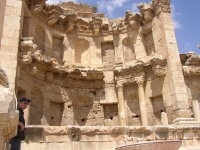
the private consumption, the need for (a) new bath house(s), a nymphaeum and/or more fountains. Subsequently the need for a more abundant water supply
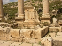
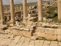
rose too. In total the remains of seven bathhouses (plus one in Birketein), 1 nymphaeum and numerous fountains have been found until now.
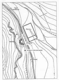
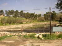
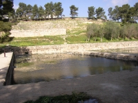
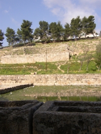
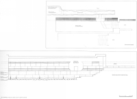
Springs 1200 m N of Gerasa fed the reservoir of Birketein (=double pool) which had a rectangular shape and was divided into two parts by a barrier wall.
It is 43,5 m wide, 88,5 m long and some 3 m deep. Originally a colonnade, which can be dated to 209 AD ran along the western side
framing the ancient processional way, which was lined with funerary monuments, from the northern gate of Gerasa via the Birketein pools
to the Tomb of Germanus, some 100 m to the north. Birketein was a luxury ′suburb′ including a theater, at the same time a cult place for the
Phoenician divinity of Maiuma(s) with its annual nautical festival which involved, among other activities, the ritual submersion of naked women.
However the water level in the reservoir was to low to supply the city center of Gerasa with fresh water. The Birketein water was (and still is)
only used for local agricultural purposes.
In a wider range around Gerasa there were more springs present on higher grounds like 'Ain Suf and 'Ain Shawahid, at the low end of the village
Deir-el-Liyyat. It is obvious that this water could have been brought to the higher parts of the W side of the city by means of an aqueduct.
Because of the local terrain conditions a siphon must have been part of the arrangement. However, until now no concrete remains have been found
that can confirm this hypothesis.
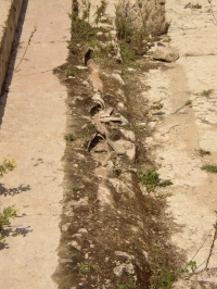
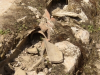
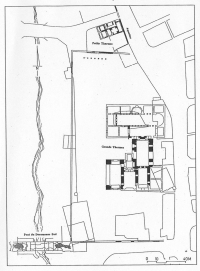
On the other hand only a small part of an aqueduct structure have been found between the 'Ain Karawan spring and the eastern bathhouse.
Wilke D. Schram
Jerash - GERASA
| Item
| Info
|
| Length |
unknown |
| Cross-section |
unknown |
| Volume |
unknown |
| Gradient |
unknown |
| Period |
unknown |
| Features |
|
| Recommended literature :
|
A. Hoffmann and S. Kerner: Gadara - Gerasa und die Dekapolis (2002) (in German)
|
| Recommended website :
| non
|
| How to visit :
| By bus from 'Amman. Entrance at the S side of the site, near the hippodrome.
|