Gortyn(a) (Greece / Crete)
Roman aqueducts: Gortyna (Crete - Greece)
Agii Deka - GORTYNA
Roman interest in Crete occurred rather late; the island became a province in 27 or 24 BC when it was combined with Cyrene to form Cyrenaica.
Gortyn was named capital of the island, probably because of its early and strong support of the Roman cause and its animosity towards Knossos,
a Roman enemy. The remains from Gortyn affirm its role as a place worth it capital status (...) gymnasia, fountains, colonnades, temples, workshops,
schools, aqueducts and baths. Gortyn also had a praetorium (governor's residence), theaters, an amphitheater, an odeion [where the famous inscriptions with the lawcodes were found wds], a circus, waterworks and markets.(...)
Gortyn was inhabited from the Hellenistic through the Byzantine period, a rather unusual occurrence on Crete where many sites begin in the Minoan period.
Its remains, especially its architecture, are also well preserved. As the capital of Roman Crete, Gortyn occupied an important political and economical position (...)
[from: Gortyn: first city of Roman Crete, J. Francis and G.W.M. Harrison (in: AJA vol 107-3 (2003) pag 487), reviewing the series Gortina written by A. di Vita]
|
|
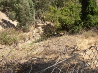
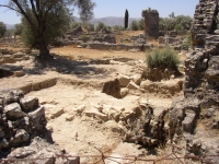
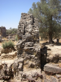
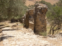
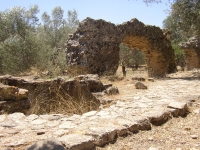
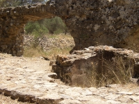
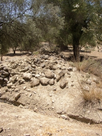
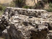
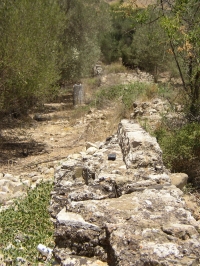
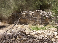
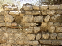
Remains of the aqueduct branch just N of the Praetorium of Roman Gortyn, looking SW
|
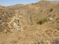
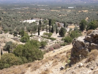
The source of the aqueduct of Gortyn can be found N of Zaros on the S slopes of mount Ida, following its course in the valley of the river Lethaeus S towards Gortyn.
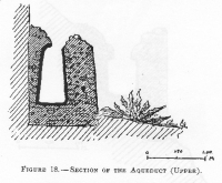
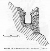
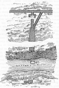
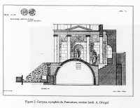
In his AJA-article of 1902 Taramelli gives a description of the area around the source of this aqueduct including drawings of a cistern, the drainage system under the main channel, cross-sections of the aqueduct and a fountain near a Roman villa. At an unknown point the main channel splits into two branches
(...) both on the right bank of the river, and about 43m apart; the higher of the two was slightly larger than the lower,
both in the actual size of the aqueduct, up to 1.7 m and 1.8 m wide as compared to the lower at circa 1.1 m x 1.0 m and in the size of the
channel - higher 0.65 m x 0,56 m, lower 0,55 m x 0.45 m. Some distance [about 500 m wds] before they approached the Acropolis the lower one sent off a branch
which crossed over the river [by means of a siphon, see the drawings of Taramelli below wds] and continued on the left bank down into the city. At the point of crossing there are visible remains of a caput aquae [=header tank wds] to maintain pressure in the system as it crossed over and rose up the other side.
The aqueducts remaining on the right bank continued along the gorge but came together to cross a valley by an other bridge [N of the acropolis wds]
on two levels on the west side of the acropolis before separating again to flank it. The lower branch finally left the other just before the Larger Theatre
and crossed down to the area of the Forum and the Odeion. The higher branch continued down to the plain on the west side of the Lethaeus, partially
underground, where it was ventilated by wells. It is possible that it finally finished at the series of vaulted concrete structures just W of the river
and N of the modern road, which may have been a nymphaeum.
[from: I.F. Sanders: Roman Crete (1982)]
It can be supposed that Gortyn had at least the following waterworks: 46 fountains, several bathhouses, water supply systems for privati and several nymphaea.
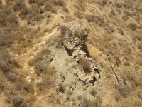
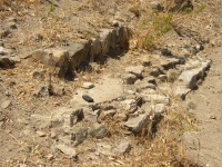
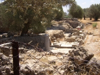
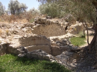
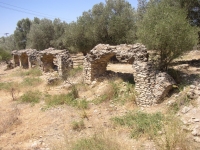
All these waterworks must have required a tremendous flow of water. The aqueduct branch on the E side of the river Lethaeus can be considered
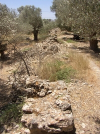
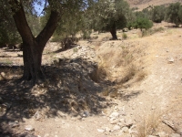
as the trunk line of the are S of the main road including the Praetorium with its own nymphaeum and bathhouse. The line towards this complex is in very
fragmentary state but it was obvious carried on arches with small cisterns at the bottom of some arches for distributing water en route. Sanders:
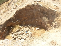
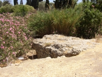
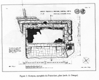
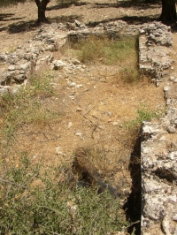
The only dating evidence for the aqueduct itself in the area is supplied by its relation to a building next to the Praetorium nymphaeum. Here
the water tower at the end of the aqueduct overlies this building, which is rectangular, 10m x 15 m, and constructed of porous blocks;
from the material found with it would seem to be a little temple of Augustan date dedicated to a female deity (Sanders1982).
The picture of the water supply of Gortyn seems to be complicated:
- what was the course of the aqueduct between the source up to 1 km before the acropolis of Gortyn and where the split took place between the higher and lower branches ?
- where is and what is left of the caput aquae of the siphon as described by Taramelli in 1902?
- what is left of the siphon-system as in 1902 described by Taramelli and what was the function of the bevel / shortcut (see Taramelli's drawing below) even if it is a later alteration?
- which courses took the higher and lower branches of the aquaduct system on and around the acropolis and what were their destinations?
- the most E branch of the aqueduct seems to have been the trunk line for the water supply of the area around the Praetorium up to the 'Megali Porta' and the hippodrome. How can we draw a final map of the total water supply system in this area and how can we describe and understand the dynamics of this work in Gortyn?
NEW RESEARCH
In het PhD-thesis (2016) Elisabetta Giorgi presents the results of a careful study of all the known remains of water related structures of Gortyn (Crete, Greece).
The overview starts at the source area in Zaros, goes to the Acropolis and of course towards the city mainly east of the river Mitropolianos. She incudes all knows
remains of the main course of the Roman aqueduct and its branches, two aqueduct bridges, nymphaea, at least two castella aquae, a series of early Byzantine
cistern-fountains, and smaller and bigger water storage reservoirs.
Although her main interest is the relation between the developments in the city and their echo's in the water supply system, Giorgi also presents a new proposal
for the course of the aqueduct and its branches in and near the city.
Please take in mind that the remains span a time frame from the 2nd to the 7th c CE.
|
 |
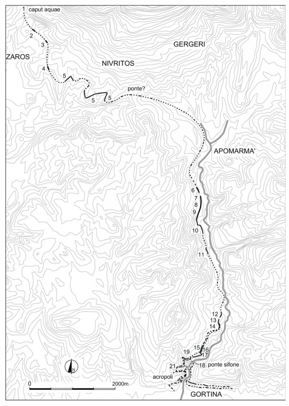
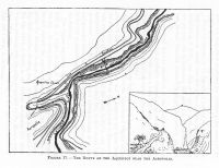
The course of the Gortyna aqueduct extra urbem (left).
At point 1 the Caput Aquae plus (formerly covered) reservoir of ca 400 m3. At point 14 the first splitting; at 19 a second splitting, now in the lower aqueduct;
one branch crossed the river by means of a siphon (18) after which another splitting took place, heading to the east to feed the city east of the Mitropolianos river.
At 21 a (siphon?) aqueduct bridge towards the Acropolis.
(map from Giorgi 2016 fig 74)
|
 |
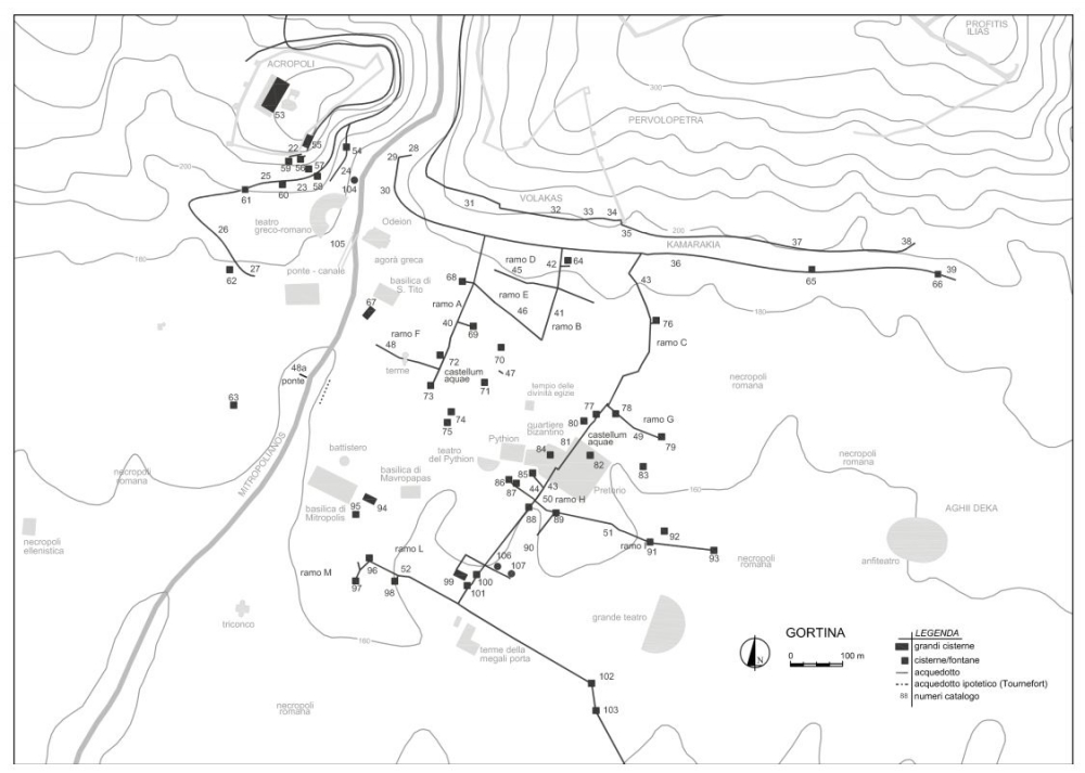
Map of the course of the different branches of the aqueduct, supplying the urban areas (above).
At 53 and 55 two probably uncovered storage basins. The central part of the first one had a capacity of at least 6.000 m3. The second one could contain about
800 m3 water. The numbers 72 and 81 were probably castella divisoria in resp. branch A and C.
(map from Giorgi 2016 fig 122).
|
Wilke D. Schram
Agii Deka - GORTYN(A)
| Item
| Info
|
| Length |
15 km |
| Cross-section |
0,5-0,6 m x 0,9-1,0 m |
| Volume |
Average 7.000 m3/day; max. 17.000 m3/day |
| Fall |
1,8 % |
| Period |
2nd - 6/7th c CE |
| Features |
- Huge settling basin near the spring
- One, probably two, siphon(s)
- Huge storage basin(s) at the Acropolis
- (at least) Two castella divisoria
- Over 50 early Byzantine
cistern-fountains (ca 50 m3)
|
| Recommended literature :
|
- A. Taramelli (1902): Gortyna (in: AJA 2nd series nr 6 (1902) pag 118 ff)
- I.F. Sanders (1982): Roman Crete item 10/10 pag 156
- M. Pagano (1992): Recherches sur l'aqueduc romain de Gortyne (Crete) (in: G. Argoud (ed): L'eau et les hommes en Méditerraneé ... (1992))
- E. Giorgi (2007): Water technology in Gortyn in the 4th - 7th c AD: transport, storage and distribution (in: L. Lavan a.o. (eds): Technology in Transition: 300 - 650 AD (2007) pag 287 - 320) - E. Giorgi
- E. Giorgi (2016): Archeologia dell'acqua a Gortina di Creta in eta protobizantina (PhD-thesis in Italian with English summaries) - E. Giorgi
|
| Recommended website :
| none
|
| How to visit :
| see maps above and below
|
| Waypoint |
Location |
Latitude |
Longitude |
| G1-28 |
At split with L in main channel |
35 03 39.1 |
24 57 13.1 |
| G2-27 |
In main turn towards the Praetorium |
35 03 40.0 |
24 57 10.9 |
| G3-30 |
E of the new parking lot |
35 03 37.5 |
24 57 04.3 |
| G4-29 |
Aqueduct L near the main road |
35 03 36.6 |
24 57 10.7 |
| G5-26 |
Aqueduct behind the Praetorium nymphaeum |
35 03 31.0 |
24 57 14.4 |
| G6-35 |
Double bridge N of the acropolis |
35 03 56.5 |
24 56 49.7 |
| G7-33 |
High aqueduct on the acropolis |
35 03 49.1 |
24 56 52.8 |
| G8-31 |
N brige over the Letaeus |
35 03 45.6 |
24 56 55.7 |
| G9-34 |
Top of acropolis |
35 03 52.4 |
24 56 51.7 |