Larnaca (18th c)

Roman aqueducts: Larnaca - KITION (Cyprus) Larnaca - Kition (Cyprus) (18th c)
For the photo's, see below
Home / the complete website

The most visible parts of the old water supply of Larnaca are the three series of arches better known as the 'kamares' (which means 'arches'), one series along the southeast exit road A5, the second south of the suburb 'Kamares Neighbourhood' and the third two km northwest of Dromolaxia, often called Grandioso, the Middle one, and the Lower one.
This 18th century Ottoman aqueduct had its sources in the riverbed of the Tremithos torrent. First the water was conducted by means of an underground water channel with a slight fall and accessible via a series of vertical shafts. In Cyprus this system is known as laoumi but may have its origin in Persia and better known as qanat. The second part used channels on substructions and arcades to conduct the fresh water.

Kamares, the old aqueduct of Larnaka
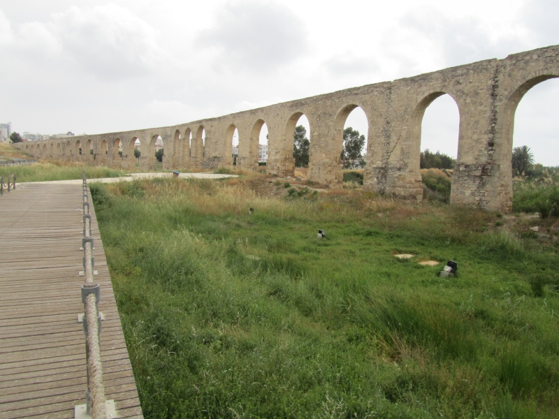
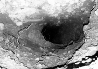
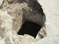
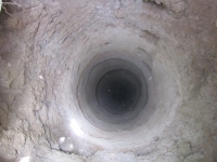
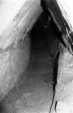
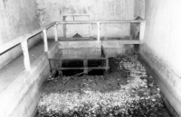
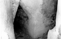
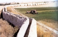
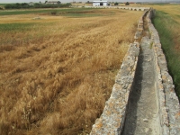
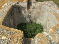
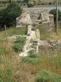
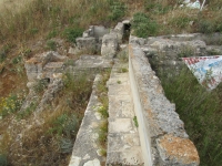
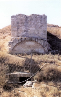
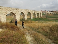
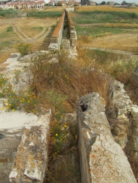
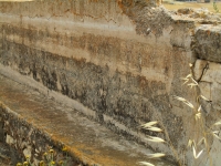
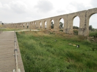
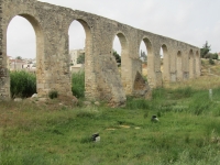
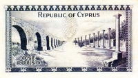
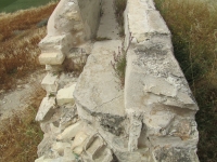
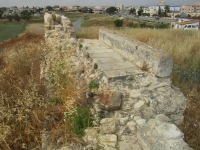
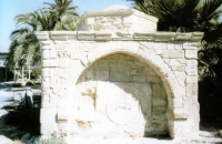
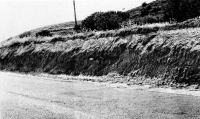
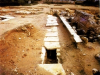
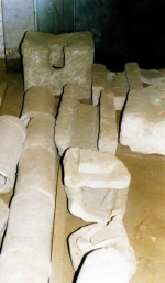
At the exit from Larnaka towards the Limassol highway you see the most grandiose arches (kamares) of the 15 kilometers long, 18th century aqueduct of Larnaka. For the traveler the old aqueduct of Larnaka offers a interesting challenge. Walking straight line from these 1st arches at about 2-3 kilometers you arrive at the 2nd arches and after a walk of almost the same distance, but having to pass the airport 'by-pass highway', you arrive at the 3rd and lowest arches. At this point you have to look for the old grain mill, which was working with the aqueduct's water. And then for almost 8 kilometers up to the river, the water channel becomes underground, but every 250 meters you can see the 'visiting wells' of this unbelievable project, which channeled the water of river Tremithos to Larnaka till the 1950's.

Abou Bekir Pasha (1670 - 1758), one of the Ottoman governors of Cyprus, ordered the construction of this water supply system with its total length of 15 km: 8 km underground and 7 km on substructions and arcades. The actual builder was the dragoman (diplomat and interpreter) Kostantinos Christofakis; the work took him three years (1746 - 1748).

Water for Kition

An interesting question is whether this system had a Roman predecessor. The first dwellers of Kition (ancient Larnaca) will have used wells and rain fed cisterns for their water needs. At several locations in and around present Larnaca remains of stone protected wells, cisterns, terracotta pipes and stone channels from the classical and Roman period have come to light. For example, in the course of road work a line of ancient clay pipes have been found at Prastio, along the west side of the road between Kalochorio and the road Larnaca - Limassol, possibly carrying water from an unknown source to Kition.

Cyprus and the Tabula Peutingeriana
= See the entry Salamis =

The earliest account of an aqueduct for Kition is in the so-called 'Acts of Barnabas' (5th c AD) in which Saint Barnabas and Evangelist Mark, on their travel from Salamis to Pafos (circa 50 AD), paid a visit to Kition:
"When we arrived in Kition no one received us in the city but we stopped at the city gate near the aqueduct and took a rest before moving on."
(Lipsius and Bonnet 1903: Acta Barnabae, 21).

At least ten 18/19 c travelers make mention of (an) ancient aqueduct(s), many in the area west of Larnaca. One of them (Mariti, 1760 - 1767) noted:
"Remains exist of ancient aqueducts, proving that even in those days it was necessary to bring the water from distant places ... " (Cobham 1909 pag 25).
This remark does not fit with the at that time 'modern' Abou Bekir Pasha aqueduct built between 1746 - 1748.

The Abou Bekir Pasha aqueduct

Just south of the present Kiti dam in the Tremithos torrent, the church of Saint George of Arpera was built in 1745 by Konstantinos Christofakis, a man of Greek origin, an Ottoman official (dragoman) and contractor of the Larnaca aqueduct.
A fresco in the church presents him and all his family offering the Church to Saint George to thank him, according to legend, for successfully completing the difficult project of the aqueduct.
The source of this Ottoman aqueduct was in the riverbed of the Tremithos torrent 15 km southwest of Larnaca, just north of the present Kiti dam. A set of over 30 vertical shafts were horizontally connected to each other forming one large underground channel ( 0,70 x 1,25 m) with a gabled roof, conducting the water (see map). When after about 8 km the channel entered the surface a settling basin and an overflow were built; the latter was - after 6km - connected with the Hala Sultan Tekkè near the Salt Lake south of Larnaca.

The main line continued heading northeast, partly on substructions and partly on arches (kamares). On its way to Larnaca the water powered two grain mills, the remains of one is still present downstream of the lowest series of arches Kamares I, 2 km northwest of Dromolaxia, along the A3 highway. A good 50 m before the mill a wide settling basin was built to prevent that debris in the aqueduct water could ruin the mill.

The second arcade Kamares II, actually a bridge, is just south of the new residential area 'Kamares Neighbourhood' crossing a shallow riverbed. Right in the middle two pillars are missing, probably because of poor foundation. Just before the aqueduct crossed the stream a small settling basin was built to prevent debris to ruin the bridge.

The third series of arches - the 300 meter long Kamares III - are the most prominent ones, positioned along the southwestern main exit road of Larnaca (A5; Avenue of Nicos and Despina Pattichi) and can easily be visited. Just at the end at the downstream side of the arches the remains of a small settling basin or overflow is still visible.

In former days the aqueduct supplied seven public fountains in Larnaca. Only two of these have survived: one close to the Tusia / Touzla mosque in the Athanasiou Karydi street, the other annex to the Kebir (Buyuh) mosque, behind the Larnaca fort.

The aqueduct and its mills were in full operation till the early 1950's


Wilke Schram
with kind support of Alexis Michaelides, Larnaca, Cyprus

Larnaca - KITION

Item Info
Length 15 km
Cross-section 0,70 x 1,2 m (laoumia)
0,30 x 0,40 m (channel)
Volume m3/day
Fall %
Period 1746 - 1748
Features
  • Laoumi source
  • Settling basins
  • Grain mill


Recommended literature :
  • A. Michaelides and S. Christodoulides: Larnaca's water supply, a history of 4000 years (2005) (in Greek)
  • A. Michaelides: Collection, storage and distribution of water in antiquity, linking ancient wisdom to modern needs (n.d.), see the Hydria-website
  • K. Nicolaou: The historical topography of Kition (1976)
  • R.A. Lipsius and M. Bonnet 'Acta Barnabae', in: Acta Apostolorum Apocrypha vol 2-2 pag 300 (1903)
  • C.D. Cobham 'Travels in the island of Cyprus' (1909), a translation of G. Mariti's Viaggi per d'isola di Cipro vol 1 (1769) - also on the web
Recommended websites   :
How to visit                  : see text above
HOME More literature on more aqueducts Last modified: June, 2011 - (webmaster)


Old and new supplies

Spring source

Access shaft

View towards the laoumi

Subterranean channel

Konstantinos Christofakis

Regulation box

Part of the overflow

Fountain of Sultan Tekkè

Kamares I

Water tight lining

Settling basin

The firts grain mill

Works before the mill

Back side of the mill

Kamares II

Settling basin

Lining of the channel

Kamares III

Two buttresses

Banknote with kamares

Cross-section

Remains of a basin?

Touzla fountain

Fountain near the mosque

Two surviving fountains

Pipes in the road talus

Covered channel in Kition

Ancient pipes and channels

Logo of the LWB