Roman times on Crete began with an unsuccessful attempt in 71 BC by Marcus Aurelius to invade the island. It then took Quitus Cecilius Metellus
another three years to conquer Crete. From 68 BC on Gortyn took over the major role from Lyttos and Knossos on Crete and became the capital
of the island (and Cyrenaica ).
Lyttos, 25 km SE of Iraklio, was of Doric origin and once was a Spartan colony. It thrived during Roman times. It had a temple of Athena Polias and a theater.
Statues of Trajanus and Marcus Aurelius have been discovered; both are now exhibited in the Archaeological Museum of Heraklion.
The port of Lyttos was Chersonisos.
In 1586 AD Oxigio Belli paid a visit to the area, made excavations, drew many pictures, wrote a book on his journey to Greece and letters
to his uncle. His works are at the Biblioteca Ambrosiana di Milano. While staying in Chania he wrote (October 11, 1586):
It [Lyttos] also had a very good aqueduct, which was bringing the water of a very big spring. This aqueduct was beginning
four or five miles away from Lyttos and was taking the water of a big spring of the very high mountains called Lasithi ...
Do not think that this is the unique aqueduct in the whole kingdom. There are many others, not of course of the same cost and length.
In his book 'Roman Crete' Sanders (1982) states that there is no connection between the aqueducts of Lyttos and Chersonesos.
This view is underlined by the maps of Oikonomakis (1984) who made a detailed study into both aqueduct systems.
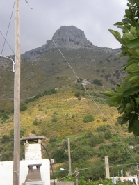
The Lyttos aqueduct - in total 22 km long - had its source at the W flank of the present Oropedio Nissimou mountain - its summit is 1148 m high -
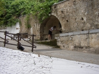
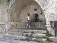
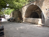
at a location called Pègè Kournias (altitude unknown), a few kilometers S of Krasi (altitude over 600 m). The channel here was 0,35 - 0,40 m wide.
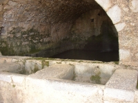
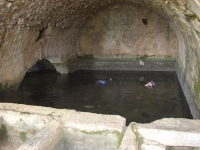
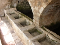
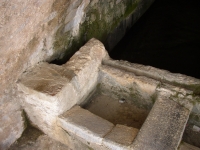
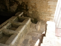
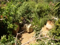
This is a region with many springs which is underlined by the present springs and the spring building in the village of Krasi (see photos).
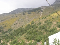
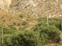
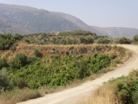
The aqueduct continued along the NE and NW sides of the Louloudaki, where remains are still visible.
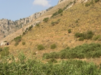
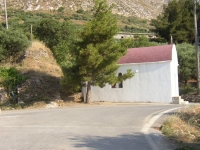
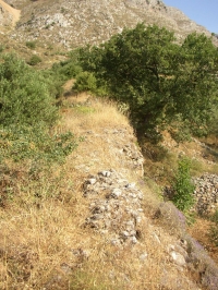
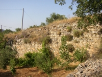
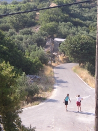
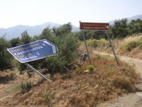
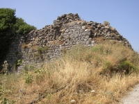
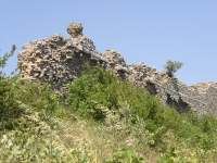
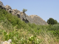
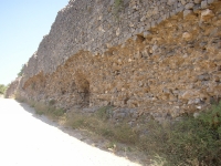
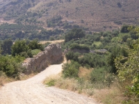
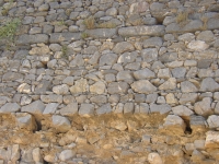
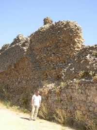
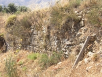
Close to Kastamonitsa the channel made a sharp turn to the N heading for Lyttos. Here the most visible remains can be seen between
Kastamonitsa and Toichos: the wall (toichos means wall!). It is the substructure and partly the aqueduct bridge composed of
stretches of several dozens of meters of stone wall, at some places 10m high, at others used as roadway. At ground level
the wall is over 2 meter wide. Unfortunately, after this section no visible remains have yet been identified until Lyttos.
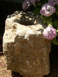
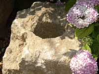
Quite unique is the presence of several stone pipe blocks in the area, most of which were used locally as building material.
The one on the photos below (dimensions 0,52 x 0,52 m and 0,66 m long) was found in a garden of a villager of Kastamonitsa,
and had a bore of 0,21 m without any sign of connection (no male or female side or rings). These blocks could have been
used to build a siphon on top of the wall (tichos), as also was stated by Harrison (1993) who adds "including lead lines".
Both header and receiving tanks have not been discovered yet.
W.D. Schram July 2006
The assistance provided by Stavros Papadimitriou (Heraklion), Mike Saridakis (Kastamonitsa) and Lydia and Nikos Psaltakis (Villa Ippocampi, Koutouloufari, Crete) is gratefully acknowledged.
W.D. Schram
Xidas - LYTTOS
| Item
| Info
|
| Length |
22 km |
| Cross-section |
m x m |
| Volume |
Unknown |
| Gradient |
Unknown |
| Period |
Augustan |
| Features |
|
| Recommended literature :
|
- Oikonomakes (1984): The aqueduct of Lyttos (in: Lyktos, scientific periodical edition vol 1 (1984) pag 66 (in Greek))
- Kelly (2018): A Roman aqueduct through the Cretan highlands � securing the water supply for elevated Lyttos (in: G.A. Aristodemou: Great waterworks in Roman Greece (2018) pag 147 - 172)
|
| Recommended website :
| none
|
| How to visit :
| see description above and the waypoints below
|
| Waypoint |
Location |
Latitude |
Longitude |
| L1-022 |
Springs in Krasi (Crete) |
35 13 56.5 |
25 28 19.4 |
| L2-020 |
Toichos, near chapel |
35 11 40.4 |
25 23 09.4 |
| L3-041 |
The Wall |
35 11 54.5 |
25 22 56.4 |
| L4-040 |
Between Lyttos and Toichos |
35 12 08.2 |
25 22 37.7 |
| L5-039 |
Ancient Lyttos (Crete) |
35 12 24.9 |
25 22 18.4 |