Mainz (Germany)
Roman aqueducts: Mainz (Germany)
Maintz - MOGONTIACUM
The aqueduct of Mainz was built in the time of the Flavian emperors, 69-96 AD to serve the 12.000 men of the two legions stationed at Mainz.
The 'Castra' of the two legions was situated on a flat-topped hill opposite the mouth of the Main, nowadays still known as the 'Kastrich'.
The city of Mainz, nowadays and in Roman times, lies below the Kästrich to the east, on the slope towards the river Rhine.
Mainz was the provincial capital of Germania Superior.
The aqueduct was 9 km long from springs in the north of the village of Finten (from latin Fontanetum) known as 'Ober den Sandmühlen' and
'Königsborn' (1) to the Legionary Castra west of the present centre of Mainz. Only the foundations of the aqueduct are visible in some places,
 |
|
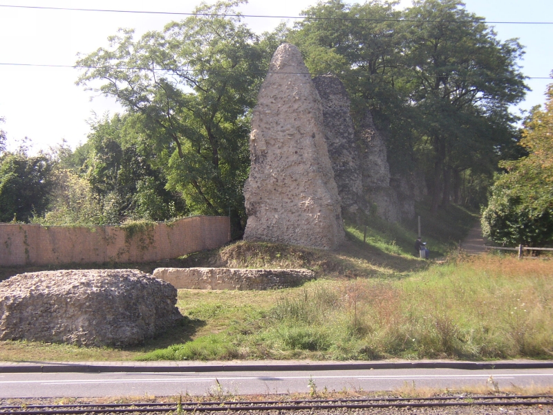
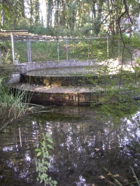
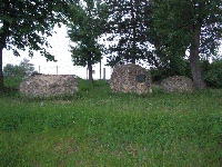
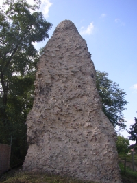
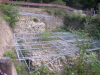
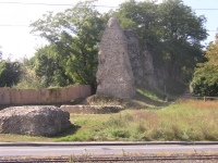
Die Römersteinen (the Roman Stones) in Mainz (Germany), the pillars of the arcade / bridge for the aqueduct, along the footpath 'An den Römersteinen", seen from the Obere Zahlbacherstrasse (bottom of photo)
|
and the entire suprastructure is lost. The reason for this is that Mainz is built on a site that lacks building stone; any solid structure
of Roman age was therefore 'recycled' during the Middle Ages.
The first 6 km of the aqueduct was built as an underground channel, while the last 3 km was on arches. The westernmost part of this series
of arches was relatively low, and foundations of two pillars of this aqueduct are preserved on both sides of the road at the entrance
of the University (2). The final stretch of 600m crossed the steep valley of the Zahlbach, and was on arches of up to 30 m high.
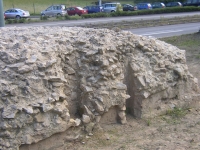
The remains of these arches are a series of 58 square, tapering columns of concrete 8.5 m apart, now know as the 'Römersteine' (roman stones).
These tapering square structures are the concrete cores of the pillars, while the outer facing stone was robbed long ago
(apart from two pillars which still have some remains of facing stone). Nothing is left in situ of the arches nor of the specus on top.
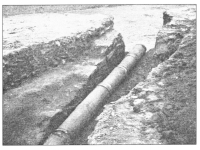
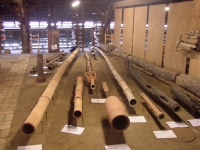
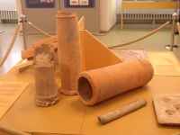
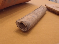
The specus was originally composed of hundreds of U-shaped sandstone blocks, 2 m long and 88 by 35 cm in diameter. The known part
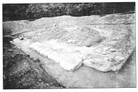
of the aqueduct ended at the SW corner of the Legions Casta, where two large blocks were found that may be the foundation of the
Castellum Divisorium.
The slope of the aqueduct is approximately 9m /km. The aqueduct had a capacity 6000-7000 m3/day.
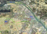
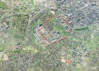
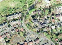
Visible remains (see satellite pictures):
- Springs, at the site where the roman aqueduct originated, in a small garden east of the road in Finten
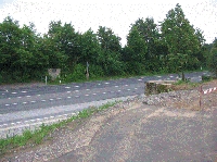
- Foundations of two pillars of the aqueduct bridge along the Koblenzerstrasse, at the bus stops south of the entrance
to the University (Ackermanweg)
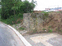
- Remains of foundations of three pillars at the southern end of the University running track, corner Dahlheimerweg
and Albert Schweizerstrasse (slightly shifted from their original position)
- 58 foundations of aqueduct pillars (Römersteine) along a footpath 'An den Römersteinen'; also two excavated pillar
foundations on the slope just west of the Obere Zahlbacherstrasse, near the top of the slope
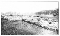
- Remains of the foundations of the Castellum Divisorium on the terrain of the University Hospital.
C.W. Passchier
Mainz - MOGONTIACUM
| Item
| Info
|
| Length |
about 9 km |
| Cross-section |
m x m |
| Volume |
6.000 - 7.000 m3/day |
| Fall |
0,9 % |
| Period |
2nd half 1C AD |
| Features |
|
| Recommended literature :
| Frontinus Gesellschaft (1993): Die Wasserversorgung antiker Städte teil 2: Römische Anlagen nördlich der Alpen
|
| Recommended websites :
|
|
| How to visit :
| see references above
|