Nijmegen (Netherlands)
Roman aqueducts: Nijmegen (The netherlands)
Nijmegen - NOVIOMAGUS (Castra of legio X Gemina)
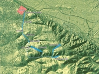
A series of long existing earth works in the woods south of Nijmegen (NL) - six in total, possibly from the 1st c AD - could have been the preparations
for a 5,5 km long aqueduct which destination was the castra of the 10th legion at the 'Kops Plateau' in Nijmegen.
After intensive scientific research no remains are found of any water conduit: pieces of stone, metal rings (to tight wooden pipes), pieces of pottery
and lead remains are absent.
On the other hand, there are many indications to support the aqueduct hypothesis:
- at three out of the four castra along the lower part of the river Rhine (Neuss, Cologne and Vetera/Xanten, all in Germany nearby)
a (kind of) aqueduct has been found
- the output of the existing well and cistern at the castra were insufficient to supply one (temporarily even two) legion(s) with drinking water
- new research proofs that when building an aqueduct for the castra only two traces are possible; a Northern one which will experiences severe difficulties; the other one coincides with the earth works as present in the woods today
- there where obstacles in the chosen SW trace could block the watercourse, the proper earth works are available on the right spots to solve the problems
- the existing earth works are of ancient date (before 1600 AD) and could have been part of one system with a gradient of about 0,2% (technical suitable)
- the last part of the trace - the 'Broerdijk' in the present city of Nijmegen - is heading for the highest area of the castra
- almost all hypotheses on alternative forms of use (defense works, roads, mining, water mill complex, landslide prevention etc)
have been rejected on good grounds.
Remarkably, a similar construction is present in Tongeren (Atuatuca Tongrorum) where a 6 km long earthen dam exists, possibly
the substructure of an aqueduct of which the source is unknown and terminates close to the town wall.
Hoogveld was the first person - in 1965 - who presented the idea of an aqueduct for the 10th legion, between 1995 and 2000 prof. dr. Ben Brus
 |
|
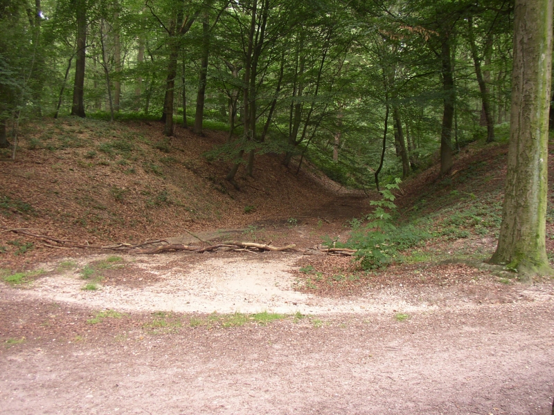
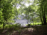
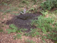
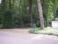
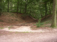
The dry canal called Louisedal, in origin 7m deep and 2,5m wide could have been one of the caption areas, the water source for the aqueduct.
It can easily be visited via a parking lot and an alley / wood-path at the N side of the Meerwijkselaan, Nijmegen (NL)
|
- a layman in this field, who wrote two private publications (Brus1997 and Brus1999, see literature list) -
elaborated the concept but the most comprehensive research was done by drs. Peter A.C. Schut, staff member of the ROB
(Dutch National Service for Archaeological Heritage - now RACM)
who also conducted the fieldwork and made the earth works to a subject of his master thesis (2002 - 2005).
The information here is mainly based on Schuts work (Schut 2005).
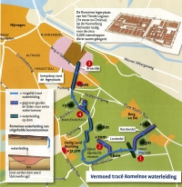
Topographical details (see also the map below):
- the Kerstendal, a dry canal on 60m NAP-level, about 3,5m wide and 1,25m deep, could have been the caption area, the water source
for the aqueduct [hardly accessible but visible from the road called Kleefse Baan (just before the village of Berg en Dal),
coordinates: 191.32 / 425.70]
- nowadays Water Meerwijk is a pool, in antiquity possibly in use as a settling basin [inaccessible but visible from the Meerwijkselaan,
coordinates: 191.25 / 425.17]
- the function of the dry canal called Louisedal, in origin 7m deep and 2,5m wide, is unknown [it can easily be visited via a parking lot
and an alley / wood-path at the N side of the Meerwijkselaan; coordinates 190.39 / 425.56]
- in the Marienbos a (roman?) V-shaped canal was found, 3m deep and 7 m wide including a potsherd from the 1rst c AD
[open to the public, in between the roads localled called Sophiaweg and Bosweg; coordinates 189.55 / 426.44]
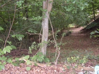
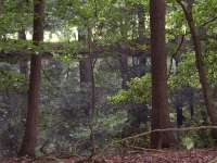
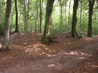
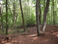
- right across an alley in the wood (a continuation of the Koning Davidlaan) in between the Louisedal and the Marienbos
one may find a longitudinal piling-up of earth (see photos) with all characteristics of a substructure of an aqueduct [coordinates 189.73 / 426.15]
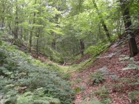
- the Broerdijk (public road) has all the features of a dyke right across the Hengstdal valley and may have served as a substructure
of the aqueduct, all the more because it is heading for the highest grounds of the castra of the 10th legion at Kops Plateau
[coordinates of the Broerdijk: 189.35 / 427.45].
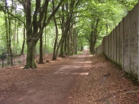
Volunteers of the Gilde (guild) organisation in Nijmegen (NL) offer you a walking tour along the course of the aqueduct, see their
website (in Dutch).
W.D. Schram
Army camp of the Xth legion Gemina, Kops Plateau CASTRA LEGIO X GEMINA
| Item
| Info
|
| Length |
5,5 km |
| Cross-section |
conduit not present |
| Volume |
not applicable |
| Gradient |
0,2 % |
| Period |
1rst AD |
| Features |
- only earth works
- a pool as setling basin?
|
| Recommended literature :
|
- P.A.C. Schut: De aardwerken van Groesbeek: een aquaduct voor de Romeinse legioensvesting van Nijmegen? (ROB-RAM report nr 119 - 2005), schut2005 (in Dutch)
- P.A.C. Schut: Ein Aquadukt fur das Römische Nijmegen? (SdFG vol 25, 2003), schut2003 (in German)
- P.A.C. Schut a.o.: Een karterend booronderzoek rond het Kerstendal (Rapportage Archeologische Monumentenzorg vol 191, 2011)
|
| Recommended website :
|
|
| How to visit :
| see above. "The Guild" (Het Gilde) in Nijmegen offers you a guided walking tour along the remains of the aqueduct's substructure.
|