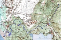
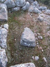
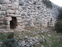
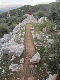
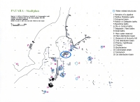
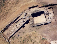
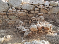
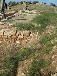
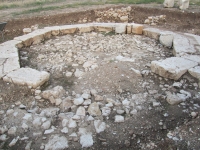
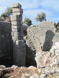
The Roman aqueduct entered the town from the north towards nr.10, the main (first order) distribution basin. At nr.12 and nr.18 the second order distribution basins, which also acted a pressure
reduction towers.
| For the photo's, see below |
| Home / the complete website |
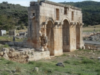
Patara, the capital of the Roman province of Lycia, was one of the main ancient maritime and commercial centers of the eastern Mediterranean, on the southwest coast of Turkey.
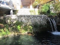
Because of its wealth and function as an important port in the eastern Mediterranean, Patara needed an aqueduct, both for the city and for the supply of visiting ships.
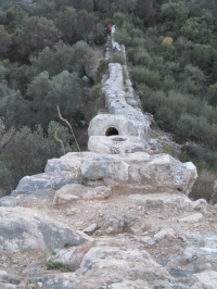
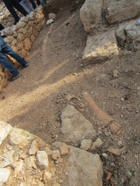
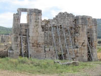
The aqueduct of Patara was built during the reign of Claudius and renovated / partly rebuilt under Vespasian after an earthquake. It transported water from sources near the village of Islamlar
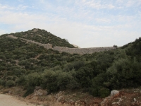
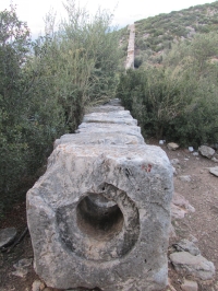
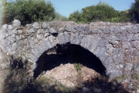
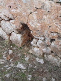
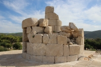
at 680 m a.s.l. over a distance of 22,5 km to Patara at 50 m a.s.l. The aqueduct comprises five bridges as well as a stretch of pressurized conduit, an inverted siphon locally known as Delikkemer.
There seem to be at least two stages in the development of the aqueduct.
| Locations | Latitude | Longitude |
|---|---|---|
| Akbel cemetery | 36 16 49 N | 29 24 31 E |
| Delikkemer siphon | 36 15 56 N | 29 21 59 E |
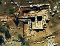
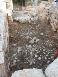
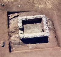
| Main distribution basin | 36 15 56 N | 29 19 25 E |
|
|
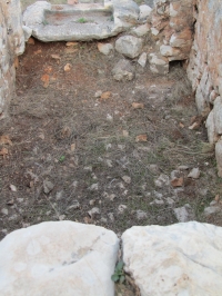
Water related structures in Patara (Turkey). The Roman aqueduct entered the town from the north towards nr.10, the main (first order) distribution basin. At nr.12 and nr.18 the second order distribution basins, which also acted a pressure reduction towers. |
|
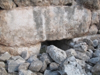
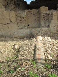
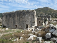
Text of the two inscriptions on the siphon Delikkemer in the aqueduct of Patara (Turkey). A free translation of the Greek text, see Iskan 2008 Jens Köhler and Wilke Schram Imperator Caesar Flavius Vespasianus Augustus, after earthquakes had caused the collapse of the wall of the aqueduct, rebuilt it from the bottom together with the conduit of ashlar stones running on it, and he installed an additional pressure conduit along the wall in three rows of clay pipes, and as a result, being there two (conduits), when one needs maintenance, the conduit is not obstructed, and the service actually is not interrupted. He repaired also the rest of the aqueduct, and the water that had run out for four months he let bring (to the city) by Sextus Marcius Priscus, his legate with propraetorian rank. (Everything was paid) from the city's treasury from the poll-tax, and the (Lycian) league also contributed xx denarii, without that any taxpayer would have been charged by a special payment. The construction (of the conduit) had been begun by Vilius Flaccus, legate of Claudius Caesar Augustus with propraetorian rank, it was completed and the water brought (to the city) under Eprius Marcellus, legate of Claudius Caesar Augustus with propraetorian rank. |
| Item | Info |
|---|---|
| Length | 22.5 km |
| Cross-section | variable; mean: 0,60 x 0,40 m |
| Volume | Present capacity of the source = 10.000 m3/day |
| Fall | mean 2,7 %; from 0,1 - 7,7 % |
| Period | Vespasian |
| Features |
|
| Recommended literature : |
|
| Recommended websites : | |
| How to visit : | Patara can be reached from the D-400, the main road from Fetihe to Kas, turn right / south after the branch to Gelemis. |
| HOME | More literature on more aqueducts | Last modified: February, 2015 - (webmaster) |