Phaselis (Turkey)

Roman aqueducts: Phaselis (Turkey) Tekirova - PHASELIS
For the photo's, see below
Home / the complete website

History

The town Phaselis was set up by the Rhodians around 700 BC. Because of its location on an isthmus separating two harbors, it became the most important harbor city of western Lycia and an important centre of commerce between Greece, Asia, Egypt, and Phoenicia, although it did not belong to the Lycian League. The city was captured by the Persians after they conquered Asia Minor, and was later captured by Alexander the Great.
After the death of Alexander, the city fell into Egyptian hands from 209 BCE to 197 BCE, under the dynasty of Ptolemaios, and with the conclusion of the Apamea treaty, was handed over to the Kingdom of Rhodes, together with the other cities of Lycia. From 190 BCE to 160 BCE it remained under Rhodeian hegemony, but after 160 BCE it was absorbed into the Lycian confederacy under Roman rule.
Phaselis, like Olympos, was under constant threat from pirates in the 1st century BCE, and the city was even taken over by the pirate Zekenites for a period until his defeat by the Romans. In 42 BCE Brutus had the city linked to Rome. During the Byzantine period, the city became a bishopric, although in the 3rd century CE, its convenient harbor had fallen under the threat of pirates once again. It began to lose importance, suffering further losses at the hands of Arab ships, until totally impoverished in the 11th century CE. When the Seljuks began to concentrate on Alanya and Antalya as ports, Phaselis ceased to be a port of any note.
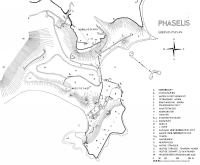
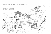
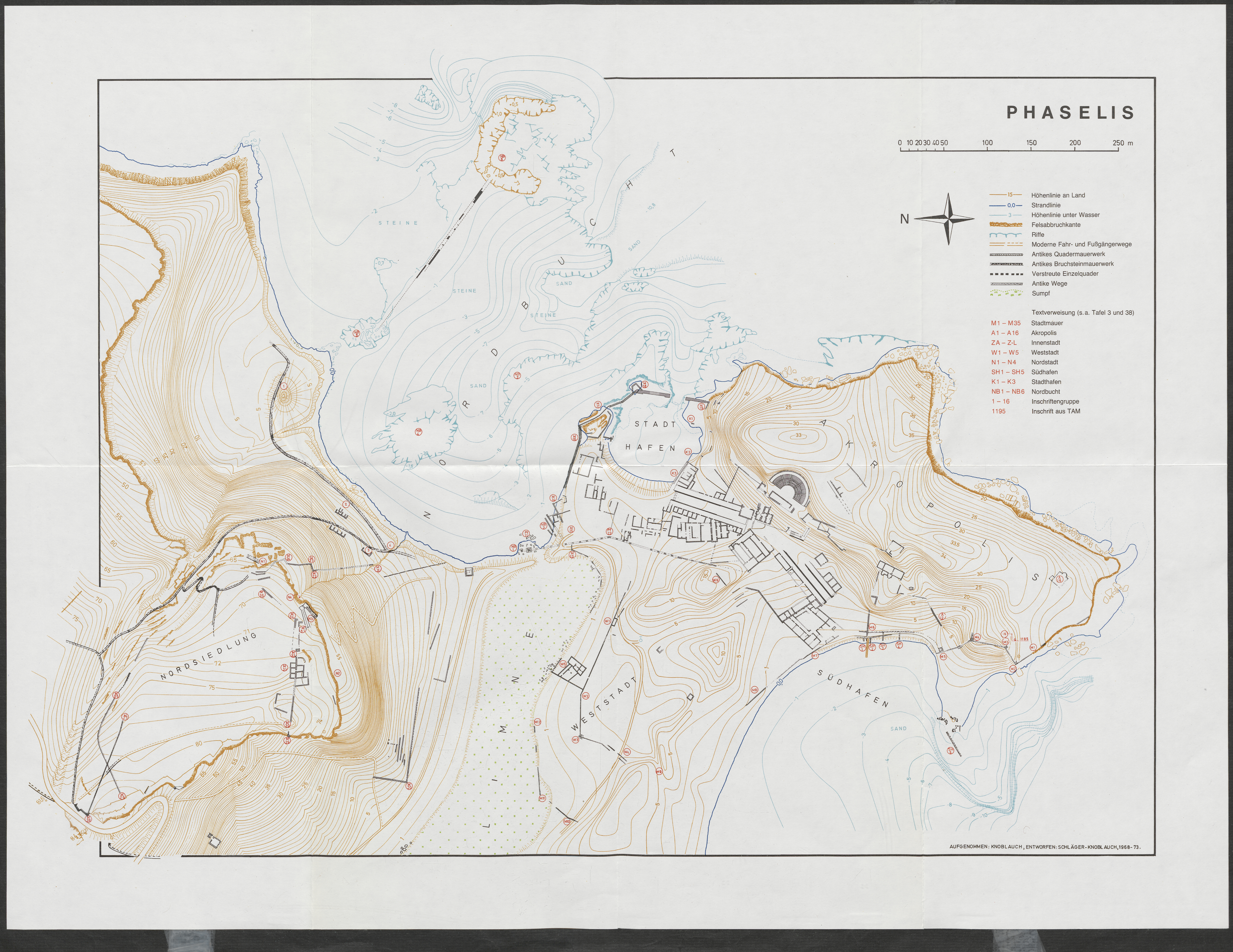
Very detailed map (30 Mb) of Phaselis (Turkey) (Schafer 1981).
Right or left click with your mouse to enlage.
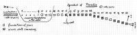
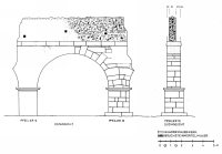
Site

Largely covered by rich vegetation, the ruins of Phaselis may be considered among the most picturesque ancient remains in Turkey. The buildings still visible on the site are concentrated on the neck of the peninsula between the north and south harbors. A fine 24m wide paved street connected both of these harbors. It began near the southwestern harbor, where the gateway erected in honor of Hadrian's visit in 131 CE stands. The theatre, much overgrown, lies on the west side of the paved street: near the northeastern end is located the agora of the city. South of Hadrian's gate, the remains of an unidentified temple, as well as a portion of the city wall can be distinguished. To the northeast of the paved street there is a church, and north of this the aqueduct begins. Stone built and sarcophagus-like tombs are located north of the city and east of the aqueduct.

Water supply

In early days the major settlement on the Acropolis of Phaselis the area east and south of the theater was fed by some local springs and a combination of rainwater harvesting and cisterns. At an unknown date a short aqueduct was built for the water supply of the buildings in the southern, inner city. Its source was a series of springs near the northern end of the city. A combination of a substructure and wall, plus a series of piers and arches, sought the shortest way to the agora area, a route running in between the sea and a swamp.
The first stretch of the piped aqueduct is missing. Its first viewable appearance is a substruction of ashlar stones with a layer of stone with on top, consisting of an eccentric placed wall of rubble, small stones, spolia, and mortar with two ceramic pipes, one above the other. The inner diameter of the (lower) pipe was 0,085 m.
Close to the beach the aqueduct made a very small bend; heading, as a series of piers and arches plus superstructure, towards the agora area in the south. The locations of the first nine (underwater) foundations are surmised, so what can be seen today at the beach east of the swamp, are the remains of the piers 10 - 12 in the water and the remains of the piers nrs. 13 - 15 on land.
In between piers 16 and 17 the aqueduct crossed the town wall, or just the other way round. At pier nr 22 the aqueduct made a bend of about 24 degrees to the west. The piers 26 and 27 are missing. In general the aqueduct was made of ashlar piers, well chiseled horizontal courses (imposts), ashlar arches, an even thicker horizontal course and again an eccentric placed wall of rubble, small stones, spolia, and mortar, with one (or two?) ceramic pipe(s) on top.

The plan of the piers was about 1,80 x 180 m, they were from about 1,78 to 1,91 m high, the first course was ca. 0,28 m thick. The distance between the piers was about 6,50 m, the arch rise was ca. 1,28 m, the horizontal course was 0,40 m high. The eccentric placed wall on top was about 2,6 m high and 0,61 m wide, which left room for a ca. 0,50 m wide service way.
Just after the last pier (nr 31) it is assumed that there was a distribution basin with branches to the Domitian agora (ZK) (and beyond?), the fountain and the small baths (ZF) at the square in front of the theater, and both baths (ZB and ZC) along the northwestern side of the main road. One may suppose that the public toilets (ZE) were flushed by the waste water of one of the baths or from the fountain nearby. See also the city plan.

The length of the known aqueduct is about 450 m, starting at a level of about 13 m a.s.l. Its slope over this distance is about 1 m which results in a gradient of 0,22%.

W.D. Schram

Text partly from Wikipedia and E. Akurgal's Ancient civilizations and ruins of Turkey (ed. 2011)


Tekirova - PHASELIS

Item Info
Length 0,45 km
Cross-section Pipe diameter 0,085 m
Volume ?? m3/day
Gradient 0,22 %
Period unknown
Features
  • pipe on wall partly on substruction
    and on arches on piers


Recommended literature :
  • Der Aquadukt (62.2) in: J. Schafer (ed) 'Phaselis, Beitrage zur Topographie und Geschichte der Stadt und ihre Hafen' (1981)
Recommended websites   :
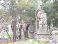
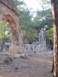
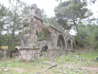
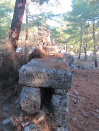
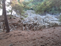
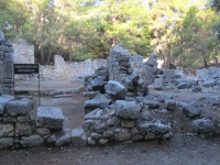
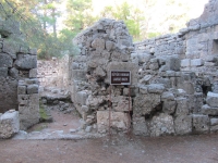
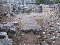
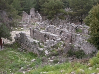
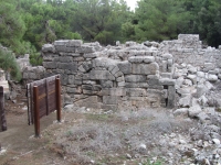
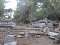
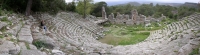
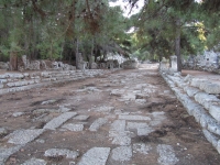
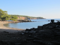
How to visit                  : Take the main road south of Antalya. After about 50 km (a few kilometers after Kemer) there is a well-signposted road to the left.
After 300 m one has to buy a ticket. Follow the main road towards the (northern) harbor of ancient Phaselis.
HOME More literature on more aqueducts Last modified: December 2014 - (webmaster)


Map of Phaselis

31 piers

Aqueduct on a wall

View to the north

Aqueduct in full view

Missing arches

Tha last visible part

Cross-section

Walkway

Water distribution

Plan of the town

Baths-Gymnasium

Baths

Public toilets

Small baths

Room for a pipe

Hadrian's gate

Cavea of the theater

Main road

Central harbor