Pompeii (Italy)

Roman aqueducts: Pompeii (Italy) Pompei - POMPEII
For the photo's, see below
Home / the complete website

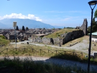
Pompeii rises on a plateau at about 30 metres above sea level, formed by a flow of Vesuvian lava, overlooking the valley of the River Sarno (ancient name Sarnus) at the mouth of which was a busy port.
A mixed population of Etruscans, Greeks and indigenous people led to the development of the city and the construction of a fortified limestone wall (5th century BCE). Towards the end of this century, the Samnites descended from the mountains and conquered the cities near Mount Vesuvius and the coast in a league with Nuceria (Nocera) as capital.
Pompeii was highly urbanised during the Samnite period. A new fortification constructed in Sarno limestone, which dates back to the 4th century BCE, had to trace a path similar to the previous one.

Towards the end of the 4th century BCE, the movements of the Samnite population unsettled the political order, thereby forcing Rome to intervene in southern Italy: alliances and successful military campaigns led to its hegemony throughout the Campania region (343-290 BCE). Pompeii then joined the political organisation of the Roman res publica as an ally, however, in 90-89 BCE, together with other Italic cities, the city rebelled and demanded equal social and political status as Rome. Pompeii was besieged by the troops of Lucius Cornelius Sulla, the city surrendered and became a Roman colony by the name of Cornelia Veneria Pompeianorum (80 BCE). Once the colony was founded, Pompeii was enriched with private and public buildings and further embellished particularly under the ruling of Emperors Augustus (27 BCE - 14 CE) and Tiberius (14-37 CE).

A violent earthquake struck in 62 CE and shook the entire area surrounding Mount Vesuvius. Reconstruction work in Pompeii began immediately, however, it took a long time to be completed 
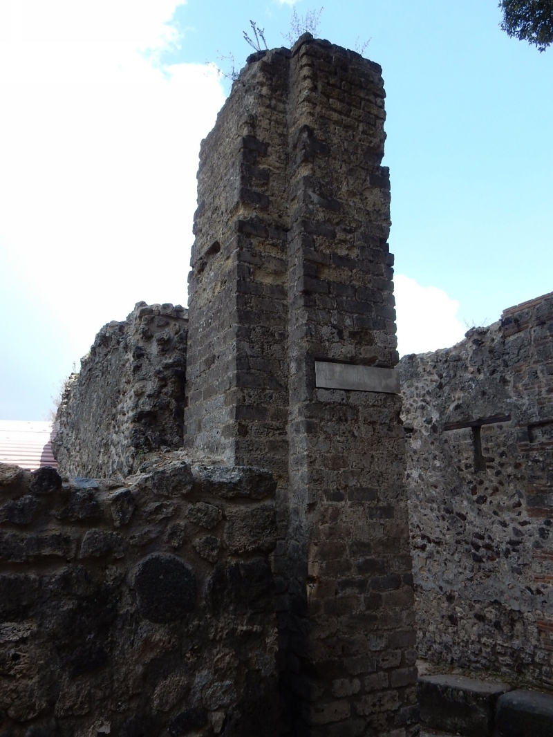
due to the extent of the damage and the seismic swarm that followed. The sudden eruption of Vesuvius 17 years later, on August 24, 79 CE, buried Pompeii under ash and lapilli, creating what seemed to be an open construction site.

The city was rediscovered at the end of the 16th century but explorations only began in 1748, under the King of Naples, Charles III of Bourbon, and continued systematically throughout the 
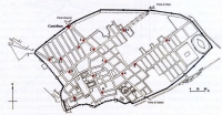
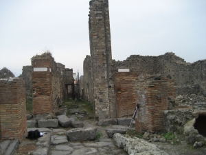
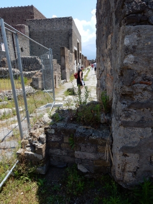
19th century, right up to the present excavations, restorations and enhancement of the city. The archaeological site of Pompeii spreads over 66 hectares, of which 49 have been excavated.
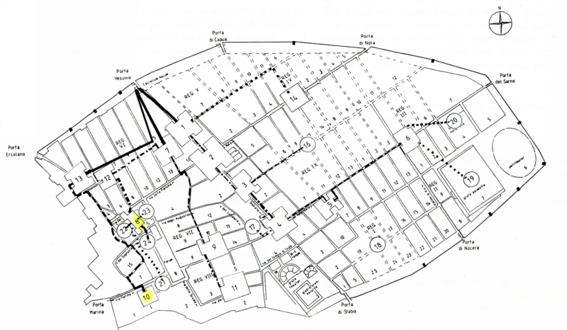
In 1858, due to the necessity of study and direction, Giuseppe Fiorelli divided the city into regiones (neighborhoods) and insulae (blocks). The names of the houses when the owner was not known, were coined by the excavators according to the particular discoveries or other criteria.
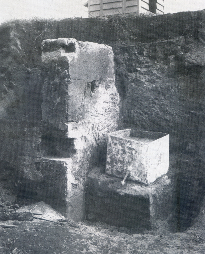
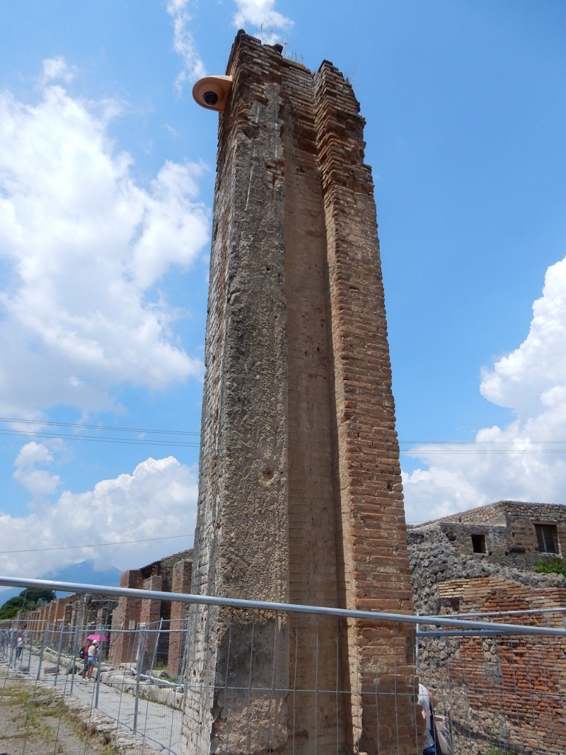
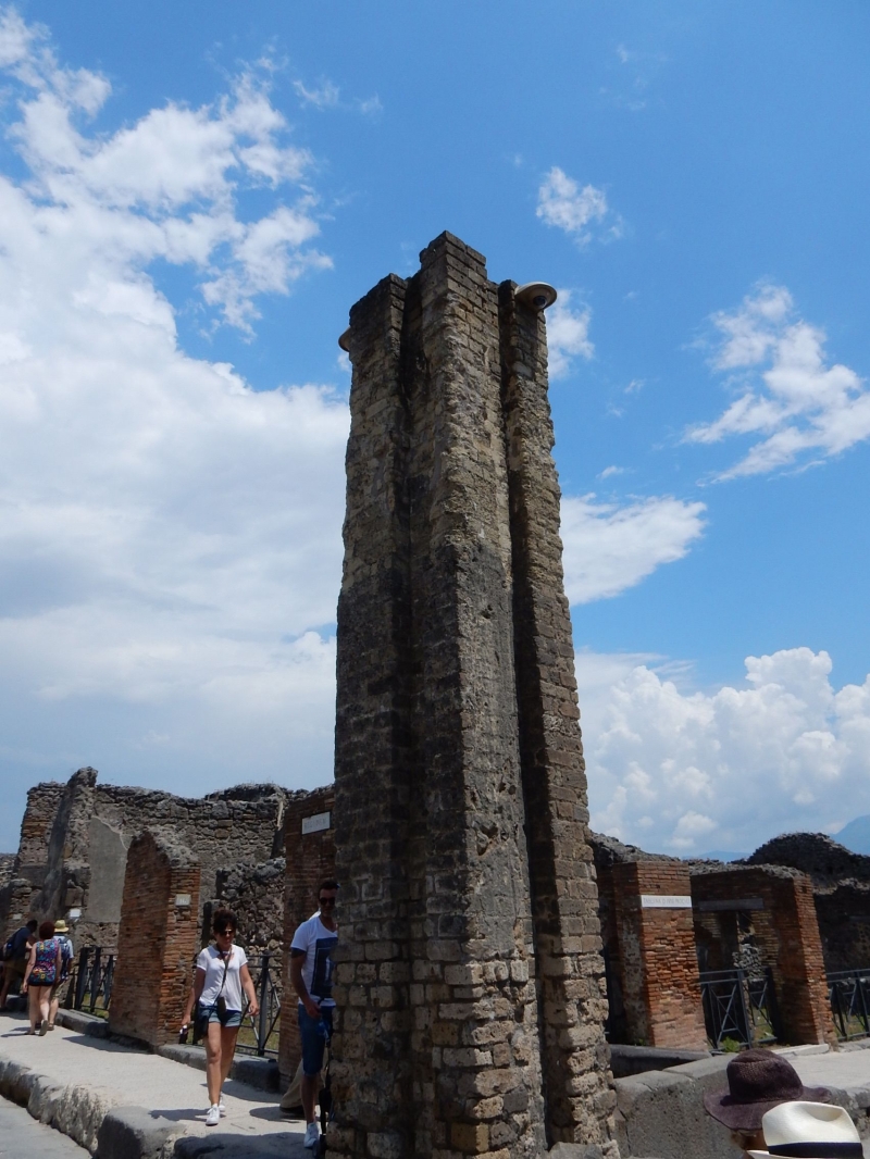
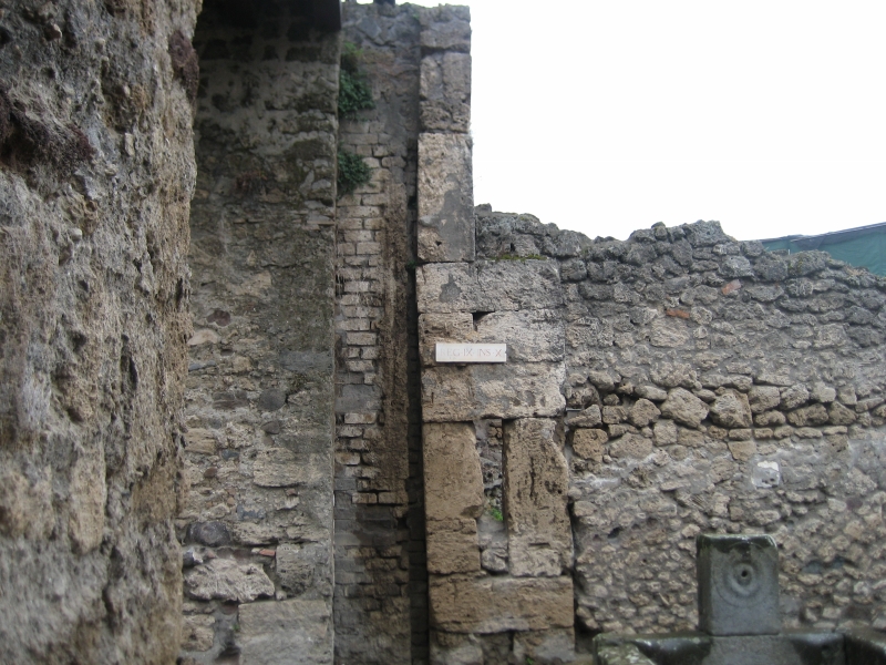
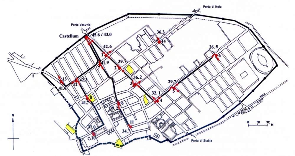
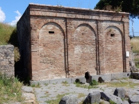
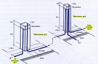
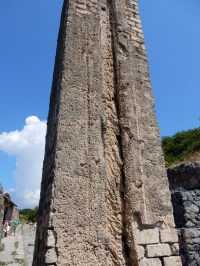
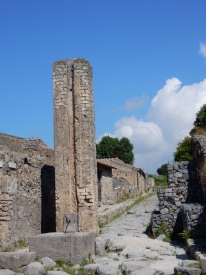
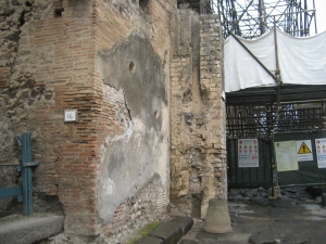
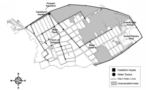
Herculaneum and Pompeii

The effects of the Vesuvius eruption of 79 CE were quite different for the surrounding cities: Pompeii was confronted with a gulf of ash and lapilli (‘little stones‘: rock fragments formed by a lava spray). But a pyroclastic flow (stones, pumice, lapilli, water vapour and gasses - up to 500 degrees C) struck Herculaneum later followed by a mud flood. That is why the effects were different for both cities, see the charred beams in Herculaneum, absent in Pompeii.
A vivid description of the eruption and of the rescue operation of his uncle Pliny the Elder, can be found in two letters of Pliny the Younger written to Tacitus, (Letters 6.16 and 6.20)


Aqueduct and water Supply

There are almost no physical remains of the actual aqueduct which fed Pompeii. Only the last 112 m before it entered the castellum divisorium (also called castellum aquae, the main water division station at the high end of the Via del Vesuvio) are known, see plan below. Note both manholes 90 and 17 m before the actual castellum.

The present hypothesis on the water supply of ancient Pompeii reads as follows (Ohlig 2001 / 2016):

The main elements

Pompeii‘s water supply consisted of the following elements - much research on the water supply in Pompeii was done by dr. G.C.M. Jansen and dr. Chr. Ohlig.:

Secrets of water tower 6

This copy of a photo stems from a report of an excavation in Pompeii (Spinazzola, NSc 1917 pag 247 - 264, fig 7). The dimensions of the lead box were 0,65 m square and 0,56 m high, so with a maximum capacity of 237 liters. In the report this box is called a castellum aquae. Given the description of the location, the lead box should have been attached to what we now call water tower 6.
However, this area suffered from an allied bomb attack in autumn 1943: both tower and lead box were hit.

So what is the link between the stone structure plus the lead box on the 1917 photo and the present water tower 6 at the crossing of the Via dell‘ Abbondanza and the Vicolo di Octavius Quartio?
The structure left, adjacent to the lead box, may have nothing to do with the present tower 6: the structure is not (almost) square as the other towers, no masonry work, no vertical groove(s), too low compared to the present tower; any film or layer of calcareous deposits on the present tower is missing.
And the lead box? Its capacity is quite modest given the estimates of the other ones, but not unusual (Olsson 2015). But its dimensions do not match with the structure annex (estimated as 0,40 x 1,20 m) which is too narrow to support the box. Or was the box already placed on its tower of which we see only the top?
Tentative conclusions: the present tower is post-Second World War and the structure on the 1917-photo is not suited to support the ancient lead box. But what we do not know is whether this box was used as a distribution box in the public water supply.


The users

Bath establishment Storage capacity
Stabian baths
Initially with a tread-wheel with buckets on a chain
38 m3
later enlarged to 70 m3
Forum baths
Idem
Probably 15 m3
Suburban baths
aqueduct fed
> 10 m3, possibly 110 m3
Sarno baths
aqueduct fed, in renovation
Unknown
Central baths
Aqueduct fed, under construction
Unknown


The key elements in the water supply for the inhabitants of Pompeii were the 40 street fountains; almost all were equipped with a spout (plus a small sculpture) and a square or rectangular basin. Its overflow water went into the drain (where present). Some (all?) fountains were equipped with a hole just above the bottom, to be used during cleaning actions.
Note that there were almost no bigger fountains nor nymphea in Pompeii. The arch in the NE corner of the forum should have been equipped with a reservoir feeding the fountain at the north side of the arch, but this container was situated too high to be fed with aqueduct water.

Public baths were major water consumers. They were often equipped with their own water storage basin, whether to store water during the off hours at night, or to counter interruptions of the main supply, see the overview. Of the five baths present in Pompeii during the first century CE, one was under redevelopment and an other was under construction.

About a 100 private households (out of the about 1.000 dwellings) in Pompeii had their private connection to the public water supply by mean of a lead pipe from the most adjacent water tower. Contrary to what one would expect, the major destinations were often the fountains in the impluvia and the gardens. The kitchen was just of second importance; water will have been drawn from a fountain pool. So wealthy water displays were used to underline the social status of the owners. To a lesser extent water was considered as a utility, in support of the kitchen, the toilet(s) and / or the private baths.
Just less than 50 workshops (laundries, dye houses and tanneries) were fed with aqueduct water.

Specialty

A large water reservoir in the Vicolo delle Terme (VII.6.17 - region VII insula 6, location 17) opposite water tower 8, could hold 300 m3 but was situated too low to feed the Forum Baths nearby. As options were suggested: a strategic reserve (in times of war, spare to feed the fountains nearby) or as storage site for firewater.

Wilke D. Schram

The first part of the text was taken from ‘Pompeii, a guide to the Pompeii excavations‘ (2015), the official guide booklet, with minor alterations.


14 water towers

Water tower 1

Location: VI.16.4, at the crossing of the Via del Vesuvio and the Vicolo di Mercurio. Present height 6.67 m.

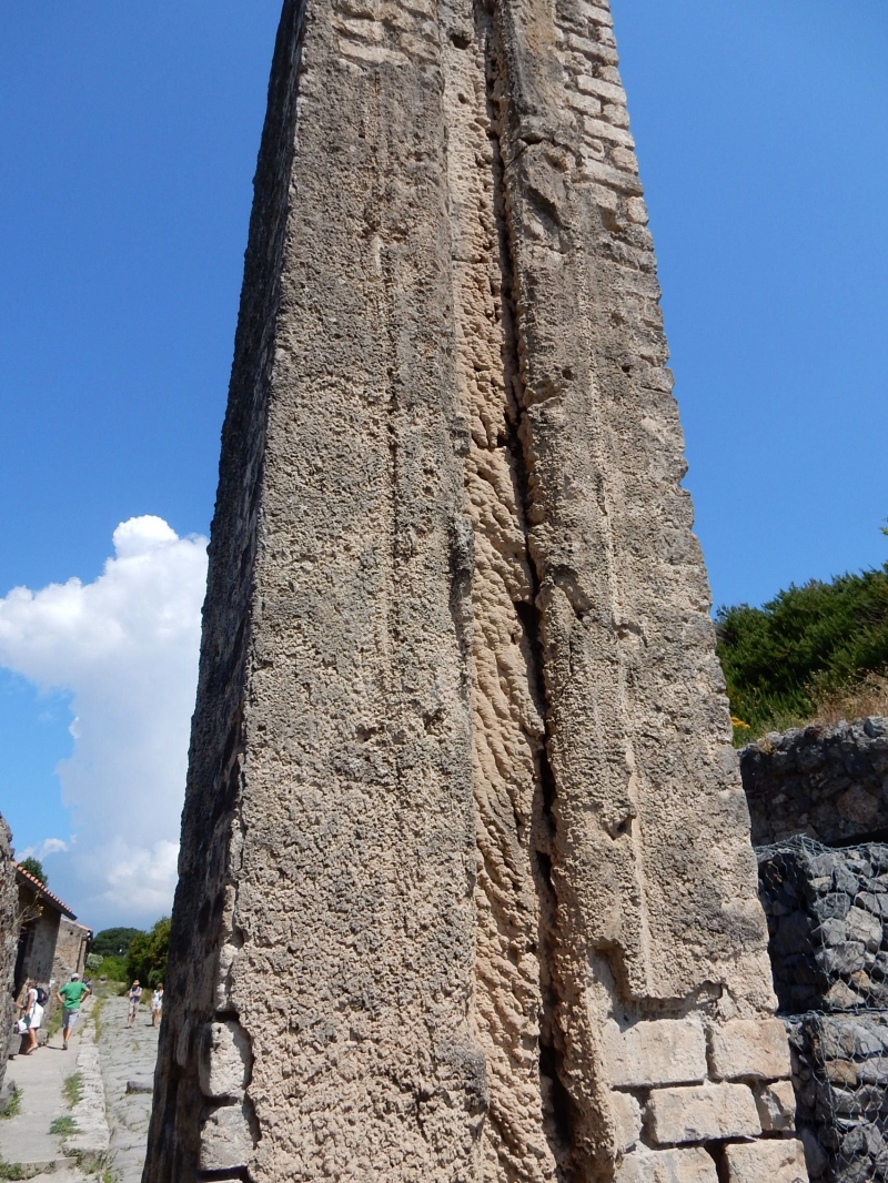
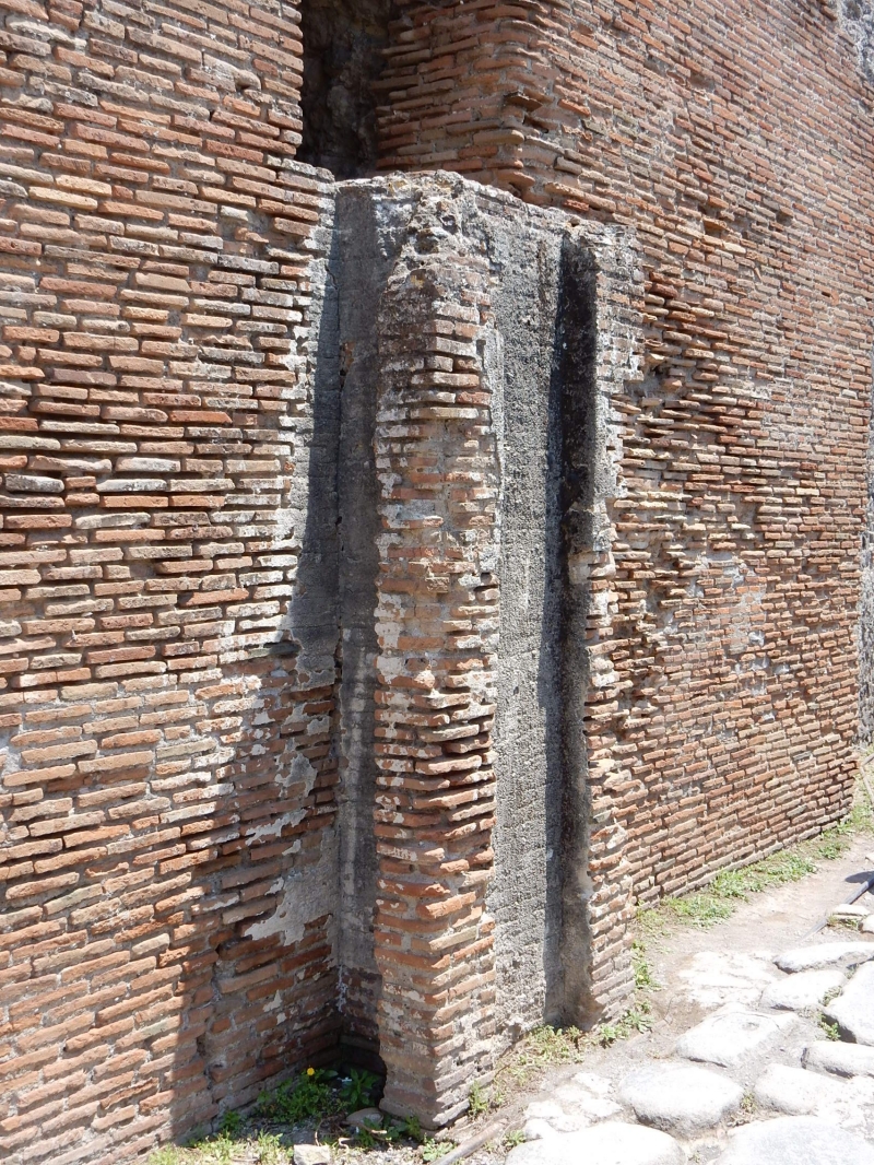
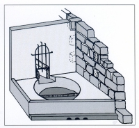
Calcareous deposits

in water tower 1. Note the imprints of the lead pipes.

Water tower 2

Location: VI.14.17, at the crossing of the Via del Vesuvio / Via Stabiana - Via del Fortuna / Via di Nola. Present height 6.34 m.

Water tower 3

Location: VII.2.1, at the crossing of the Via Stabiana and the Vicolo degli Augustali. Present height 5,96 m.
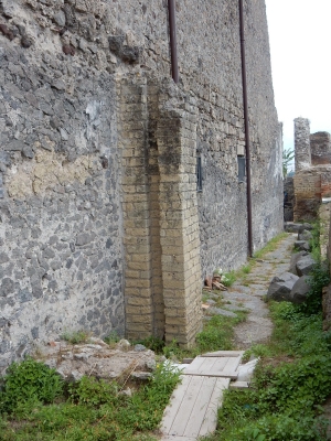
Water tower 4

Location: I.4.15, at the crossing of the Via Stabiana and the Via dell‘ Abbondanza. Present height 6,15 m.
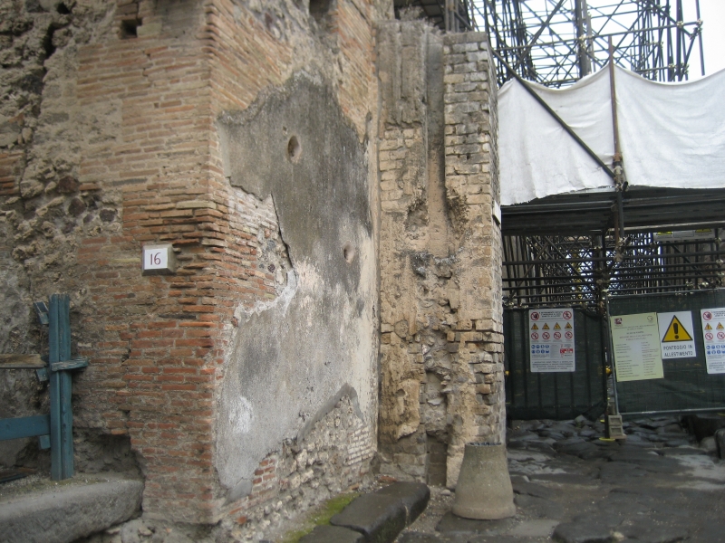
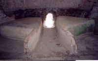
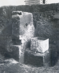
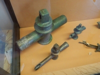
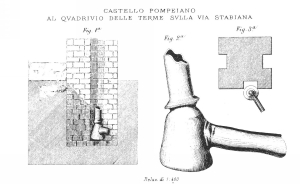
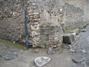
Lead angle

At the subterranean foot of water tower 4 a lead angle was found by Lanciani in 1882 (Tavole X nrs 1-3).

Water tower 5

Pompeii‘s water tower 5. Location: I.6.1, at the crossing of the Via dell‘ Abbondanza and the Vicolo di Pasquius Proculus. Present height 3,33 m.

Water tower 6

Location: II.2.1, at the crossing of the Via dell‘ Abbondanza and the Vicolo di Octavius Quartio. Present height 3,03 m. Note that the original tower has been destroyed by an allied bomb in the autumn of 1943.
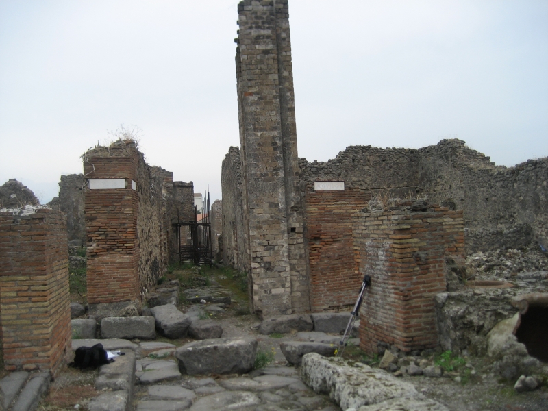
Water tower 7

Location: VI.13.16, at the crossing of the Vicolo di Mercurio and the Vicolo dei Vettii. Present height 4,37 m. Photo: R. Olsson
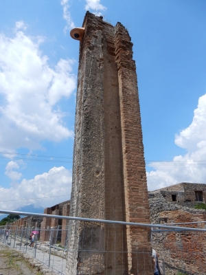
Water tower 8

Location: VII.5.8, in the Vicolo delle Terme. Present height 2,83 m.

Water tower 9

Location: VII.10.7, at the crossing of the Via di Eumachia and the Vicolo del Balcone Pensile. Present height 6,02 m. Photo: R. Olsson

Water tower 10

Location: VIII.1.2, along the Via Marina, at the west side of the Basilica. Present height 3,15 m.

Water tower 11

Location: VIII.5.3, at the crossing of the Vicolo del 12 dei and the Vicolo delle Pareti Rosse. Present height 5,69 m.

Water tower 12

Location: VI.6.11, at the crossing of the Vicolo di Mercurio and the Vicolo della Fullonica. Present height 1,63 m. Photo: R. Olsson

Water tower 13

Location: VI.1.19, in the Via Consulare at the splitting with the Vicolo di Narciso, behind the small building protecting a deep well. Present height 0,80 m.

Water tower 14

Location: IX.10.2, on the south side of the Via di Nola between two buildings. Present height 5,37 m. Photo: R. Olsson


7 proposals for the main water system

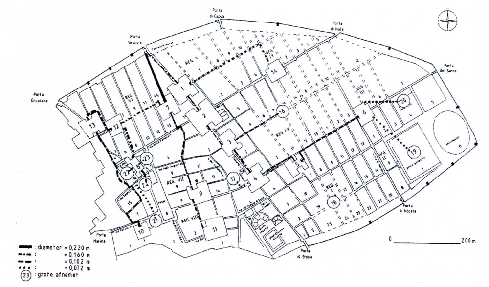
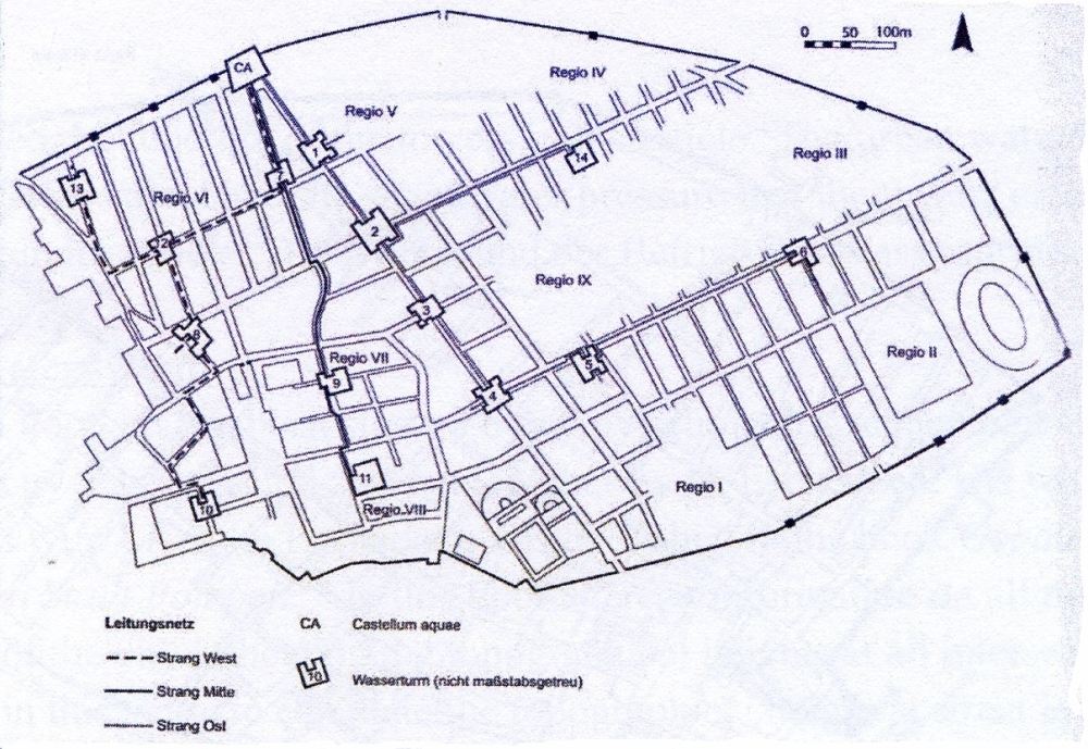
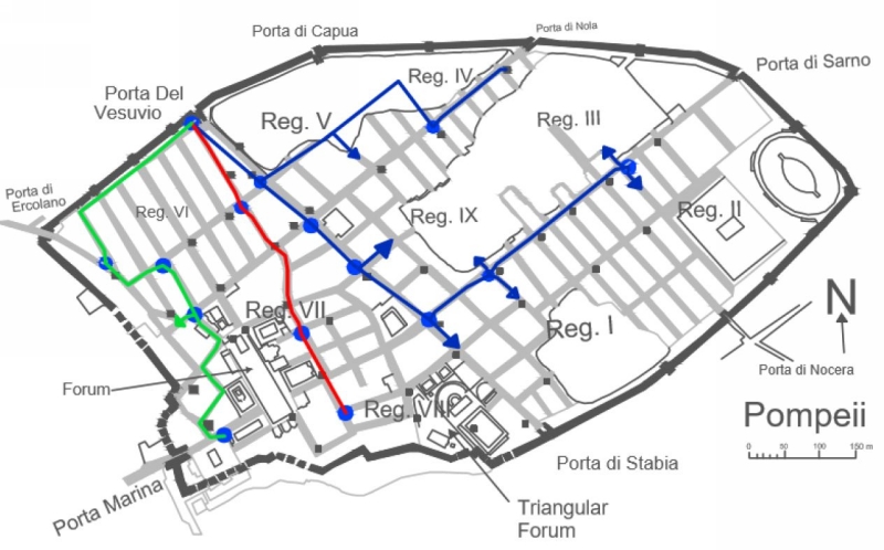
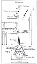
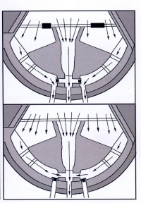
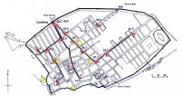
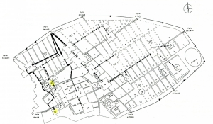
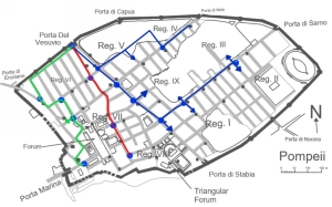
Wiggers‘s proposal for a water distribution system in Pompeii with 14 water towers and the suggested position of the main water pipelines (Wiggers 1996) 
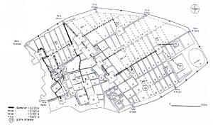
Jansen‘s proposal for a water distribution system in Pompeii with 14 water towers and the suggested position of the main water pipelines (Jansen 2002) 
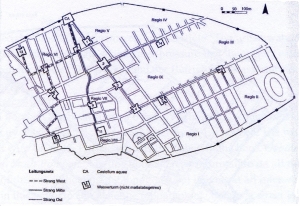
Schmolder-Veit‘s proposal for a water distribution system in Pompeii with 14 water towers and the suggested position of the main water pipelines (Schmolder-Veit 2009) Keenan-Jones‘s proposal for a water distribution system in Pompeii with 14 water towers and the suggested position of the main water pipelines (Keenan-Jones 2011)
 
Olsson‘s proposal for a water distribution system in Pompeii with 14 water towers and the suggested position of the main water pipelines (Olsson 2015) Ohlig‘s proposal for a water distribution system in Pompeii with 14 water towers and the suggested position of the main water pipelines (Ohlig 2016) Rasmussen‘s proposal for a water distribution system in Pompeii with 14 water towers and the suggested position of the main water pipelines (Rasmussen 2017)  


Pompei - POMPEII aqueduct

Item Info
Length 35 km, after 62 CE
14 km (theoretically)
Cross-section 0,6 m x 1,2 m
Volume 4.000 m3/d,
after 62 CE 2.000 m3/day
Fall 0,07 % theoretically
(Keenan-Jones 2010)
Period Augustan
Features
  • Castellum divisorium
  • 14 water towers


Recommended literature :
  • J.B.M. Wiggers (1996): The urban water supply system in Pompeii (in: N. De Haan & G.C.M. Jansen (eds, 1996): Cura Aquarum in Campania, 9th congress ... (1994) pag 29 - 32)
  • G.C.M. Jansen (2002): Water in de Romeinse stad: Pompeji - Herculaneum - Ostia (PhD-thesis in Dutch)
  • D. Keenan-Jones (2010): The Aqua Augusta, regional water supply in Roman and late antique Campania (PhD-thesis)
  • Chr. Ohlig (2001): De Aquis Pompeiorum, das castellum Aquae (PhD-thesis in German)
  • D. Keenan-Jones a.o. (eds): Lead contamination in the drinking water of Pompeii (in: E. Poeler a.o. (eds): Pompeii, art, industry and infrastructure (2011) pag 131 - 148)
  • Chr. Ohlig (2016): Wasser im antiken Pompeji (also published in Band 25 of the DWhG publication series ‘Neue Beitrage zur Hydrotechnik in der Antike‘ (2016; Chr. Olig ed))
  • R. Olsson (2015): The water-supply system in Roman Pompeii (Master thesis, on the web)
  • C.K. Rasmussen (2017): A comparative analysis of Roman water systems in Pompeii and Nimes (Master thesis, on the web)
Recommended websites   :
How to visit                  :    by Circumvesuviana train adjacent the main train station of Naples, direction Salerno. Stop at Pompeii Scavi, Villa dei Misteri
HOME More literature on more aqueducts Last modified: July, 2016 - (webmaster)


Map of Pompeii

Castellum with 3 outlets

Castellum plus manhole

Behind the castellum

Inside the castellum

Control by plugs

Mouth of the aqueduct

Modern castellarius

Predecessor

The 14 water towers

Water tower and fountain

Pipe connections

Lead box of tower 6?

Calcareous deposits

Distribution proposal

Public fountain

The lady and the fountain

Separate water reservoir

As strategic reserve?

In the Forum Baths

Basin in the caldarium

Private connection

Stop-cocks

Opening to the drains

Stepping stones