
 Potaissa (Romania)
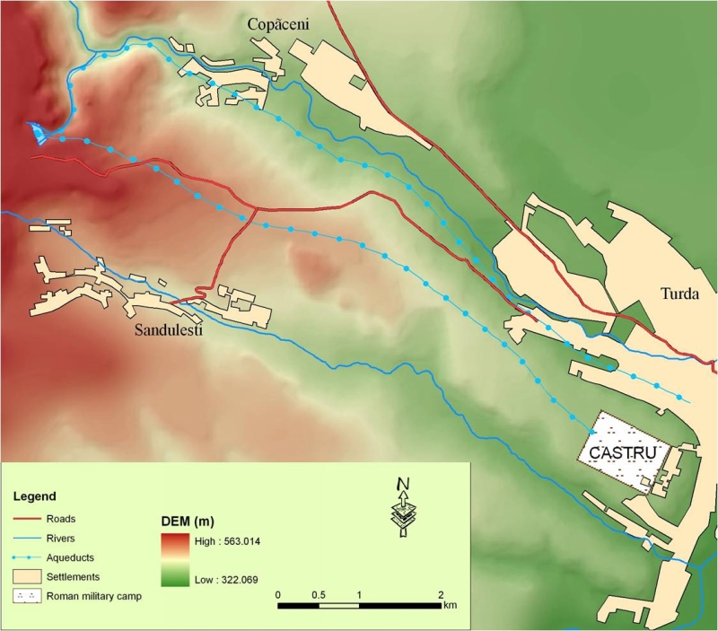
Digital elevation map of the area with one aqueduct along the valley of the Parau Racilor brook,
from Copaneci towards present Turda, the other on a higher level towards the military castrum
(CASTRU). Levels above sea level: source 525 m, Turda / Potaissa 350 m, castrum 375 m. Both
aqueducts (2nd c AD) were built of ceramic pipes and were about 5,000 m in length.