For the photo's, see below |
Home / the complete website |
Teucer, the legendary founder of SalamisThe traditional founder of Salamis is Teucer, son of the king of the Greek island of Salamis and one of the heroes of the Trojan war. He was banished by his father because he did not take revenge after the death of his half-brother Ajax. It is said that he set sail with some captives from Troas and landed at Cyprus. |
Saint BarnabasSalamis was the home of the apostle Barnabas who accompanied St. Paul when he visited the city on his first missionary journey in 45 AD (Acts 13 vs 6). In 75 he died as a Christian martyr, stoned to death by the Jewish community of Salamis, the city where he grew up. |
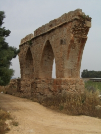
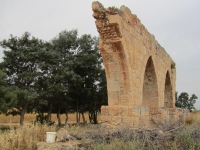
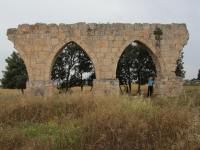
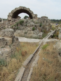
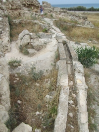
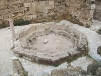
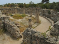
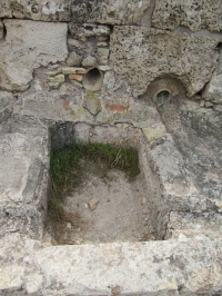
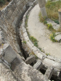
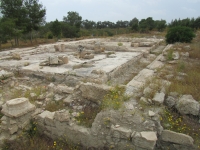
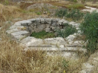
The springs of Kythrea“... Today, our Sunday was spent by going on a car ride and our aim was to visit an enormous spring above a village called Kythrea, east of Nicosia. 
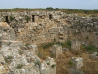
The spring is renowned as a landscape oddity throughout all Cyprus and truly it did measure up to this fact now in this the first tender spring greenery. We all travelled together and brought the children with us sitting on our knees. Kythrea is situated at the foot of the Kyrenia range in the middle of a 
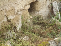
desert-like landscape with small hills, but thanks to the plentiful springs and water, that rushes and spurts forth everywhere in the village, which is like one large overgrown oasis. You have no idea, what significance running water has in this dry country! A flowing river is hardly ever seen and a fountain, that does not evaporate at once, is a rarity.”From: The fantastic years on Cyprus, illustrated extracts from Alfred Westerholms letters to his parents 1927 - 1931. Note 1: Westerholm took part in the Swedish Cyprus Expedition which laid the foundation for the scientific studies of Cypriote archaeology and history and worked all over the island during the years 1927 to 1931. 
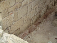
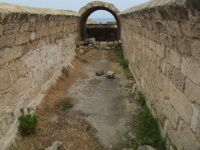
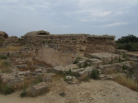
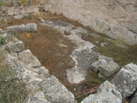
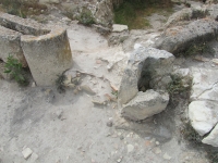
Note 2: Because of deep pumping the springs are now dried up. |
The cisterns consist of two large circular chambers, 16 ft. deep (see plan). The first is situated below room 1 with which it is connected by shaft 1; the second cistern is joined to the first by double passages, about 5 ft. long, one above the other). On the west side of the second cistern another series of double passages lead into the foot of shaft 2.The researcher noted that this structure has, in the first instance, been built as rainwater cisterns, being filled through the aperture over cistern 1, round which the catchment area of concrete was situated. The date can probably be placed in the 1st century AD. After a period of disuse, the cisterns must have been reopened and (at a later date) possibly connected to the / an aqueduct. The date of the building over it, together with the paintings, is presumably the late 5th or the early 6th century AD. Procopius records the building of new aqueducts in the reign of Justinian, which may coincide with the reorganization of the town water-supply, according Du Plat Taylor. Given the inscriptions one may presuppose that the cisterns were used as a baptistery at one period.
The floor of the cistern, like that of the passages, slopes slightly towards the foot of the shaft, where it is some 4 in. lower. The passages are 2 ft. 6 in. to 3 ft. wide, and high enough to admit of a man standing erect.The two circular chambers taper slightly towards the roof and become nearly oval; the apertures are closed with large blocks of cut stone meeting at an angle in the centre; an inspection hole in the roof of cistern 2 has been closed by other blocks laid across it. The walls of the cisterns have been built of roughly cut stone, except for the last three feet, which seem to be hewn in the rock. The face of the walls has been covered with hard gypsum cement, 3 in. thick, which is well preserved. At three-foot intervals from the bottom, bands of cement 7 in. wide project from the side and seem to mark the water-levels. One also surrounds shaft 2 at the level of the upper passage. In both chambers, above the second band, traces remain of large holes, three on each side, which have been plastered over; these appear to have held the scaffolding beams used in the construction of the upper wall, or in the case of cistern 1 they may have held a platform from which the artist could do his paintings.
All the inscriptions and paintings are in the first cistern, with the exception of three red crosses in each upper passage, one overhead and one high up on each wall.
![]() |
On map | In Greek | In Turkish | On map | In Greek | In Turkish |
---|---|---|---|---|---|
Soloi | NW of Lefka | NW of Lefke | Tremithous | NW of Tremetousia | NW of Erdemli |
Lapethos | Lapithos | Lapta | Kition | Larnaca | |
Kerynia | Kyrenia | Girne | Amathos | E of Lemesos | |
Chythroi | Kythrea | Degirmenlik | Kourion | SW of Episkopi | |
Salamis | N of Famagusta | N of Gazimagusa | Palai Pafos | Palia Pafos | |
Tamassos | SE of Politiko | Nea Pafos | Kato Pafos |
The most remarkable surviving monument of the Byzantine epoch is the great aqueduct constructed at some period when Constantia was in a flourishing condition. The history of this colossal work about 35 miles in length is completely unknown, the very imperfect inscription on one of the arches near the village of Ay. Serghis conveying but an indefinite idea as to its date.-----
There is a reference in Procopius (Pal. Pil. Text. Soc. translation, p. 151) to an aqueduct of ’St. Conon’ in Cyprus as one of the works of Justinian, but although not improbable the statements of Procopius must be received with caution.
The Kythrea-Salamis aqueduct, although one of the most remarkable monuments in the island, is not mentioned by any author or traveler until somewhat late in the middle ages. There is no evidence about the date of its disuse or destruction, which must however have been previous to the foundation of Famagusta in the XIIth century ; otherwise it would probably have been made use of to supply the new city. The first historical reference to the aqueduct is by Nicholas Martoni, an Italian traveler (a native of Bologna), with a taste for antiquities:
”In the middle (of the city built by the Emperor Constantius, father of the blessed Catherina, i.e., Salamis), where the castle stood, is a certain ancient cistern, no bigger one I think, is found in the world, with a vault raised on thirty–six columns, and with apertures above whence the water was drawn. Into this tank water flowed continuously from a certain mountain, along a conduit built with pillars and arches, just as at Scolo, an appurtenance of the Castle of Tragetto or Garigliano.” N. Martoni, Peregrinatio, 1394.
Martoni might have instanced other examples in Italy of similar aqueducts such as the curious one on pointed arches at Sulmona in the Abruzzi.
Pococke (1738) noted many arches of the Kythrea–Salamis aqueduct in a state of preservation, and on one of them he observed a Greek inscription referring to some Bishop who may have been the original builder of this colossal work.
The explorers of 1890 (J. Hell. Studies)² found two aqueducts which crossed the plain from the west and entered the city at nearly the same point, after which the older one is lost to view. The later aqueduct on entering the city turns sharply away north – north-east occupying in all probability the line of the wall of the older town. The older aqueduct supplied the Loutron (basin), and this is proved by the ruins of a small piscina near the tomb of St. Barnabas exactly resembling the Loutron, in construction, vaulting, corbels, etc. This more ancient aqueduct was not carried to any great distance but collected the water from several surface runnels. In other words the older aqueduct and the Loutron possibly belong to the more ancient city of Salamis on the southern portion of the site, whilst the much more imposing aqueduct with pointed arches of the Byzantine period belongs to Constantia which was the city of a later period built on the northern part.
The ’Loutron’, remarkably preserved, is a nearly unique example of an ancient piscina or reservoir for the filtration and distribution of water in a city. It appears to have been a covered vaulted area with a buttressed retaining wall similar to the ’Hundred and One Columns’ of Constantinople. Its internal dimensions are 194 feet by 72 feet, divided into aisles by 36 columns.
Item | Info |
---|---|
Length | 40 km |
Cross-section | 0,80 m x 0,80 m |
Volume | 10.000 - 15.000 m3/day |
Fall | 0.4 - 0.6 % |
Period | [foundations probably Neronian] 6th c AD |
Features |
|
Recommended literature : |
|
Recommended websites : |
|
How to visit : |
Salamis is situated just a few kilometers north of Gazimagusa / Famagusta (Cyprus) which can easily be reached from Lefkosia / Nicosia by motorway. The site is
adequately signposted. Entrance fee, brochures and drinks can be paid in Euro's. The easiest but not most comfortable way to visit the three pillar – two arches of the aqueduct is a ten minutes drive on the dirt road to the north just 100 m west of the St. Barbara cloister. Not all international car rental companies let you hire a car in the south and take it to the north; the Avis branch at Larnaca airport did. Currently you can drive across the border at Bostanci, Metehan, Beyarmudu and Akyar (in Greek, Astromeritis-Zodhia, Agios Dometios, Pergamos and Strovilia). Note that the locations for border crossing are not signposted as such! Coming from the Larnaca area I took (in 2011) the Pyla / Pergamon / Beyarmudu crossing, showed my passport and asked for a visa (a sheet of paper with stamp and signature). Be sure that no stamps are put in your passport. I bought an additional car insurance (€ 20 for three days). In total it took less than 15 minutes. |
HOME | More literature on more aqueducts | Last modified: June, 2011 - (webmaster) |