Selge (Turkey)

Roman aqueducts: Selge (Turkey) Altinkaya / Zerk - SELGE
For the photo's, see below
Home / the complete website

High up in the Taurus Mountains about 50km north of Aspendos lies the village of Altinkaya (Zerk; 1,090m) and the ruins of ancient Selge. The road via Beskonak beyond Alabalik is good and quite an experience.
Very little is known of its earliest history. It is certain that the city was settled by Lakedaimonian colonists, and that it was not subdued by the Persians. Because its independence was threatened, Selge sided with Alexander against Sagalassos and Termessos when the king rose up against Phrygia (Arr. Anab. 1.28.1). Its government, composed of fierce and tenacious mountaineers (Pol. Hist. 5.75), opposed Achaios, the kings of Pergamon, and finally the Goths (Zos. 5.15).


For a very helpful description how to reach Selge, including scenic texts and precise coordinates of the major places of interest, see Mike Crosby's: "Secret Aqueduct of Selge" in the Manavgat & Side Post dd January 3, 2013


The extensive ruins contain many interesting remains, but the principal sights are the Roman theater with a Greek auditorium with 10.000 seats and the adjacent stadium. Some distance to the southwest on a mound lie the remains of a temple of Zeus and a temple of Artemis. Just beyond these temples lies a cistern-like round structure for the town's water supply. Its depth is 7,5m. and its diameter is 21m. The cistern with its maximum capacity of 2500 m3, was built to store rain water probably augmented by water from one or both aqueducts. From here it was distributed to the city.

The decline of Selge started towards the 4th century and at the century following Selge was nothing any more but a town of reduced importance which pushed back an attack of the Goths. From the 5th to the 9th century Selge was still the only city in the ancient province of Pamphylie with a seat of a diocese autocéphale (independent bishopric).
Selge was the first city in the far region to mint their own coins from the 5th century BCE until the 3rd century CE, which shows their wealth at that time. Starting in 1840, travelers and scientist who studied Selge, have written articles and books about the city. However, until these days, there has not been any work (except one) which was based on archaeological excavations.

Roman bridges over the Eurymedon

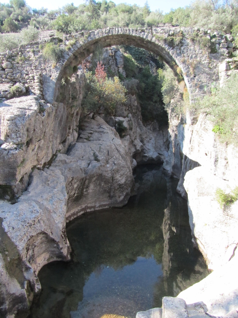
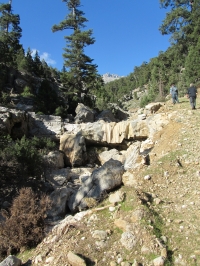
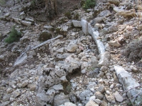
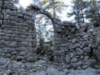
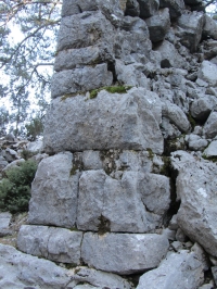
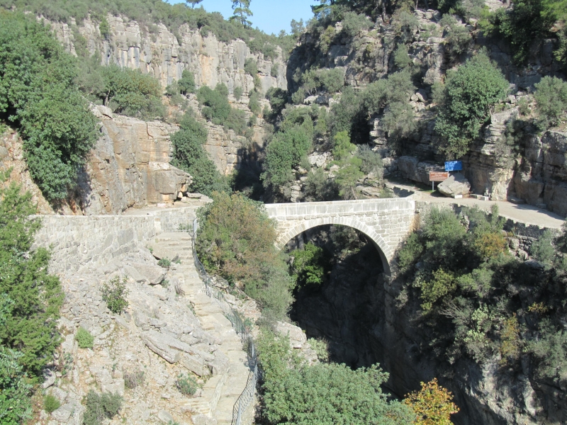
Near the fork off the road to Beskonak, 10km east of Aspendos, a long Seljuk hump-back bridge with Roman foundations crosses the Eurymedon / Köprülü river, see the entry Aspendos.
About 46km further north behind the village of Alabalik near Beskonak, the river narrows, marking the point where the mountainous and impressive Köprülü Kanyon National Park begins. Behind some small fish restaurants a track leads off to Selge (within the park) across a Roman bridge Oluk Kopru which spans the Eurymedon / Köprülü gorge (see photo left). The length of the bridge is 22m, the width between the parapets 2,70m and the height of the arch above the river is 35m.
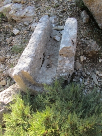
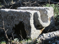
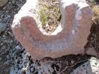
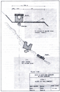
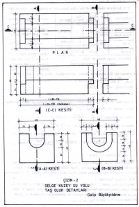
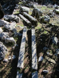
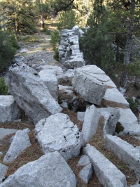
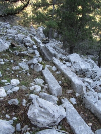
Remains of an ancient cobbled road can be found on the road from here to Selge.
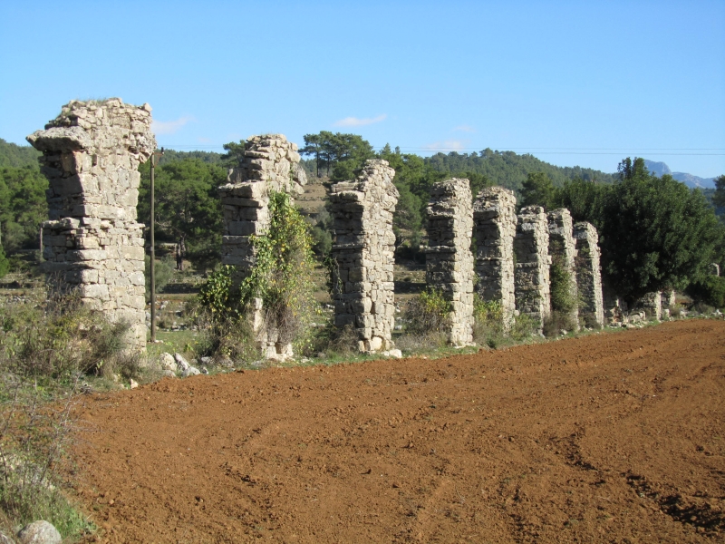
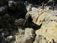
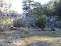
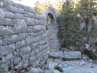
After you crossed the bridge and followed the road for another 300 meter downstream, you can discover another bridge, from Byzantine period, over a side branche of the Köprülü river (photo right).

Northern aqueduct

At the foot of the 1400m high Yonealiusa mountain lies the source of the northern aqueduct, 4 km as the crow flies, from Selge. The source is called Derekaptaj ('Dere kaptaj' means 'Stream catchment' - in principle it was a dam in a water stream), on a level of 1260 masl (see map below). In antiquity some 10 - 15 m long galleries were dug into the mountain which, together with some stone walls, gave the name to this area.
In 1970 this catchment area (water collection structure) was put into use again, to deliver water via a modern pipeline to the village of Altinkaya / Zerk. However, in recent years this water source became insufficient at the end of the summer.
Today the remains of the antique Derekaptaj source and the water channels can still be seen in the wood, between ancient Selge and the spring. Behind the spring - seen from Selge - no remains of water channels have been found.

An other, Byzantine aqueduct

As you reach Bozyaka village you will notice the recovery sites where the white water rafting adventure tours end. Just over four kilometers further on, marching across the fields at right angles to the road, are the remains of an aqueduct (37.1842460 N and 31.1845420 E).
This is believed to date from the Byzantine period and probably fed water to one or more mills. There is speculation it may have been for olive oil production. If you look to your left towards the river you can see the ruins of what may have been the mill(s) sticking out of a small wood.

The Keriz aqueduct bridge
On some maps the Keriz aqueduct bridge is indicated as 'Kurukopru arch', at a distance of 1300m from the source and at an altitude of 1180 masl. Although a lot of stones of the bridge lay scattered around, the bridge still links both sides of the valley. Some technical characteristics:
Pipes and blocks
In the northern aqueduct two different systems were used to conduct the water: ceramic pipes with a bore of about 0,15m, buried in the ground. This system must have felt in disuse for unknown reasons. On a later date and above it a series of local limestone blocks with semicircular channel (r = 0,10m) with flat stone covers replaced the old system to convey the water to the city of Selge. For details, see the drawings below.

Selge's southern aqueduct

The main direction of the water from the Taurus Mountains was from north to south, in the direction to the Mediterranean sea. The southern aqueduct just took the opposite course.
The Kumasuyu spring was positioned at the south slopes of the Gedigi Yamac mountains (1260m high). The spring is a rich source of water, even in the driest season, with a capacity of at least 15 - 20 l/sec (8600 m3/day). In modern times it never reached Altinkaya / Zerk again! The sloop of the aqueduct near the spring is very steep and there are indications that it shifted many times. The distance from source to destination is about 2.500m in straight line where - because of the rough terrain - the winding aqueduct needed over 6 km to reach Selge. The difference in height is 50m which results in a mean slope of less than 1%.

Charisteristics Northern aqueduct Southern aqueduct
Source Derekaptaj Kumasuyu
Level (masl) 1260 1140
Destination Selge Selge
Level (masl) 1090 1090
Length (m) 4300 6250
Gradient (%) 3,95 0,8
Capacity (m3) 3500 3500
Conduit Two types of conduit, one above the other: subterranean pipes (r=0,075m), and stone channels with cover Partly half open circular pipes (r=0,175) and rectangular half open channels, 0,40m wide
masl = meters above sea level

Degirmendere aqueduct bridge
This bridge can be visited by car via a dirt road as its position is 1,5 km west of Altinkaya / Zerk and it is over 1100 masl, at the north slope of the southern Kuma. The arch has gone; on both banks the abutments are still present. At the downstream end of the bridge the water course makes a 90 degree angle.

Okuzbuzu aqueduct bridge
At an altitude of 1117m and with a distance of 2900m from the source, the Okuzbuzu bridge has been destroyed to a large extent due to natural conditions; only ruins of a wall are visible, 2m high and 3 - 5m long. One can reach the Okuzbuzu by car via a dirt road up to 300m above / before the bridge.

Open channels
The southern aqueduct comprised of two types of water conduits: semi circular open pipes and open rectangular channels. Near the Degirmendere bridge both types of conduits were found on the surface and half buried in the ground. Never a solid pipeline was observed. The estimated sizes are given in one of the drawings.

Wilke Schram
Mainly based on G. Buyukyilderim 1994: Selge Antik Kenti su Yollari (The aqueduct of the ancient city of Selge)


Altinkaya / Zerk - SELGE

Item Selge North Selge South
Length 4300 m 6250 m
Cross-section m x m m x m
Volume 3500 m3/day 3500 m3/day
Gradient 3,95 % 0,8 %
Period unknown unknown
Features
  • Channel blocks and
    pipes
  • Half open circular and
    rectangular pipelines


Recommended literature :
  • G. Buyukyilderim (1994): Selge Antik Kenti su Yollari / The water supply of ancient Selge (in Turkish)
  • M Crosby (2013): Secret Aqueduct of Selge. In the Manavgat & Side Post dd January 3, 2013
  • A. Machatschek and M. Schwartz (1981): Bauforschungen in Selge (in German) (Libs: VU & ULeiden)
  • U. & H. Johson (2010): Tradition und Moderne in einem turkischen Dorf (in German, about the present people of Altinkaya). On the web
Recommended websites   :
How to visit                  : see text frame above

HOME More literature on more aqueducts Last modified: November, 2013 - (webmaster)


In the mountains

Selge's Roman theater

Two Roman aqueducts

Derekaptaj

Caption area

Channel block

Male side

Female side

Cross-section

Dimensions

Course of the aqueduct

Channel in the wood

Abutment

The last arch

Cyclopean stones

Keriz' dimensions

Complete view

On the Keriz bridge

Continuation

Southern aqueduct