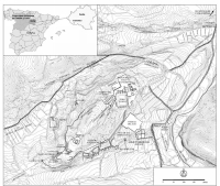
Tiermes (Spain)
Roman aqueducts: Tiermes (Spain)
Tiermes -TERMES
The original part of the aqueduct of Tiermes (ancient Termes, or Termantia) dates back to the Roman era; some claim that it was built during the
time of Tiberius (14 - 37 CE). The aqueduct could have been in use till the end of the 4th / early 5th c CE. It consisted of the well-known elements:
catchment, transportation and finally the distribution of water in the city.
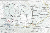
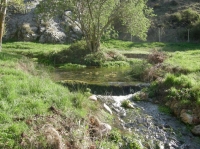
It is assumed that the water catchment point (caput aquae) was located at the foot of the northern slopes of the Sierra di Pela, in the Manadero del
rio Pedro, 3,6 km SW of Tiermes at 1266 m asl (above sea level). From this point an underground channel started through which the water flowed
at atmospheric pressure, following a regular slope, although the layout of this extra-urban canalization is poorly known, being hidden by sediment
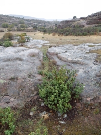
or even lost in some sectors. Only a section of 42 m long and 0,6 m wide, carved in the rock, has been found, located in the area called Peña Grande,
600 m outside the city.
The capacity of the aqueduct has been estimated of circa 6.000 m3/day (70 l/sec).
Between this point and the arrival of the channel in the city, next to the Puerta del Oeste (West Gate), there is a small depression that surely
had to be bridged by an arcade and / or a wall (substruction). Next to the Puerta del Oeste was a bifurcation structure, today almost complete lost,
from where two urban branches of the aqueduct start, well known to have been explored in large part.
|
ILLUSTRATIONS of TIERMES
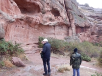
Recent interventions at the Forum area and the so-called Casa del Acueducto has undoubtedly facilitated the access to this mythical site,
respecting the remains as much as possible. However, the signpostings suffer from something fundamental in archeology: an interpretative proposal.
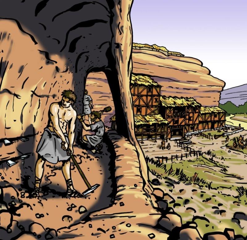
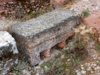
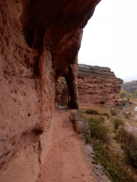
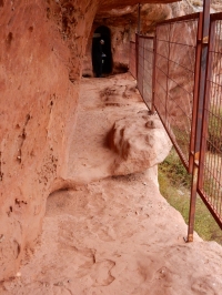
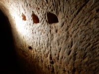
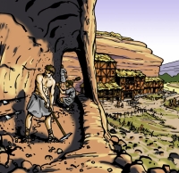
The city of Tiermes is excavated in reddish sandstone but that does not mean that it was a rock city. Above the warehouses and basements dug
\into the rock were built houses which interiors were sometimes decorated with rich marbles and paintings. But all that is lost, a long time ago.
Today, the visitor cannot imagine the appearance of these places without a few clues and that is what is missing in some explanatory panels
which are limited to viewing what already can be seen: holes, voids, empty places ...
This is my graphic contribution to this beautiful place.
Jose Ramon Almeida
E-mail: joserralmeida@gmail.com
Web-address
|

|
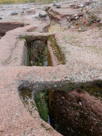
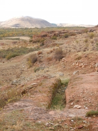
Northern branch
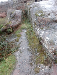
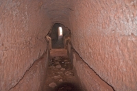
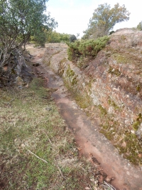
The northern branch of the aqueduct borders the northern sector of the city at a level of 1209 m asl with a channel carved into the rock that runs
through the different terraces, always running under streets and buildings. It is about 600 m long, 0,6 m wide and 0,9 - 1,2 m deep. Several settling
basins were arranged along its course, to get rid of debris and to allow access to the channel. At several points transverse arches were constructed,
especially where the channel was deep and in the curves of the course; they also contributed to the stability to the structure.
The northern urban channel reached the northern castellum divisorium - one of the two city's distribution points - located next to the Forum, from
which it proceeded to deliver water through pipelines for consumption.
|

|
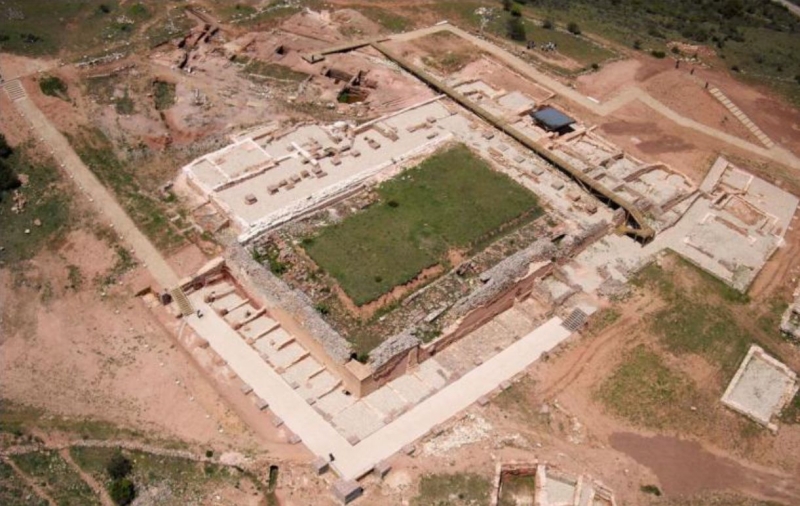
Forum or Castellum Aquae?
There has been a serious debate about the major structure now known as the Flavian Forum (Foro Flavio), until recently also known as a
Castellum Aquae (water distribution station). In the 80's J.L. Argente Olivier and A. Diaz Diaz did research on both branches of the Roman aqueduct, the
Casa del Acueducto and the structure indicated above. In their view the function of the latter, 46 x 32 m with walls up to 3,5 m wide,
was cleaning and distribution of water, supplied by the northern branch of the aqueduct, see Diaz and Argente 1984a.
In an article published in 2001, Hernando del Cura unfolded a detailed proposal how this structure could have functioned.
In 2010, based on new and detailed research, Martinez Caballero made a final end this idea and other misunderstandings, see Martinez Caballero 2010.
To conclude: the above described structure did not play a role in the water distribution of Tiermes.
|
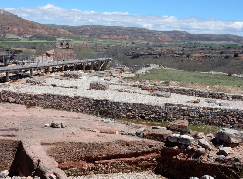
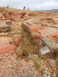
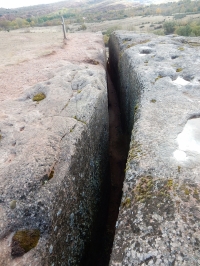
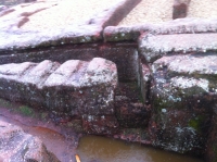
Southern branch
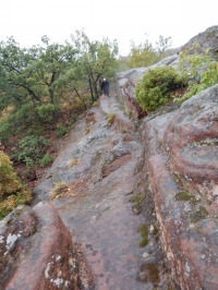
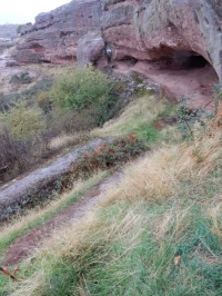
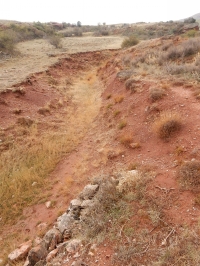
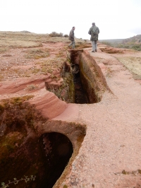
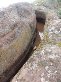
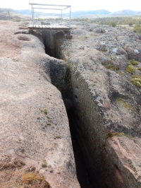
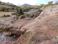
In turn, the southern branch, at a lower level than the previous one (1204 m asl), was drawn along the southern edge of the hill, in another trench,
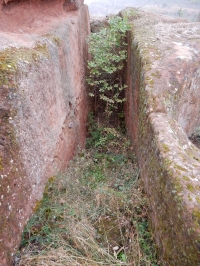
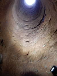
60 m long and up to 6 m deep, carved in pink rock, also equipped with cleaning basins and buttressed arches. The presence of a large vertical rock
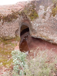
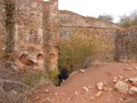
made the carving of a tunnel of 140 m length into the rock necessary, in order to house the channel and to reach the southern castellum divisorium,
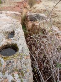
probably located behind the exit of the gallery, close to the Casa del Acueducto (House of the aqueduct). In the same area a cleaning basin was built,
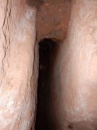
2 m square and 1,3 m deep. The tunnel was vaulted and had four cylindrical shafts (spiramina) - 1,2 m in diameter - which allowed ventilation, access
to its interior, and during construction also served to evacuate the rock. The southern aqueduct also may have fed the southern baths of which
considerable remains are still present amoung which the characteristic cornerstones of one of its rooms.
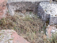
Recently (2010?) a third urban branch of the aqueduct has been excavated, next to the Julio Claudio Forum, which is only known in 13 m length,
and had to be fed by the northern aqueduct from an unknown point prior to the northern castellum divisorium.
Even the remains of a fourth aqueduct has been found in the industrial area at the west side of Tiermes, the place of metal, stone and wood working,
fulling, dyeing, and pottery production.
To conclude
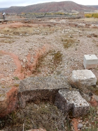
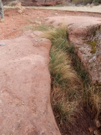
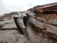
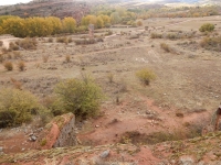
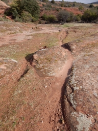
South of the western gate (Puerta Oeste) is a fine channel of the south branch of the aqueduct, carved in the rock. Standing on the modern bridge
above the channel, one has a beautiful overview over the area south and west of Tiermes.
But within a reasonable distance there is no place on a higher level than the actual location. So how did (aqueduct) water ever reached this site?
It is time for a thorough plan to make level measurements of all relevant aqueduct locations: the supposed source, the intermediate channel,
the proposed site of the bifurcation, along the north and south branches, the castellum divisorium, the channel near the Casa del Acueducto,
both baths and the industrial area. This will help to relate the different parts of the whole aqueduct, will add to our understanding of its nature
and probably help finding remains of new elements (bridges, substructures, possibly a siphon ... ?)
Wilke D. Schram
Text based on the sources below
We want to thank Jorge Manuel and Victor Mayoral for their support during our visits to the Tiermes-site in October 2017.
Manuel is the manager (gerante) of Hotel / Restaurant Tiermes, adjacent to the excavation site.
Mayoral is independent guide and researcher. His mail-address: arqueturismoSL@gmail.com
Tiermes - TERMES
| Item
| Info
|
| Length |
3 - 6 km |
| Cross-section |
North branch: 0,6 m wide, 0,9 - 1,2 m high
South branch: 0,9 m wide, max 1,9 m high (tunnel) |
| Volume |
6.000 m3/day |
| Gradient |
0,7 - 1 % (calculated guess) |
| Period |
Unknown |
| Features |
- Splitting in N and S branches
- Tunnel
|
| Recommended literature : |
- - J.L. Argente and A. Diaz Diaz (1980): Campana 1977-78: el acueducto romano (in: Tiermes I, Campanas 1977 - 1978, EAE 111 (1980) pag 193ff) (in Spanish)
- A. Diaz and I. Argente (1984a): Edificio publico numero 19 'Castellum aquae' (in: Tiermes II, Campanas 1979 - 1980, EAE vol 128 (1984) pag 16 ff) (in Spanish)
- J.L. Argente and A. Diaz (1984b): Casa del acueducto y acueducto romano (in: Tiermes II, Campanas 1979 - 1980, EAE vol 128 (1984) pag 53 ff) (in Spanish)
- M. Hernando del Cura (2001): El abastecimiento de aguas romano a Tiermes (see the Traianus website) (in Spanish)
|
Recommended websites :
(general on Tiermes) |
|
| How to visit : |
see above |