
| For the photo's, see below |
| Home / the complete website |
In the period Julius Caesar conquered Gaul, present Tongeren was one of the villages of the Eburones and Ambriorix was its leader. In 54 BC he ambuscaded one
of Romans legions which - at the end - resulted in the annihilation of his tribe (see Caesar: The Gallic War chapter 6 and Cassius Deo: Roman history chapter 40).
After the defeat the Tungri made this area their home location; their capital became known as Atuatuca Tongrorum. Surprisingly, since 1860 Ambriorix is honored
by a statue at the main square in Tongeren.
|
| The statue of Ambriorix in the city center of Tongeren. |
|
|
|
| Recommended literature : | Opmetingen van het Romeinse aquaduct te Tongeren (in: Archeologie in Limburg vol 93 (2003) pag 3 - 6) - L. Ponzetta, N. Dewinter and E. Wesemaal (2002) (in Dutch) |
| Recommended website : | none |
| How to visit : | Take the Sint Truidersteenweg from the city center to the west; after 500m at your right hand turn into the Legioenslaan. The dyke of the aqueduct is at your left hand. |
| HOME | More literature on more aqueducts | Last modified: April, 2012 - Wilke D. Schram (W.D.Schram 'at' romanaqueducts.info) |

Ambriorix |
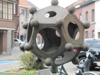
Dodecahedron |
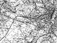
West of Tongeren |
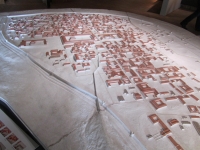
Model |

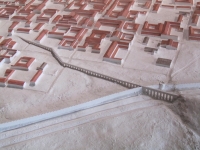
Substructure |
Detail |
Beukenberg / Beeches hill |
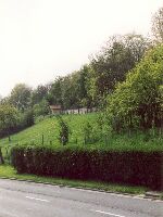
Earthern dyke |
