
 Uxama (Spain)
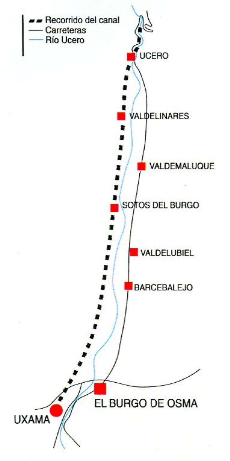
The Northern aqueduct of Uxama follows the bed of the Ucero river. Its caput aquae (source)
was north of the town of Ucero. West of El Burgo de Osma is made a little curve to the west to
reach the NW side of the Uxama hill. Recorrido = course; Carreteras = roads. From the folder
Gormaz, Vilde y Ucero (Junta de Castilla y Leon.