Uxama (Spain)

Roman aqueducts: Uxama Argaela (Spain) El Burgo de Osma - UXAMA ARGAELA
For the photo's, see below
Home / the complete website

For a description of the Roman city, see below.

The Ucero tunnel

A few hundred meters from Ucero, leaving the village via the road to Nafría, there is a tunnel carved into the rock that was part of the hydraulic work supplying water to the Roman city of Uxama (S of El Burgo de Osma), from the sources of the Ucero river near the confluence with the river Losbos, which found its origin in the nature park Galiana. Most of the 18 km the aqueduct runs in the open air and must have conquered some obstacles through tunnels, dams, bridges, and possibly a siphon. Between the village of Ucero and the Castro hill of Uxama remains have been found at quite a few locations.

One of these remains, the Ucero tunnel - locally called the 'La Cueva de la Zorra' (Cave of the fox) - crosses the hill side by side with a length of 133 meters and is divided into three sections by two circular manholes (vertical shafts or spiramen) that rise 20 and 30 m to the surface at a distance of 52 m of each other. Their mission was to allow access to the channel for maintenance. Its construction was done simultaneously from both ends and from the manholes. In the tunnel one can observe alignment-corrections that had to be made by slight errors in calculating the gradient.
The peculiar shape of the section is due to further widening the foot of the tunnel on a later date, in order to get more water and possibly to reduce the water level, allowing passage for cleaning. At regular intervals small cavities can be observed in the walls to support oil lamps for lightning.

The Northern aqueduct

At the foot of the north-western slope of the Uxama hill, you can find and visit the last known part of the Northern aqueduct that brought water from the headwaters of the river Ucero, via the Ucero tunnel, to the foot of the Uxama hill. According to Garcia Merino it should have been built in the second half of the first century CE. Here its level is 947 masl, where at the caput aquae it is estimated on 962 masl so the fall is about 15 m resulting in a gradient of 0,07 - 0,08% which is not unusual in Roman aqueducts.

Two remarks here: the level of the cisterns on the Castro hill is 31 - 42 m higher than the floor of the Northern aqueduct here. Second, the maximum capacity of the aqueduct in the Ucero tunnel is estimated on 26.000 m3/day (300 l/sec) where the capacity at the foot on the Uxama hill is 4.300 m3/day (50 l/sec). Which suggests a secondary use of aqueduct water for adjacent villa's, industry and/or irrigation.

Archaeological Interventions
Between 2004 and 2009 excavations were executed in the Northern aqueduct, located a few meters from the car park along the N-122. In total 79 m rock gallery has been documented, covered by a pointed or slightly pointed arch, between 31 and 56 cm in width, which is extended toward the base, up to 81 cm. The height is just over 2 m.
At intervals, small holes were made in the walls that served to place lights illuminating the construction and later the maintenance workers. A manhole has also been excavated, 1,2 m in diameter, with notches in the wall that facilitated the access to the interior of the channel.

From the information panel at the parking place along the N-122

The cisterns

On the Uxama-hill more than 20 cisterna (reservoirs) have been excavated, which had the function to store and distribute water to the city. Unique is the large vaulted cistern of semicircular plan, 32m of perimeter and 5m high on one of the highest points of the Castro. It was divided into three major curved and two small rectangular interconnecting compartments with a total capacity of 300 m3. It was built of concrete and is 3,6m deep. Floor and walls were made watertight by means of opus signinum with so-called quarter-rounds in the joints, see photo's below.
Another interesting cistern is called 'El Arca' (the ark) with external dimensions of 7,75 m x 4,25 m and internally 6,0 m x 2,5 m which, with an estimated water level of 2,5 m above the cistern floor, had a storage capacity of almost 40 m3. The walls of 0,90 m might have been extra thick to withstand sliding of the structure towards the valley. In history this and other cisterns have been interpreted as wheat silo's notwithstanding the presence of watertight plaster on the walls and floors.

The main question is of course how the higher parts of the city of Uxama were supplied with water hence the level of the aqueduct was at least 30 m lower than the cisterns in the city. The Romans had to cope with two types of problems: how to elevate the water to the desired level and what to do with excess water. Garcia Merino (2010, 294) proposes the use of a water lifting device like a noria powered by donkeys, which is theoretically possible.
But there was a constant flow of water supplied by the aqueduct, where the demand was irregular so a kind of subterranean buffer (reservoir / cistern) had to be installed under the Castro and surplus water should have been drained away. Until now indications of such installations are missing. Other options to feed the cisterns: rain water harvesting from the roofs of the houses, to designate suitable areas for that purpose and / or to dig wells, like at the Acropolis in ancient Athens.

Uxama's Eastern aqueduct
A 30 meter long stretch of the Eastern aqueduct channel of Uxama on the east side of (the cycle path and) the ravine of the river Ucero, opposite the Uxama hill.

There is not much known about the chronology of this aqueduct, beyond its Roman affiliation and the link with industrial and agricultural production in the Uxama area. The Eastern aqueduct of Uxama has its caput aquae higher up in the river Ucero. From there it followed the left bank of the river canyon to Portuguí and Vegahoz. This section was still well preserved in the eighteenth century when researched by Loperráez. But today it has almost disappeared due to the construction of the road from Burgo de Osma to Gormaz, as well as the exploitation of a quarry, apart from a stretch of a gallery of 30 m in a half triangle, carved into the rock, 1,2 m in height, 1 m in width, and a with parapet of 0.5 m.

Outside the canyon several branches have been excavated. It seems that one of the channels was used for irrigation and supply of various rural settlements; it had a width of 0,40 m and a depth of 0,30 m. The other, which seems directed towards an industrial area of Ladrillejos is 0,35 m wide and 0,12 m deep, according Sanchez Lopez 2016, 148.

The city

Uxama Argaela was a Celtiberian, and subsequently Roman, city located on El Castro hill, overlooking the present town of El Burgo de Osma in Soria, Spain. As one of the cities of the Arevaci, it actively participated in the Celtiberian Wars (153-133 BCE) and was conquered by Rome in 99 BCE. Later, it supported the cause of the Roman rebel Quintus Sertorius against Rome and was destroyed by Pompey the Great in 72 BCE, although it was rebuilt shortly afterwards.
According to Pliny and Ptolemy it was one of the communities of the Conventus Luridicus Cluniensis province in Hispania Tarraconensis and became a Municipium under Tiberius, after which began an important monumentalising process that involved the construction of a small forum, a series of large urban villas, city walls, and an industrial district on the banks of the river Ucero.

The city covers two plateaus with an area of 28 ha. The walls, protected by rectangular towers, can be seen to the north east and south of the city. The most important monuments are the Mina (section of a drain), cisterns, baths, and a basilica with mosaics. Finds are numerous and significant and are displayed in the Soria Celtiberian Museum and the National Archaeological Museum in Madrid. They include sculptures, Roman capitals, iron weapons, including inscriptions, republican and imperial coins, ceramics, glass objects, and a set of horse bronzes.
There is also a modest museum, open only in the summer months, about 2 kilometers from the old fort along the N-122.[From: Wikipedia]

Wilke D. Schram
Mainly based on Sanchez Lopez (2016)


El Burgo de Osma - UXAMA ARGAELA

Item Info
Length 18 km
Cross-section 2,00 m x 0,80 m
Volume 4.300 m3/d
Gradient 0,07 - 0,08 %
Period Augustan
Features
  • Tunnel with special profile
  • Interesting cisterns
  • Unknown siphoning mechanism


Recommended literature :
  • C. Garcia Merino (2006): Avance al studio del acueducto de Uxama, see the Traianus website
  • C. Garcia Merino (2010): Las cisternas y la elevacion de agua des acueducto en Uxama, see the Traianus website
  • G.M. Leather (2002): Roman aqueducts in Iberia
  • E. Sanchez Lopez (2016): Los acueductos de Hispania, construccion y abandono ((only ?) from the web 2016)
Recommended websites   :
How to visit                  : 
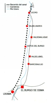
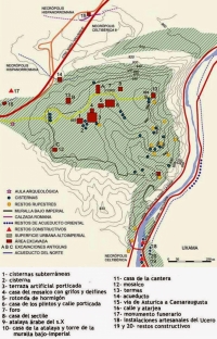
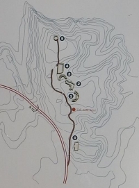
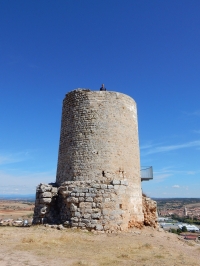
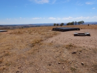
The excavation site Uxama Argaela is located just SW of El Burgo de Osma, along the N122 and well signposted. The admission is permanent and free. 
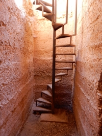
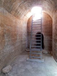
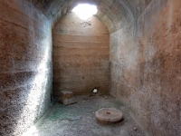
The cisterns are only open during specific hours, see the second website above.

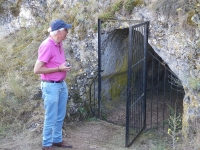
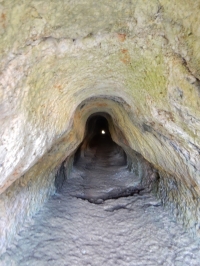
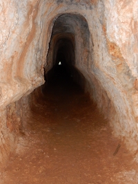
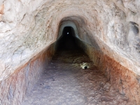
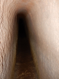
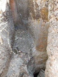
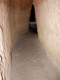
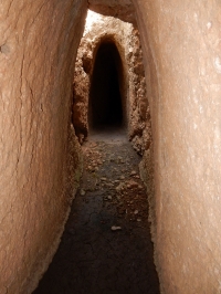
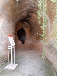
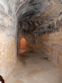
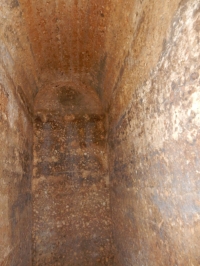
  • The 133m long Ucero tunnel - part of the Northern aqueduct - can be reached using the main road from Ucero to Nafria (P-5119). At the right / north side of the road - 250 m after you passed the (first) bridge - there is a small, wooden signpost (which easily can be missed). At this south entrance of the tunnel just 50 m from the road, there is an information panel. The tunnel is permanent open (September 2016), and the admission is free. Coordinates: 41 42 46.72N 03 03 13.14W
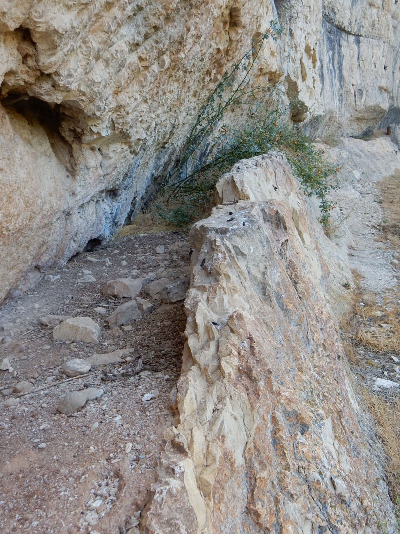
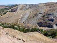
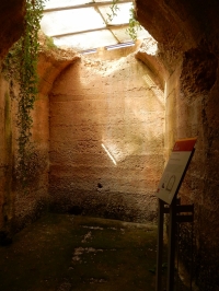
  • At the NW foot of the Uxama hill is a passable part of the Northern aqueduct tunnel, 250m north of the Uxama exit, along the N122; at the east side of the road is small parking lot plus an information panel.
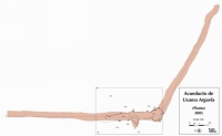
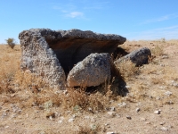
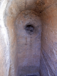
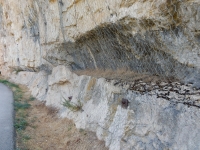
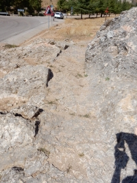
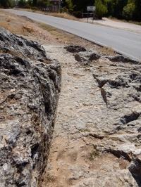
  • Remains of the Eastern aqueduct can be easily found along the SO-160 south of El Burgo de Osma, direction Gormaz. After 1 km the road crosses the Ucero river and park your car here. A short piece of the channel floor is cut in the rock surface east of the road. A longer part can be found 750 m north of the bridge, 1 m above the level of the cycle path, cut into the rising rocks.

HOME More literature on more aqueducts Last modified: November, 2016 - (webmaster)


Ucero tunnel

Near the entrance

Characteristic shape

Manhole

Near the exit

Tunnel dimensions

Map of the aqueduct

Uxama Argaela

Excavation locations

Near the N122 road

Upstream view

Aqueduct access

Course correction

Collapsed manhole

Visible remains

Islamic tower

View into the ravine

El Arca cisterna

Plan of El Arca

Entrance + screen

Reconstruction 1

Reconstruction 2

Staircase

Semicircular room

A hole in the wall

Reddish plaster

Inlet or outlet?

2nd entrance

View into the cistern

Water inlet

Eastern aqueduct

30 m long channel

Rock-cut channel

Downstream view