Pools of Jerusalem

Roman aqueducts: Pools in Jerusalem (Israel)

Supplementary to this entry is the chapter Aqueducts of Jerusalem 1 and 2, see column left For the photo's, see below Time line Land of Israel Home / the complete website

Introduction

"The ancient supply [ of Jerusalem] appears to have been obtained from springs, wells, the collection of rain in pools and cisterns, and water brought from a distance by aqueducts. The extensive remains of cisterns, pools and aqueducts show that little dependence was placed on any natural springs existing in or near the city".
Wilson and Warren (1871): The Recovery of Jerusalem page 17

In Herod's time tremendous efforts were made to exploit to the full the water resources available. The Gihon spring was one of the most important of these sources (Bahat 1994 page 32). There were also many pools in Jerusalem to store the water. Some of them were fed by one of the aqueducts like the Hezekiah's pool but the majority got their water from water run-off systems. For their catchment area's see the drawing below.
The larger pools were open, some were covered like the cisterns at the Temple Mount. The Struthion became covered after a few decades. All of the presented pools are put out of use now, often partly filled with dirt, being a cause of heath dangers, some even totally disappeared acting now as parking lot or festival area.
About the dimensions and total capacity: the given figures are only an indication, to present an order of magnitude. And please realize that these basins were seldom full of water.

Below the descriptions of 10 major pools in and around Jerusalem. The texts are often based on materials of others.
In the mean time a very informative article on this subject of dr. D. Gurevich was published: "The water pools and the pilgrimage to Jerusalem in the late Second temple period", published in the Palestine Exploration Quarterly vol 149-2 (2017) pag 103 - 134).

Pools of Jerusalem Capacity (m3)
1. Siloam Pools Unknown
2. Solomon's Pools 228.000
3. Temple Mount cisterns 40.000
4. Hezekiah's Pool 30.000
5. Serpents / Sultan's Pool 50.000
6. Mamilla Pool 30.000
7. Bethesda Pools 90.000
8. Israel Pool 110.000
9. Struthion 4.500
10. Birket sitti Miriam 6.000

Different major pools of Jerusalem: 1. Birket sitti Miriam 2. Bethesda Pools 3. Pool of Israel 4. Struthion [5. Birket el Miya'a] 6. Hezekiah's Pool 7. Serpents or Sultan's Pool 8. Mamilla Pool [9. Birket Husseini] [ 10. North-West pool (uncertain)] Map of Jerusalem in 1912 on which seven pools are indicated, including Birket sitti Miriam (NE of the Temple Mount) and (very small) the Bethesda Pools (N of Birket Israel) Most pools in Jerusalem were fed by rain water run-off systems, on this map their catchment area's. Probatica Group = Bethesda Pools, Israel Pools, and Birket sitti Miriam


1. Siloam Pools (A and B)

Also known as: Birkeh Silwan, Byzantine pool (pool A), Birket el-Hamra (pool B)
Location: close to the splitting of the Ma'alot Ir David and the Derech HaShiloah in Silwan east of Mount Zion
How to reach: you can either buy your ticket of a walk though the Hezekiah's tunnel (City of David organization - visitors center) or at the spot itself (entrance fee NIS 27).
Dimensions and capacity: area of pool B is 60 x 50 m
Literature: Wilkinson 1978 (!)
Website:
Bibleplaces.com. For more photo's see Jerusalem 101

"The other events of Hezekiah's reign, and all his exploits, and how he made the pool and the conduit and brought the water into the city, are recorded in the Annals of the Kings of Judah" (2 Kings 20:20).

Until 2004 the pool at the end of the Hezekiah's tunnel, supplied by the Gihon Spring - was often called the Siloam Pool (A) although for a long time it was known that the remains of the pillars in the pools were probably of Byzantine origin. This pool has long been regarded as the pool that played a role in one of Jesus
' miracles.

But when Bahat (1994 page 33) was describing the pool at the end of the Hezekiah tunnel (Siloam A), he finishes his explication as follows: "There is no available proof that the Second Temple period Siloam Pool was situated at the present-day site, and it is more plausible that the pool was situated at the location of the nearby Birket el-Hamra, where there is now a flourishing vegetable garden". See also the article of Wilkinson 1978.

In the year 2004 remains of a magnificent pool from the late Second Temple period were uncovered at the place some 50 m east of the end of Hezekiah's tunnel. During reconstruction work for a drainage pipe line the archaeologists Reich and Shukron revealed a series of steps leading down into an adjacent garden. The pool appears to have been extended across the entire area of the present orchard - now in the hands of the Greek Orthodox Church - covering approximately an area of 50 x 60 m. One may suppose that steps descended from all the four sides to the floor of the pool. Altogether about 20 steps - 4 sets of 5 each - have been excavated leading from street level into the pool. The steps were overlaid with stone, and underneath them were the remains of an earlier pool dating from the Hasmonean era. The special stepped structure of the pool has led excavators to posit that pilgrims used it as a ritual bath to purify themselves before ascending to the Temple.
Pottery indicates that this pool was in use in the first century. The blind man washed the mud of his eyes in this pool (John 9 vs 7) and received his sight.

An old picture of the pool at the end of Hezekiah's tunnel with some bases of Byzantine pillars in the front Both pools south of the City of David: the Lower Pool (13) at the end of Hezekiah's tunnel, and the Siloam Pool, often indicated as Birket el-Hamra Look into the pool at the end of Hezekiah's tunnel with its Byzantine pillar bases
Details of the present Siloam pool with a series of flights of steps to enter the pool right Overview of the Siloam Pool (Birket el-Hamra) with at right a modern sewer pipe. Under this pipe is an ancient water channel with water coming from the Gihon spring via Hezekiah's tunnel Artist's impression how the Siloam Pool might have looked like: an almost square basin with steps along the four edges, just inside the city's wall

Top

2. The Solomon's Pools

Also known as: Birket as-Sultan Suleiman al-Kanuni
Location: 5 km SW of the city of Bethlehem (West Bank)
How to reach: take the blue bus 24 from the Palestine bus station, west of the Damascus gate (NIS 7) which brings you to the bus station in Bethlehem (do not forget to take your valid passport). Take a taxi to the Solomon's pools (less than NIS 20).
Dimensions and capacity: see the table below.
Literature: Mazar 2002
Website: -

Solomon pools

Dimensions according to Mazar 2002
(in meters) L x W H Capacity (m3)
Upper Pool 71 x 118 9,5 - 11,0 85.000
Middle Pool 135 x 50 10 - 12 90.000
Lower Pool 179 x (46 - 81) 8 - 16 113.000
Total     228.000 m3

The Solomon's Pools consist of three open rectangular reservoirs each with a 6 meters drop to the next, fed from two aqueducts, water run-off from the mountains and several underground springs nearby. Each pool have different dimensions, see table below, with a total water capacity of approximately 228,000 m3. Consequently the pools have played a significant role in the area's water supply for centuries.

They are wrongly named after the Biblical King Solomon, stemming from the legend of Solomon using the waters and gardens as in Ecclesiastes 2 vs 6, where Solomon is recorded as saying "I made myself pools from which to water the forest of growing trees". However, recent evidence suggests that the lowest pool was probably constructed during the Maccabean period at the time of the reconstruction of the temple in Jerusalem (circa 2 BC/BCE).
A second phase occurred when the Roman Pontius Pilate built a 39 kilometres (24 mi) long aqueduct from the collection pools at 'Arrub to the Pools. Roman engineering under Herod the Great in connection with his improvements to the Second Temple created the underground tunnel feeding the upper pool.

The pools provide water for two aqueduct systems supplying ritual activities and the population of Jerusalem: one aqueduct terminated under in the great cisterns underneath the Temple Mount (the Lower or Low Level aqueduct), the other (the Upper or High Level aqueduct) brought water into the Hezekiah's Pool in Jerusalem.
A third one carried water from the Lower Pools eastwards to the Herodion where Herod had constructed a large rectangular pool, lined with columns.

The three pools were fed by - among others - two aqueduct systems, one with its sources in the Wadi el-Biyar, the other was fed from the area NW of 'Ain Kuweiziba; it followed the Wadi 'Arrub in a winding course.

The conduits were so arranged that the lowest pool, which was the largest and finest of the three, filled first, and then in succession the others. It has been estimated that these pools covered about 27.000 m2 (6 acres).
The pools were also fed by four local springs; the most prominent is 'Ain Atta or Etam at the head of Wadi Urtas, called the "sealed fountain", about 200 m to the NW of the Upper pool.
A considerable (Mazar 2002) amount of run-off rain water came from the el-Hadr plateau near the pools.

The area around Solomon's Pools has provided a pleasant atmosphere for picnics and relaxation over the centuries. On the north side at the entry to the park is an old Ottoman fort structure, built in 1620, which is known as Qal'at el-Burak or the castle of the pools. This has served at times as a caravansary (or khan - a resting place for caravans), and now has a restaurant with a garden area inside.

Partly based on Wikipedia information

The three Solomon's Pools SW of Bethlehem, seen from the west. The name is wrongly derived from king Solomon's words (Ecclesiastes 2 verse 6): "I made myself pools from which to water the forest of growing trees". At present east of Qalaat Burak (middle left) from 1620, a new conference center was built. The hart of Jerusalem's water supply: the three Solomon's Pools, 5 km south-west of Bethlehem. Two supplying aqueducts enter from the south. The Low Level and the High Level aqueducts exit to the east. The dotted line at right / east represents the start of the aqueduct towards Herodion.
The Upper and smallest pool of the Solomon's Pools eith an estimated capacity of 85.000 m3, seen from the west. Note the heavy buttresses. These pools underwent several changes and repairs in their 2000 years history. The Middle pool with a capacity of 90.000 m3. Its floor made partly use of the natural rock. View to the east.

Top

3. Cisterns on the Temple Mount

How to reach: all cisterns are subterranean and non of them can be visited
Dimensions: also because of the irregular shapes, exact figures are difficult to obtain. Estimates: the largest one (nr 8 in the plan below) should have hold 12.000 m3 (Bahat 1994). Total capacity 40.000 - 45.000 m3 (...)
Literature: Warren, Condor, Schick, Bahat 1994 page 32
Webiste: ??

The immense consumption of water at the Temple required the development of a complex water system on the Temple Mount. When the terrace was built to form the platform upon which the Temple Mount was erected, depressions were left in the filling for the express purpose of serving as water reservoirs. It is most probable that additional water cisterns were dug on the Temple Mount in later periods, but it is difficult to substantiate this assumption, since no thorough investigation has been made since Warren explored this area in the nineteenth century.
The diagram indicates the location of thirty-seven water cisterns on the Temple Mount known today. These cisterns, which all collect rainwater, were examined in the nineteenth century, mainly by Warren and Conder. The numbering of the cisterns in this diagram is that used by these two scholars, and this is the accepted numbering to this day.

Not all the cisterns were used for the accumulation of water during the Second Temple period. For example, cistern No. 19 (Barclay's Gate) and cistern No. 30 (Warren's Gate) were described by Josephus as gates which led from the Temple Mount to the street which ran the length of the Temple Mount western wall. The gates opened onto tunnels, and from there to steps going up to the Temple Mount. The entrances at street level were sealed off and in the course of time they were turned into water cisterns. It would appear that cistern No. 5 was an installation for the draining of water from the Temple Mount platform to the lower compound, and cistern No. 10 was also part of this drainage system.

There is a theory that cistern No. 1 was the tunnel which led from the Temple compound, directly out of the Temple Mount. Another theory has it that this cistern was connected to an underground passage leading to the ritual bath (Beth Hatevila), which was the purification installation northwest of the Temple.
Cistern No. 8 is the largest of the Temple Mount water cisterns, all of which were quite large. The cistern held up to 12.000 cubic meters of water. Part of the water flowed to Jerusalem through aqueducts leading from Solomon's Pools. From the Mamluk period, the aqueducts reached the purification installation built by Tankiz en-Nasiri in the fourteenth century, near cistern No. 36.
Cistern No. 22 was possibly the cistern dug in the Hasmonean period, to which a water conduit led from the vicinity of the present-day Damascus Gate.

From: D. Bahat (1994): The Atlas of Biblical Jerusalem page 32

The Temple Mount is pierced with over 30 cisterns of quite different size, as depicted by Wilson in the 2nd half of the 19th century. Number 8 is the famous "Great Sea". The Lower aqueduct enters the Temple Mount by means of Wilson's Arch (50 m south of Warren's Gate), heading for the cisterns 6 and 36. View from the Absolution gate over the Temple Mount. Somewhere the Lower aqueduct ended here in connection with one or two underground cisterns. Drawing of William Simpson from 1870 depicting the Bahr el Khabeer or the Great Sea, the largest rock-cut cistern under the Temple Mount of Jerusalem.

Top

4. Hezekiah's Pool

Also known as: Birket Hannan el Batrak, Pool of the Towers, Pool of the Patriarch's Bath, Pool of the Pillars, Amygdalon ( = Almond tree)
Location: in the Christian quarter of Jerusalem, just inside the Jaffa Gate, hidden behind the shops in the David Street / Al Bazar and the Ha-Notsrim
How to reach: from the top floor of the Petra Hostel (fee NIS 5), 1 David Street. Cleaning of the pool has been done via 76, Ha Notsrim
Dimensions: 95 x 44 x 6 - 7,5 m (or: 73 x 43 x 6 m)
Capacity: 27.000 - 30.000 m3 (other sources: 18.500 m3)
Literature: Bahat 1994
Website:
Jerusalem 101

This pool in thought to be a reservoir from Herod's time. Recent excavations show that it received its water from the Upper / High Level aqueduct (see web entry Jerusalem 1).
The identification is generally accepted, as the only reference to it is found in Josephus 'War (5,11,4). He states that the Romans set up a siege ramp at the site called the Tower's Pool, and - at a distance of thirty cubits - the Roman legions set up another ramp in the vicinity of the monument of the High Priest. Elsewhere, he states that the monument to John (the high priest) was a siege tower opposite the Upper City (Wars 5,9,2).

This pool underwent numerous transformations, but no vestiges from the Second Temple period have been found (Bahat 1994). Until recently the pool was used as a trash dump. After intensive discussions the pool is cleaned now as can be seen on the photo. Its bottom is cemented and leveled natural rock. The inlet from the High Level aqueduct is in the SW corner, about 5 - 7 m above the floor of the pool, see the excavation report.

Partly based on Bahat 1994

Recent view into the cleaned Hezekiah's Pool, situated just behind the Jaffa Gate in Jerusalem. Inlet of the High Level aqueduct into Hezekiah's Pool (photo IAA) Photo from the 1930's with water in Hezekiah's pools. Note the church towers and minaret in the background.

Top

5. Serpents or Sultan's Pool

Also known as: Birket es Sultan, Lacus Germani (German Pool), Snakes pool. Brechet HaSultan
Location: open place / public park west of Mount Zion, west of the south end of the Hativat Yerushalayim
Dimensions: 169 x 67 x 12 m
Capacity: 50,000 m3 (other sources: 74.000 m3)
Literature: ??
Website:
Biblewalks.com

The Sultan's pool was created by constructing a dam in the valley of the son-of-Hinnom, on the west side of the old city walls. The pool , named after the Ottoman Sultans who built it, was a large water reservoir (67 x 169 x 12 m) which was part of the water supply of the old city. The water was fed from rainfall collected in the basin of the upper side of the valley, and possibly an overfill from the aqueduct.

The Herodian aqueduct, which is built around the circumference of the pool, was part of Jerusalem's "Lower aqueduct" that delivered water to the city during the Roman period. It brought water from Solomon's pools (near Bethlehem), which collected water from springs around that area, all the long way to the Temple Mount (23 km in total length). The Ottomans added clay pipes into the ancient rock-hewn aqueduct. The aqueduct looped around the pool, and its traces are visible on the east and west sides. The pool is located in the son-of-Hinnom (Hinom) valley, west of Mt Zion. The bridge passes over the center of the pool and above the valley.
Ancient and Biblical periods
The valley was the border between the Benjamin (Joshua 18 16) and Jehuda tribes (Joshua 15 vs 8: "And the border went up by the valley of the son of Hinnom unto the south side of the Jebusite; the same is Jerusalem: and the border went up to the top of the mountain that lieth before the valley of Hinnom westward, which is at the end of the valley of the giants northward").

In the Bronze age and beginning of the Israelite period, there were children sacrifices to the pagan God Molech held in the valley of the son-of-Hinnom (Gei Ben-Hinnom). The Israelites stopped this barbarous ritual, although the evil custom continued partially during the times of the Kings. For example, the King of Judah Manasseh (2 Chronicles 33 6:"And he caused his children to pass through the fire in the valley of the son of Hinnom"). The prophets, such as Jeremiah, tried to stop it (Jeremiah 7: 31: "And they have built the high places of Tophet, which is in the valley of the son of Hinnom, to burn their sons and their daughters in the fire; which I commanded them not, neither came it into my heart"). The sacrifice rituals have eventually ceased, but it continued to be used as place to burn the city garbage. The association of the valley with fire, smoke and evil earned it the Hebrew word for "hell" (GeiHennom). According to a tradition this site is the entrance to that evil place.
Early Roman - Herod the Great
During the second temple period, the pool was probably a hippodrome. Josephus Flavius (Antiquities of the Jews, 15 8 1): "Herod ... appointed solemn games to be celebrated every fifth year, in honor of Caesar, and built a theater at Jerusalem, as also a very great amphitheater in the plain".
Herod constructed a network of aqueducts in order to supply waters to the city and the temple. The "Llower aqueduct" started from "Solomon's pools" at a height of 765 m above sea level. Its total length was 23 km, and the vertical drop was 32 m, reaching the temple at a height of 735 m. The last section of the "Lower aqueduct", before reaching to Mt Zion, looped around the pool; it followed a constant height of 737 m, 27m above the bottom of the pool.
Roman/Byzantine period and after
The pool was created by blocking the valley on the south edge of the pool. It was in use from the Roman/Byzantine period through the Mamluke/Crusaders and Ottoman periods. During the Crusaders period the pool was named "Germanus" (German) pool.
The Ottoman sultan Barkuk (ruled 1382-1389) rebuilt the walls of the dam on the south-east side in the end of the 14th C, and constructed the first sebil. In June 1536 the sebil was rebuilt by the great builder of Jerusalem, the Ottoman Sultan Suleiman the Magnificent (ruled 1520-1566).
Modern period
Sultan's pool is used by the municipality to host summer time concerts and festival events. Hopefully in the future the aqueduct will be reconstructed on the northern section and in the gardens of Mishkenot-Shaananim, where it is in better shape although unexposed.
The pool is used for special public performances held in the open air, and the scaffolding structures around the pool are part of the infrastructure used for the shows.

The structure on the western hillside is called "Mishkenot-Shaananim", the first residential structure outside the walls of Jerusalem, which was built by the initiative of Sir Moshe Montifiori in 1860. Montifiori (1784-1885) was a rich Jewish British financer who made major contributions to the early Jewish settlement in Jerusalem. A bank note from 1975 depicts Montifiori's portrait with his famous windmill (still present). The stone tablet on the edge of the roof is seen in the photo below.

The south side of the pool is seen below. The bridge over the valley of the son-of-Hinnom supports the Hebron road, which leads to Bethlehem. In the center of the bridge is a Sebil - Ottoman drinking fountain.
The valley behind the pool is called Gei Ben-Hinnom ("valley of the son of Hinnom"). It flows into the Kidron valley to the east. This deep valley made Jerusalem protected from this south side and the west side.

The aqueduct was constructed above the circumference of the pool, going from the west side, around the wall at the edge of the pool, and to the back of the east side. On the right side, under the road, are some blocked rock-hewn tombs dated to the 1st temple period. A section of the Lower aqueduct can be seen on the eastern side of the pool, under the busy Hebron road. It continued along the southern slopes of Mt Zion towards the temple mount.
Sebil
An Ottoman sebil (Turkish name for a drinking fountain) is located on the south side of the pool, on the bridge of Hebron road, over the Valley of son-of-Hinnom. The sebil was built in June 1536 by the Ottoman Sultan Suleiman the Magnificent (reigned 1520-1566). This great builder of Jerusalem built additional four sebils inside the walls. The inscription reads: "Instructed us to build here a drinking place, our lord the Sultan, the great King... Sultan Suleiman son of Sultan Selim Khan, Allah will keep his kingdom and government for eternity".
The water supply for the sebil came from the aqueduct on the west side of the pool. A structure, which included a cistern, diverted some of the water from the aqueduct to the water to the fountain.

Slightly adapted from www.Biblewalks.com

The rear side of the dam in the Hinnom Valley in Jerusalem, the lower end of the Sultan's Pool. On top of this dam is a Sebil (Muslim drinking fountain, not visible). Nowadays the Sultan's Pool is in use as a place for all kind of performances. Top right Mount Zion, top left the western walls of Jerusalem. The Sebil, a Muslim drinking fountain, along the Hebron road in Jerusalem, on top of the dam of the Sultan's Pool, to serve the pilgrims visiting the Temple Mount / Haram esh-Sharif.

Top

6. Mamilla Pool

Also known as: Birket Mamilla, Upper pool of Gihon
Location: near the corner of Ban Sari and the Agron roads, 600 m NW of the Jaffa Gate with an ancient Muslim cemetery
Dimensions: 96 x 61 - 66 x 5,5 m (other sources: 89 x 59 x 6 m and 97 x 60 - 65 x 6,5 m)
Capacity: 30.000 - 39.000 m3
Literature: -
Website: -

Mamilla Pool is one of several ancient reservoirs that supplied water to the inhabitants of the Old City of Jerusalem. It is located outside the walls of the Old City about 600 meter northwest of Jaffa Gate in the centre of the Mamilla Cemetery. With a capacity of 30,000 cubic meters, it is connected by an underground channel to Hezekiah's Pool in the Christian quarter of the Old City. It is not possible that the pool has received water via an aqueduct from Solomon's Pools because of its level which was too high.
There are a number of theories on the origin of the name Mamilla. John Gray writes that it may be a corruption of the Hebrew word for 'the filler' (m'malle'), though that is uncertain. Others indicate it may have been named for its sponsor, Mamilla or Maximilla, or for a church that once stood near the pool that was dedicated to a saint named Mamilla or Babila.
Roman period
During the rule of Herod the Great, improvements were made to the water supply system in Jerusalem. Two new pools were constructed during his reign, the Pool of the Towers and the Serpent's Pool (Birket es-Sultan); both were fed by the Mamilla Pool via aqueducts.
The pool's original date of construction is unknown. Itzik Schwiki of the Jerusalem Center Site Preservation Council attributes the construction of the Mamilla Pool itself to Herod.
Byzantine and later periods
Following the Persian capture of Jerusalem from the Byzantines in 614, a large number of Christians were massacred at the pool.
During the period of Crusader rule over Jerusalem in the 12th century, Mamilla pool was known as the Patriarch's Lake, and the Hezekiah's pool inside the city walls that it fed was known as the Pool of the Patriarch's Bath.
In the 19th century, Horatio Balch Hackett described the pool: "At the distance of several hundred yards we come to another pool, Birket el-Mamilla, generally supposed to be the Upper Gihon of Scripture (Isaiah 36, 2.) This reservoir is still used, and on the ninth of April contained three or more feet of water. It is about three hundred feet long, two hundred wide, and twenty feet deep. It has steps at two of the corners, which enable the people not only to descend and fetch up water, but to lead down animals to drink. It is customary, also, to bathe here".
After the 1948 Arab-Israeli war, the Jerusalem municipality temporarily tried to connect the pool to the Jerusalem water supply, and coated the pool with cement.

In recent years several controversies emerged about the conservation of the ancient muslin cemetery and the construction of a Center of Human Dignity, part of the Museum of Tolerance of the Simon Wiesenthal Center.
Ecosystem
With the first rains, the pool hosts an ecosystem of crabs, frogs, and insects. During Spring, it becomes a haven for migrating birds. In 1997, a previously unknown species of amphibian tree frogs was discovered in the pool. The researchers named their find Hyla heinzsteinitzi, in honor of Heinz Steinitz, a deceased Israeli marine biologist. As of 2007, the species is assumed to be extinct.

From: Wikipedia with alterations

The Mamilla Pool in the midst of a Muslim cemetery, about 100 m long and 65 m wide. Even after 1948 one has tried to put the pool into use again for the public water supply. Details of one of the walls of the Mamilla pool in Jerusalem. Note the reddish color, the remains of the plaster to make the walls watertight.

Top

7. Bethesda Pools

Also known as: Probatica (of sheep: near the Shepp Gate), Sheep pool, Upper Pool, Double Pool, Bat Hashda Pool
Location: just north of the Temple Mount, north of the Derech Sha'ar HaArayot
How to reach: by foor only, follow the Via Dolorosa to the east. Look for the gate of the White Fathers convent to the church of St. Anne
Dimensions and capacity: at present much is filled in (see description and plan), so 45 x 6 x 11 - 13 m (3.000 - 3.500 m3) has remained. Originally 120 x 50 x 15 m (90.000 m3)
Literature:
Website: see the very informative article of
Stephen Langfur

The two present pools lead us to suppose that, already in early times, water reservoirs existed in this valley. A simple dam would collect rainwater flowing down through the valley to form a natural lake. Later, this lake was transformed into an artificial reservoir of 40 m x 50 m, by means of a 6 m wide dam. The water was led to the Temple in an open air canal. The Bible texts of Isaiah 7,3 and 2 King 18,17 could refer to this.

Towards the end of the 3rd century BC a second pool was made, probably in time of the High Priest Simon (Sir 50:3). As it is located south of the dam, the open-air canal had to be covered and became a water tunnel.
Between 150 BC and 70 AD a popular healing centre developed east of the pools. A water cistern, baths and grottoes were arranged for medicinal or religious purposes. The largest became a water cistern (1) and small channels (2) brought the water to the baths (3). There a crowd of invalids, who were barred from the Temple, would wait to be cured. It was there, near the PROBATICA (sheep) Gate that, according to John 5, Jesus met and healed a paralytic.

In the 1st century AD the construction of a larger pool, Birket Israel, nearer to the Temple, put the pools of Bethesda out of service. A new city wall build to the north by Herod Agrippa in 44 AD prevented the water from flowing down. Before they filled in the pools, the Romans built a water cistern (4).
Between 200 and 400 AD at the time of Aelia Capitolina, fine buildings were constructed: a temple of Asclepius or Serapis (5) and vaulted rooms in front of some baths (6). Some mosaic floors, frescos, votive offerings, and coins date from this period.

When Juvenal was Patriarch of Jerusalem (422-458), a large byzantine basilica (45 m x 18 m) was built. Its naves were built on the old dike and pools, supported by seven arches. Its choir covered and concealed the healing place. One can see today its apses, four column bases and the mosaic of its martyrion (7).
The church was dedicated to "St-Mary of the Probatica". It commemorated Jesus' miracle and, at the same time, Mary's birthplace traditionally located in this area. The Byzantine Basilica was damaged and partly burnt by Persians in 614. Restored by the monk Modestus, it flourished again with many priests and nuns in the time of King Charlemagne.

Around 1010 the church was destroyed, probably by Caliph Hakim and, in 1099 the Crusaders found only ruins. They built a small monastery dedicated to Jesus' miracle.
Around 1130, a large Romanesque church, dedicated to St. Anne, Mary's mother, was built above the caves where the memory of the Virgin's birthplace was kept. It served as the chapel of a community of Benedictine nuns.

Sultan Salah-ed-Din recaptured the City and transformed St. Anne's church into a Koranic law school in 1192. The conquest of Jerusalem by the Turks brought with it period of neglect for St. Anne's. However, many pilgrims continued to visit the holy crypt discreetly.
The Ottoman Turks offered the damaged church to France as a gesture of gratitude for its aid in the Crimean War (1854-1856). The architect Mauss restored it and made the first excavations. In 1878 the shrine was entrusted to Cardinal Lavigerie and his Missionaries of Africa. While training the Melkite Clergy, they continued the excavations. They revealed the dike and the pools.
The Dominican Fathers of the "Ecole Biblique" brought to light the remains of the Byzantine Basilica and the baths of the healing place.

From the leaflet of the White Fathers - Sainte Anne

Towards the end of the kingdom of Judah a large dam was built across the Beth Zetha Valley on the site where in the Second Temple period the Sheep's Pools were located (today in the courtyard of the Church of St. Anne). The dam formed a pool which retained the waters flowing along the Beth Zetha valley southwards. This pool is situated above the second pool, to the south, and they were created at different times. (form: Bahat 1994) dam ... The Sheep's Pools were built in the Beth Zetha valley. A number of dams and some of the largest pools in Jerusalem such as the Pool of Israel, were constructed in this valley. As the archaeological evidence has shown, the Northern pool was first dug at the end of the First Temple period, and the other pool was added in the hellenistic era at the beginning of the 2nd c BC/BCE. It continued to exist, as depicted here, until the destruction of the Second Temple.
Plan of the Bethesda Pools with in the middle the separating dike. The pools were collecting rain water coming from the Beth Zetha Valley, for the service at the Temple Mount. Before Roman times the area east of the dike was already in use as medicinal baths, where Jesus met and healed the paralytic (John 5). In later times the body of the dike was in use as a substruction for what later became the Church of St. Anne. View into the Southern pool with the remains of pillars of the Byzantine church (5 c AD/CE). The well is from the Crusaders time (12 c AD/CE). Part of the Jerusalem model in the Israel Museum in Jerusalem. Top left the fortress Antonia. In front the remains of the Pool of Israel at the foot of the north wall of the Temple Mount. At right the colonnaded footpaths along the two Bethesda pools.

Top

8. Israel Pool

Also known as: Birket Israel, Sheep pool
Location: places at the east side of the north wall of the Temple Mount
How to reach: in 1934 the pool was filled in and is now known as el-Ghazali square, opposite the entrance of the White Fathers convent / church of St. Anne, and at the south side of the Derech Sha'ar HaArayot. It is now a car park with shops.
Dimensions: 110 x 38 x max 26 m
Capacity: 110.000 - 120.000 m3
Literature: ??
Website: Birket Israel at Wikipedia

Birket Israel (trans. Pool of Israel) also Birket Israil or Birket Isra'in, abbreviated from Birket Asbât Beni Israil (trans. Pool of the Tribes of the Children of Israel) was a public cistern located on the north-eastern corner of the Temple Mount, in Jerusalem. The structure is believed to have been built by the Romans for use as a water reservoir and also to protect the northern wall of the Temple Mount. Arab natives have known it by this name since at least 1857.
By the mid-19th century it had gone out of use as a reservoir; being partly filled with rubbish and reused as a vegetable garden. In 1934 it was filled in and is now known as el-Ghazali Square. It is currently in mixed use for shops, as a car park, and as a transshipment point for refuse.
Construction
According to Muslim tradition, the reservoir was constructed by Ezekiel or Hezekiah, King of Judah. Some archaeologists have determined that the cistern was possibly built during the Herodian period to improve Jerusalem's water supply. Others estimate the date of construction later, in around 130 CE. This view is held by Charles Warren who recorded that although some kind of fosse must have existed at the spot at a very early period, since there is no description of the pool in the works of Josephus, "and it is very improbable that he world have omitted to mention so enormous a reservoir had it existed in his time", it was most probably constructed by Roman emperor Hadrian during his restoration of Jerusalem. This is further attested to since the masonry of the birket is inferior in character and resembles the later Roman work in Syria. Additionally, this reservoir appears to be mentioned by the Bordeaux Pilgrim (section 4) as already existing, and "would therefore most naturally be referable to Hadrian".
The pool was constructed in the bed of the western fork of the Kidron Valley that traverses the north-west quarter of the city. It formed Jerusalem's largest reservoir, measuring 109.7 m (360 ft) by 38.4 m (126 ft) with a maximum depth of 26 m (85 ft). The cistern contained a total capacity of 120,000 cubic meters and for centuries it formed part of Jerusalem's rainwater storage system. The pool also served as a moat, protecting the northern wall of the Temple Mount.
The eastern and western ends of the pool were partially rock-cut and partly masonry. The masonry at the eastern end formed a great dam 13.7 m (45 ft) thick, the lower part of which was continuous with an ancient eastern wall of the Temple compound. The sides of the pool were lined entirely with masonry because it was built across the width of a valley. The original bottom of the reservoir was covered with a layer of about 19 inches of very hard Roman concrete and cement. There was a great conduit at the eastern end of the pool built of massive stones, and connected with the pool by a perforated stone with three round holes 5 1/2 inches in diameter. The position of this outlet shows that all water over a depth of 6.5 m (21 ft) must have flowed away.
Later uses
By the mid-19th century, Birket Israel was no longer being used as a reservoir; and towards the end of the 19th century it was being rapidly filled with refuse and part of it was being used as a vegetable garden. In 1934 the pool was filled in because its condition posed a threat to public health.

Being located just inside the Lions' Gate, one of the major entries to the Old City, the East Jerusalem Development Company initially intended to excavate the reservoir and build a multi-storey car park at the site. This post-1967 plan was rejected by the waqf authorities who own the plot because they feared that clearance work at the base of the Temple Mount would endanger the Haram compound. Subsequently, in 1981 a small square equipped with benches was constructed on part of the covered pool.
Today the area is known as el-Ghazali Square and is used as a car park and collection point for refuse before it is dumped outside the city. Some small shops also exist at the site.

From: Wikipedia

Plan and cross-section of the Pool of Israel, close to the present St. Stephen's / Lion's Gate, the ancient Sheep Gate. Nowadays it is completely filled in and in use as a parking lot. Part of the Jerusalem model in the Israel Museum in Jerusalem. Top left the fortress Antonia. In front the remains of the Pool of Israel at the foot of the north wall of the Temple Mount.

Top

9. Struthion Pool

Also known as: ?? Note that struthion means lark or sparrow
Location: NW of the Temple Mount, just north of the Western Wall
How to reach: via the Western Wall tunnel plus a short Hasmonean aqueduct. Make a reservation via the
Western Wall Heritage Foundation: the tunnels (NIS 35)
Dimensions: only a part of the now covered pool is assessable. The public part measures 15 x 17 x 5 m, the whole was 51 x 17 x 5m (other sources: 52 x 14 x 4,5 - 6 m)
Capacity: public part 1300 m3, in total 4500 m3
Literature: Bahat 1994, 2000
Website: Jerusalem 101, and Biblewalks.com

The northern end of the large aqueduct (nr 21 on the plan below) is at the western edge of the rock-cut Strouthion pool (24) north of the Antonia fortress that was divided into two barrel vaulted parts.
The northern part of this pool, which is today beneath the Sisters of Zion Convent (35), is located northwest of the Temple Mount. It is now possible to visit the southern part of this pool from the Western Wall tunnel. The southern wall of the Strouthion pool is the rock scarp that protected the Antonia fortress (20) from the north, as described in detail by Josephus (War 5, 238).
At the side of the pool can be seen the bottom of the rock-cut moat (29) that separates the Antonia from the elongated hill extending north from here. The pool roofed with the twin barrel vaults was initially hewn as an open pool during the Second Temple period and was only covered in the Roman period (2nd century AD/CE). Since it was too wide to be roofed over with stone slabs, a thick wall was constructed down the middle of the pool to support two adjoining barrel vaults. In its lower part the supporting wall incorporates large, open arches, so that what appears as twin pools is in effect one large pool.

From: Bahat 2000 page 190

The Western Wall tunnel leads from the Western Wall Plaza to the Struthion Pool in the north, parallel and adjacent the west wall of the Temple Mount. The last section is of a quite distict order as it used to be an aqueduct channel. The Hasmonean subterranean canal through which water was brought to the cisterns underneath the Baris fortress, the seat of the Hasmonean rulers. During the course of extensions to the Temple Mount, the canal was severed at various points and thus was rendered useless. The canal was discovered in October 1867 by Charles Warren, but was blocked up in 1870 and rediscovered in 1987.
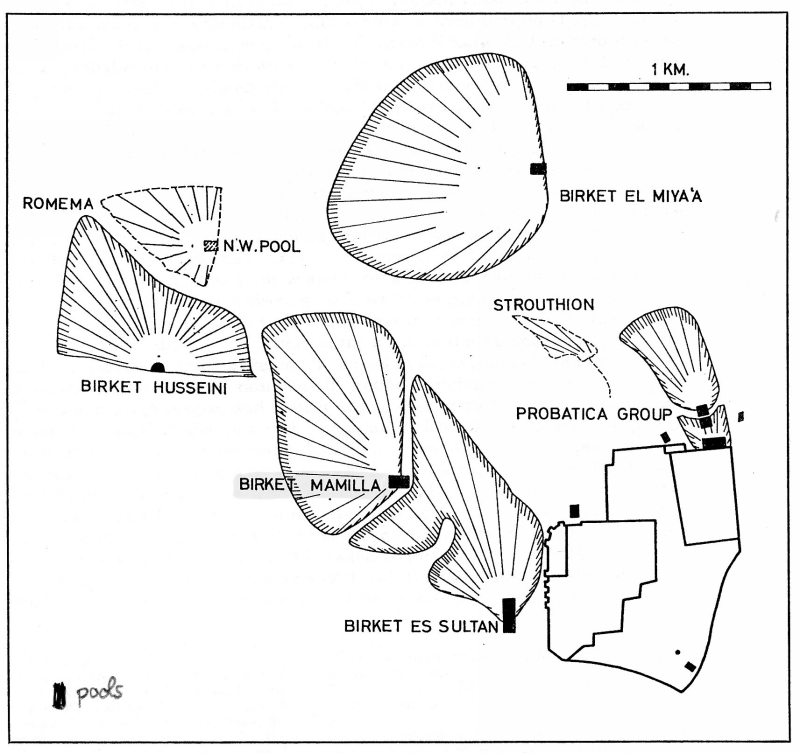
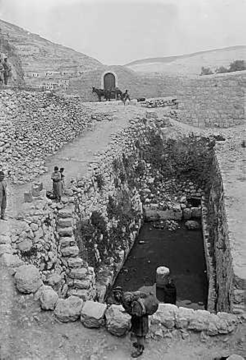
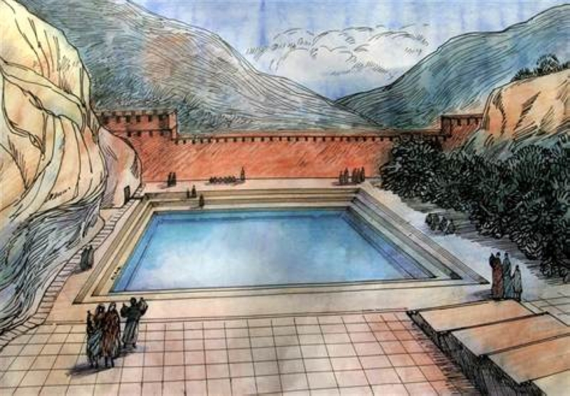
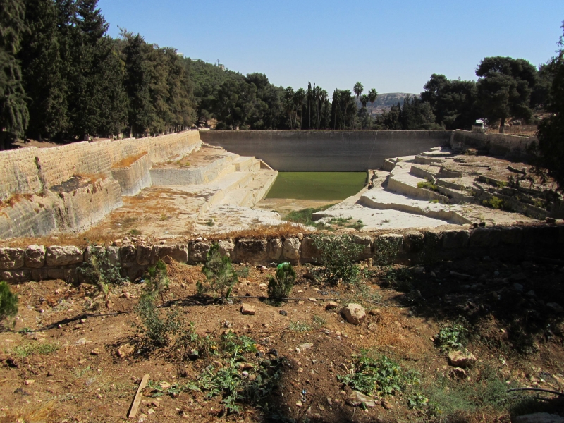
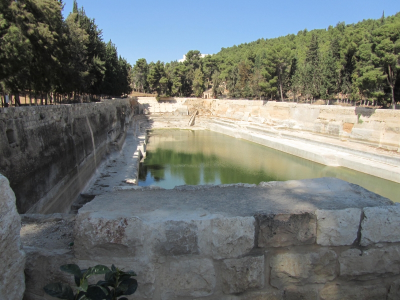
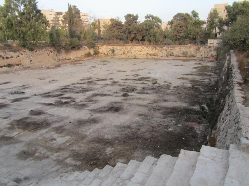
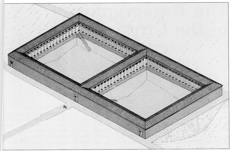
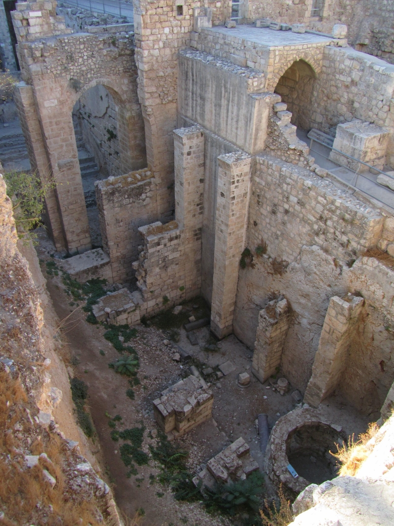
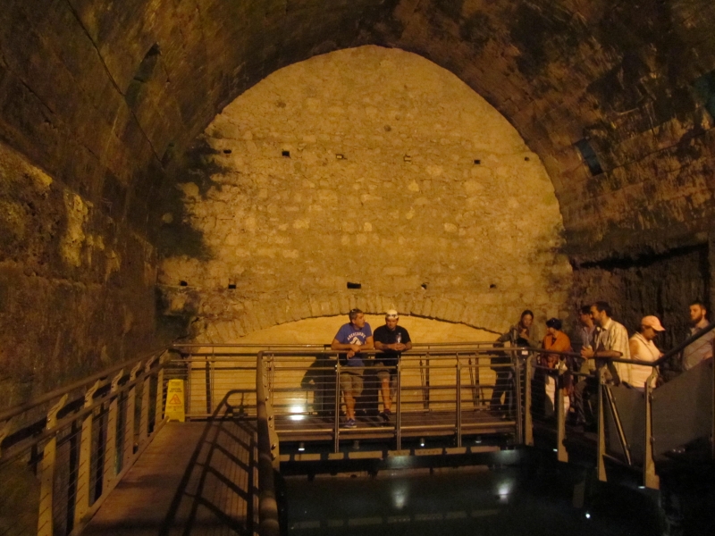
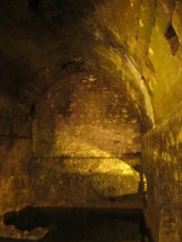
The pool was called "Struthion," which means "lark," being that it was one of the smaller public pools in Jerusalem during the Herodian period. The pool 
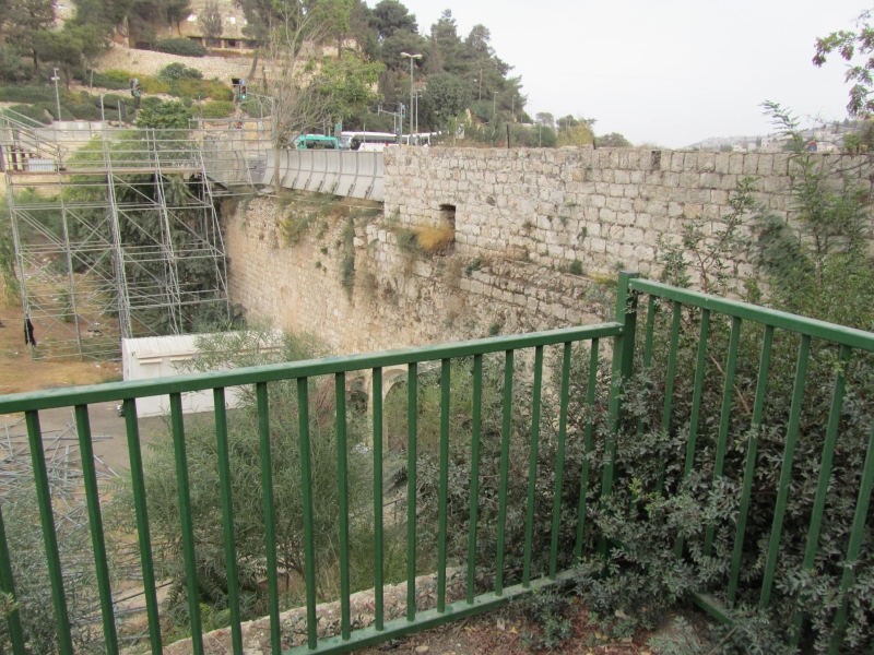
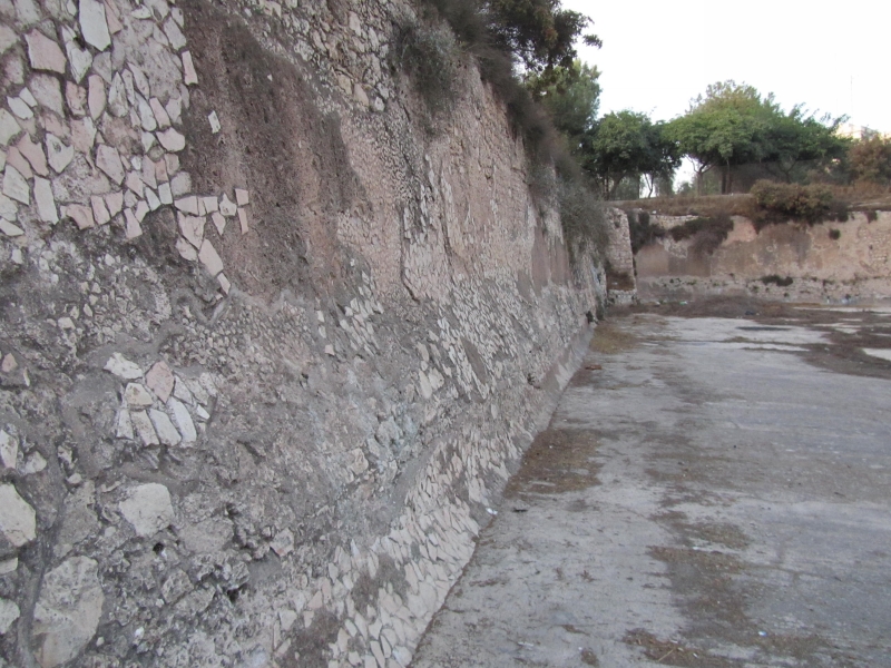
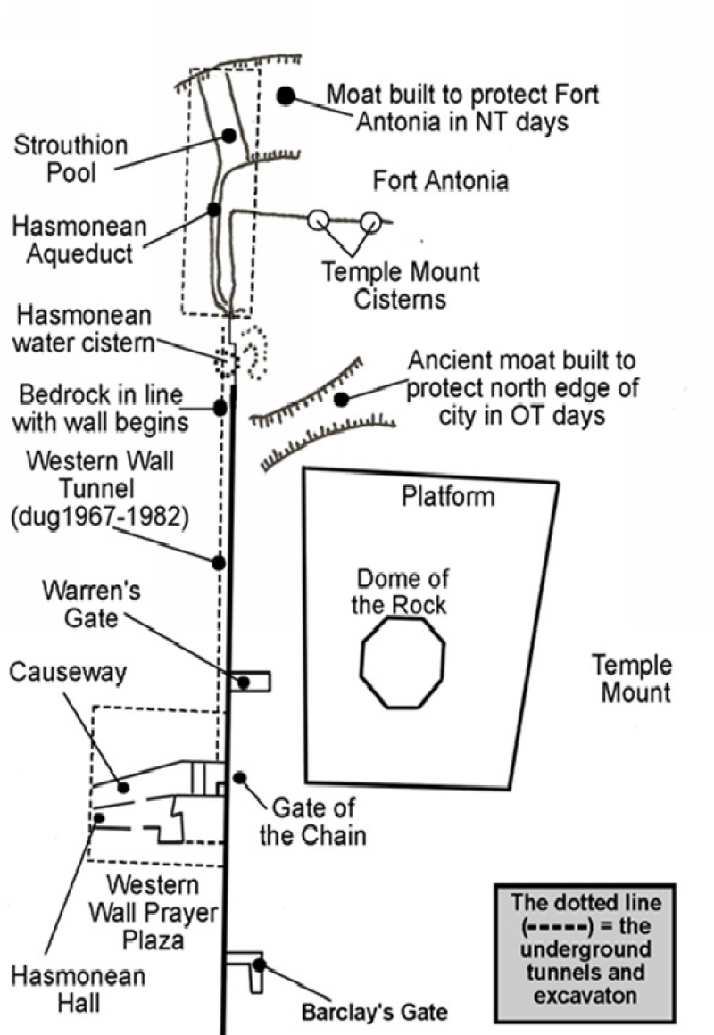
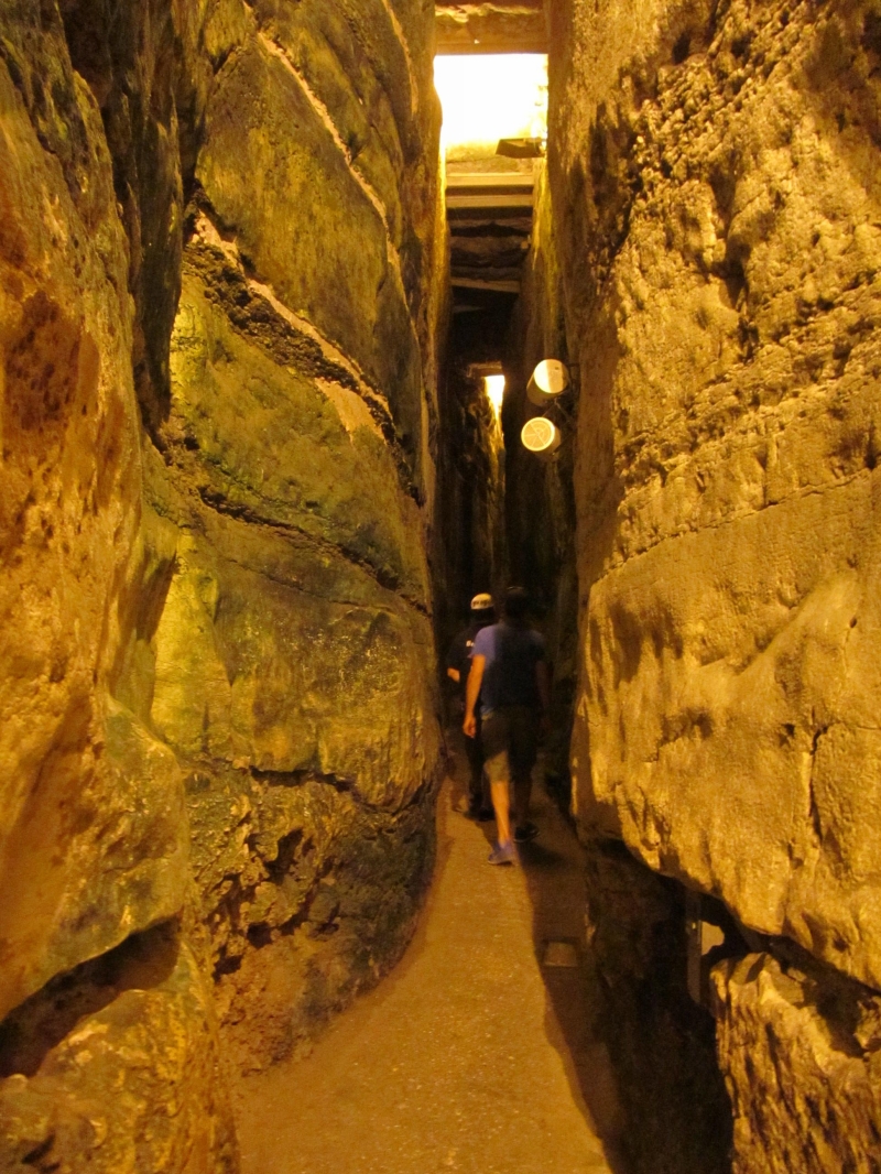
served as a moat for the northwestern corner of the Antonia Fortress. Prior to the pool's construction, the aqueduct ran from the north into this area servicing the city and the Temple Mount. 
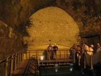
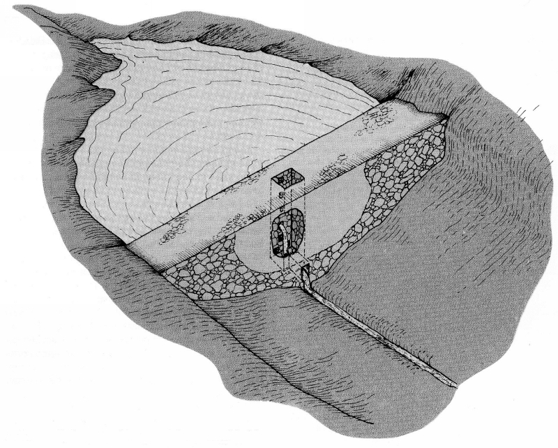
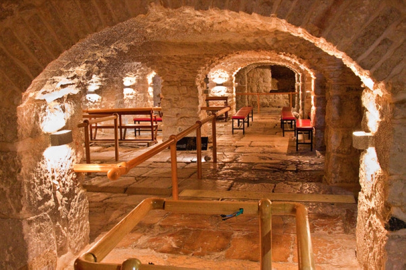
After the defeat of the Bar Kochba revolt in 135 AD/CE, the emperor Hadrian turned the entire pool area into a market place. They managed to cover the pool, first dividing it into two with a wall along its length, and then placing two arches fanning out in opposite directions from the walls. On top of these arches they built the square on the platform used for the market. 
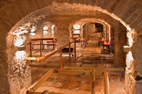
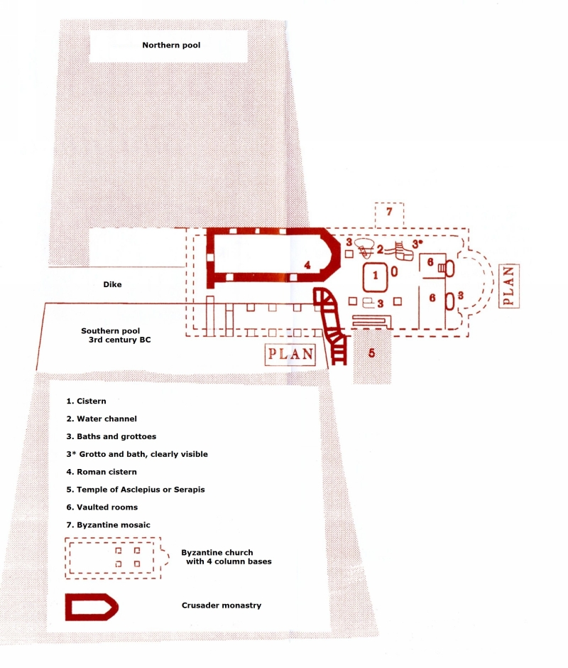
When the foundation for the Convent of the Sisters of Zion was being dug, they discovered the ancient pool and aqueduct. The nuns had another wall built, splitting the pool again, width-wise, to prevent strangers and explorers from entering into their convent through this basement.

Top

10. Birket (Hammam) sitti Miriam

Location: near the Stephen's Gate (NE of the Temple Mount, just outside the city wall)
How to reach: filled in, no visible remains. At present a Muslim cemetery on the west bank of the Kidron valley
Dimensions and capacity: 30 x 25 x 8 m (6.000 m3)
Literature: Wilson and Warren 1871
Website: -

The Birket Sitti Miriam, near St. Stephen's Gate, is of no great size. It is, however, peculiar from its position, which is such that it can receive little or no surface-water, and its supply must therefore have been brought by an aqueduct. It appears to be more modern than the others, and still holds a little water.

From: Wilson and Warren (1871): The Recovery of Jerusalem page 22

Map including the major pools in Jerusalem. NE of the Temple Mount, outside the city walls, the Birket Sitti Maryam.

Top

A final remark

Of course there were and are more basins in Jerusalem: subterranean cisterns, reservoirs, and pools like Birket el Miya'a, the Northwest Pool, Romena, and Birket Husseini (see the maps on top of this chapter). Not all of these were from (pre-)Roman origine but non the less impressive. And even today ancient basins are discovered, sometimes presented as a "massive reservoir" (250 m3) (Jerusalem Post 09/06/2012)

Wilke Schram


Recommended literature :
  • as indicated above
  • T. Tsuk (2011): Water at the end of the Tunnel, touring Israel's ancient water systems page 268 - 278 (in Hebrew)
Recommended websites   : see above
How to visit                  : see above

HOME More literature on more aqueducts Last modified: March, 2013 - (webmaster)