It started with a need for extra water in a city, supplementary to other water sources like a river, rainwater catchment, wells, and/or springs.
A suitable water source must be found, not too far away, at the right level and with water of good quality.
A (military) surveyor started his work with adequate tools, looking for a good course of the aqueduct following the contour lines, with a more or less constant gradient downwards.
The construction work of the channel or pipe-line was done - sometimes by the army - preferably in a trench just under the earth surface,
with as few works of art like tunnels, bridges, substructions, arcades and siphons, as possible.
Near some towns the aqueduct water was stored in a coverd reservoir, to balance the (more or less constant) supply to the demand (with often a strong day and night rithm).
This counts in particular for the supply to Roman baths facilities.
But how long were those Roman tunnels, how high the bidges, how deep the siphons and how large the reservoirs?
Below are the answers!
|
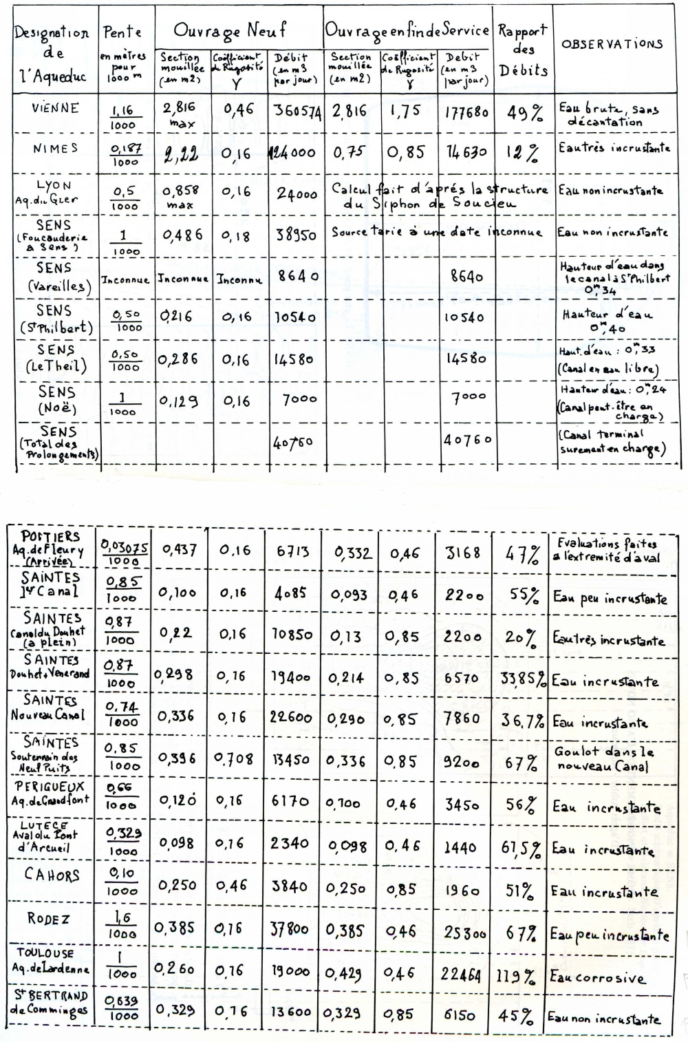
| Some statistics on the gradients of aqueducts in France (from: Bailhache 1983) |
|
| © Catherine Leah Palmer Palmyria |
| Historical introduction on aqueducts | Home | AquaClopedia |